
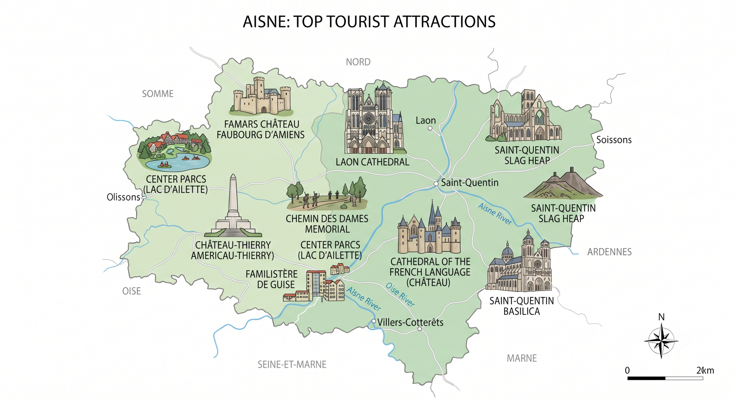
What you need to know about Aisne ?
The Aisne is a French department named after the Aisne River. Its department number is 02, and it is one of the 83 departments created in 1790 during the French Revolution. It has four sub-prefectures: Château-Thierry, Saint-Quentin, Soissons, and Vervins. The inhabitants are known as the Axonais. Today, the department has around 526,000 inhabitants spread across an area of 7,369 km², giving it a population density of approximately 71 inhabitants per km². Aisne is divided into 5 arrondissements, 21 cantons, 798 communes, and several intermunicipal cooperation authorities.
Indeed, the climate of Aisne is of the oceanic continental type. Temperatures are moderate, meaning that the difference between temperatures is not large. This difference is about 5°C during the cold season (winter) and about 20°C during the hot season (summer). However, there is a lot of precipitation in Aisne, about 123 days per year, and the amount of rain can even reach 700 mm per year, or even 1000 mm per year. This climate could be disturbed by heat waves in summer and severe cold in winter.

What are the neighboring departments of Aisne?
Indeed, Aisne is located right in the center of Île-de-France, Nord Pas-de-Calais, Champagne-Ardenne, and Picardy. The neighboring departments of Aisne are first, Belgium to the northeast, Somme, Seine-et-Marne, and Marne to the south, and finally, to the north, the Ardennes.
What are the main cities of the Aisne department?
The main cities of the Aisne department are as follows:
- Villers-Cotterêts
- Tergnier
- Soissons
- Saint-Quentin
- Saint-Michel
- Le Nouvion-en-Thiérache
- Laon
- La Fère
- Hirson
- Guise
- Gauchy
- Fresnoy-le-Grand
- Fère-en-Tardenois
- Chauny
- Château-Thierry
- Charly-sur-Marne
- Bohain-en-Vermandois
- Belleu
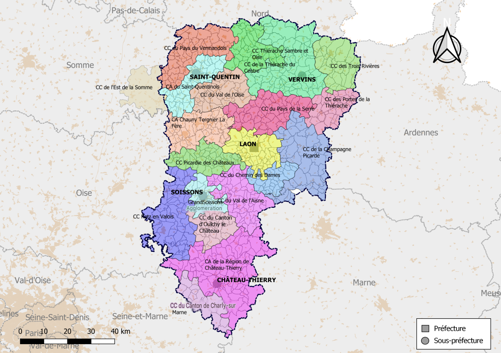
The 10 largest communes
Aisne has a total of 800 communes which are grouped into the following intercommunalities:
- Val de l’Oise
- Val de l’Aisne
- Trois Rivières
- Thiérache Sambre et Oise
- Thiérache du Centre
- Saint-Quentinois
- Retz en Valois
- Région de Château-Thierry
- Portes de la Thiérache
- Picardy of the Castles
- Land of Vermandois
- Land of Laon
- Land of the Serre
- East of the Somme (partly)
- Chemin des Dames
- Chauny Tergnier La Fère
- Picard Champagne
- Canton of Oulchy-le-Château
- Canton of Charly-sur-Marne
- CA GrandSoissons
Here are the 10 largest municipalities of Aisne
- Bohain-en-Vermandois
- Hirson
- Juvincourt-et-Damary
- Laon
- Le Nouvion-en-Thiérache
- Nizy-le-Comte
- Saint-Gobain
- Saint-Michel
- Sissonne
- Villers-Cotterêts
FAQ-Aisne map
Aisne is a department located in the Hauts-de-France region in northern France. It shares borders with several French departments as well as Belgium.
Laon is the prefecture of Aisne, while Saint-Quentin is its largest city. The department has a population of approximately 525,000 people.
A map of Aisne helps locate its main towns, road networks, and tourist attractions. It is also useful for planning a trip or exploring the department’s natural and historical heritage.
