
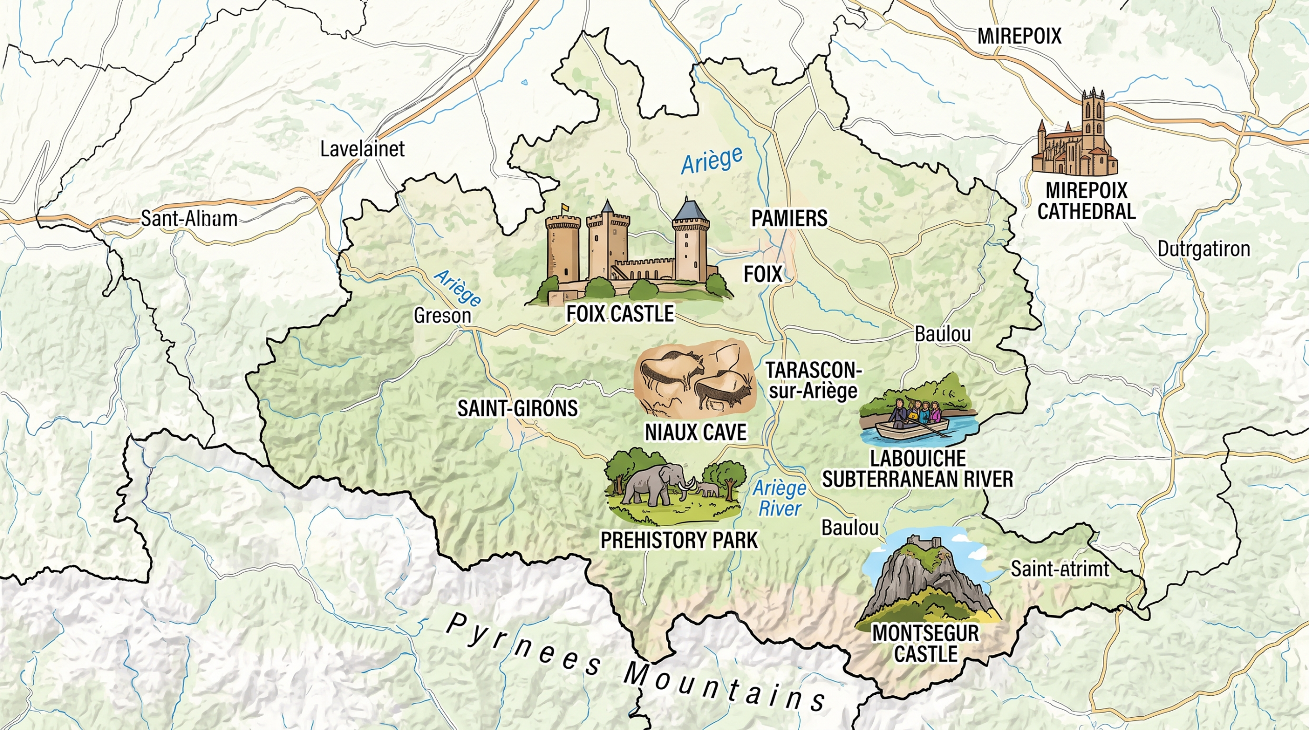
What you need to know about Ariège ?
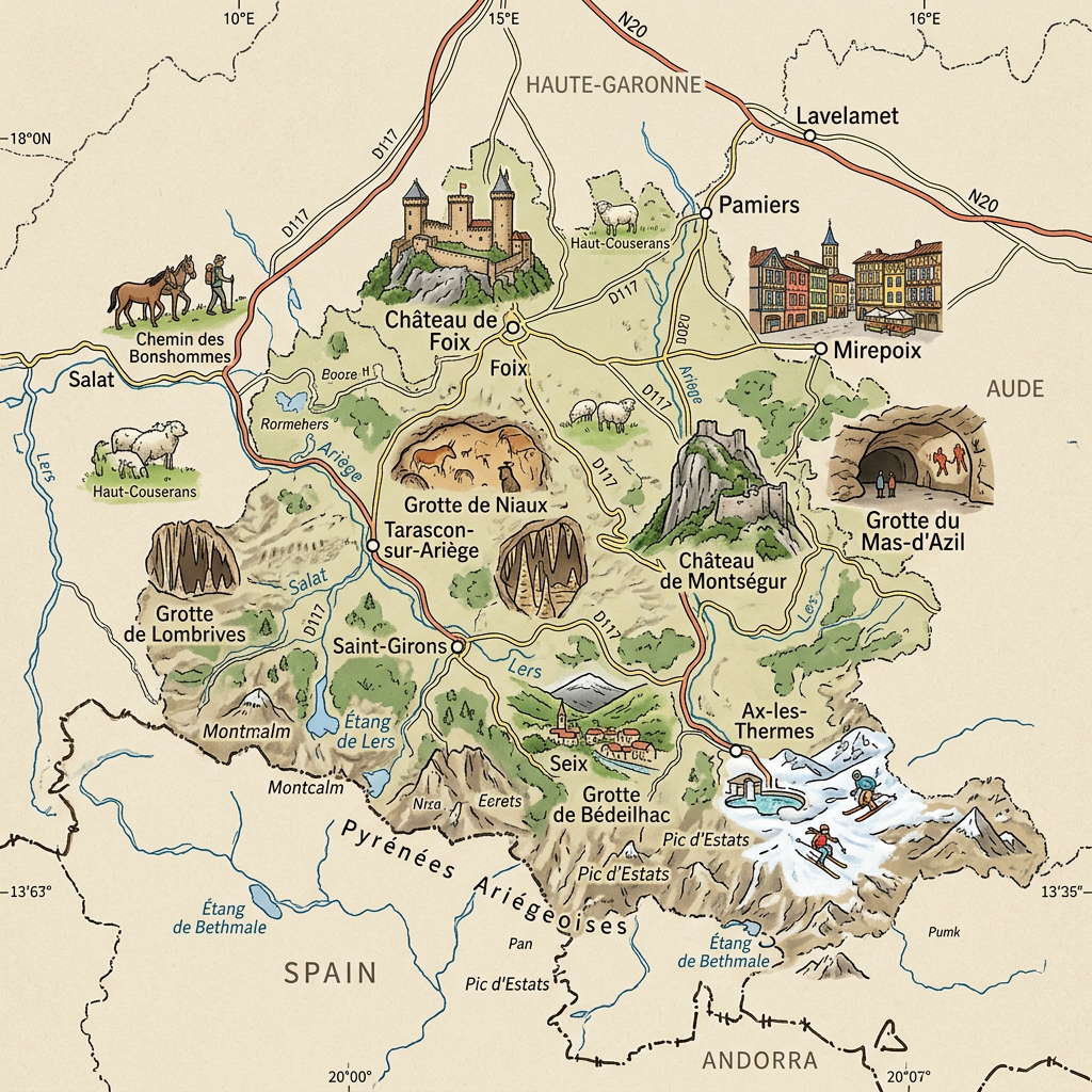
Located in the Occitanie region, department number 09 is named after the river that runs through it, the Ariège. This department is situated in the southwestern part of France and has around 154,600 inhabitants, known as the Ariégeois, spread over an area of 4,890 km². Its prefecture and administrative capital is Foix. The department is organized into 3 districts, 13 cantons, 8 intermunicipal structures and 327 municipalities.

What are the neighboring departments of Ariège?
As it is a department that is part of the Occitanie region, its neighbors are Haute-Garonne, which borders it to the west and north. The department of Aude borders it to the east, and finally, Ariège shares a common border with Lleida, a Spanish province.
Climate of the Ariège department
As it is a departmental territory dominated by a natural park called the Pyrenees Ariégeoises Park. This forest cover of 40% greatly influences the climate of the department. Additionally, the Ariège department is classified partly as Mediterranean climate and partly as continental climate.
Next, the Continental climate predominates in the valleys of the Pyrenees, where storms and significant temperature fluctuations between night and day dominate.
Throughout the year, precipitation amounts to approximately 700 – 1800 mm and increases as one moves into the valleys.
Summer periods are not very dry; there is only humid air coming from the north which brings a lot of precipitation evenly throughout the year. However, when going to the foothills, precipitation is much less significant.
Throughout the year, precipitation amounts to approximately 700 – 1800 mm and increases as one moves into the valleys. In these areas, precipitation reaches 1000 to 1800 mm.
In the western-northern section, a large part of the territory is humid throughout the year and snowy during winter periods; the snow height during the year can reach 1,000 m. However, in the foothills, summer temperatures are not very harsh and the lowest are 5 °C.
What are the most important cities in the Ariège department?
Indeed, based on the demographics from the year 2009, that is the number of inhabitants per km2, we were able to identify these few largest cities in the Ariège department:
- Pamiers,
- Foix,
- Lavelanet,
- Saint-Girons,
- Saverdun,
- Tarascon-sur-Ariège,
- Mazères,
- Mirepoix,
- Varilhes,
- Laroque-d’Olmes,
- Saint-Jean-du-Falga,
- La Tour-du-Crieu,
- Lézat-sur-Lèze,
- Verniolle,
- Ax-les-Thermes,
- Saint-Lizier,
- Montgaillard,
- Lorp-Sentaraille.
What are the 10 largest communes in Ariège ?
Referring to the area of the communes in Ariège, we have listed below the largest communes:
- Auzat
- Aston
- Ustou
- Seix
- Mérens-les-Vals
- Orlu
- Saverdun
- Sentein
- Couflens
- Aulus-les-Bains
Referring to the population density per km², the most important communes in Ariège are:
- Pamiers
- Foix
- Lavelanet
- Saint-Girons
- Saverdun
- Tarascon-sur-Ariège
- Mazères
- Mirepoix
- Varilhes
- Laroque-d’Olmes

FAQ-Map of Ariège
Ariège is a department located in the Occitanie region, in southwestern France, near the border with Spain and Andorra. It is known for its mountain landscapes, Pyrenean valleys, and rich historical heritage.
The prefecture of Ariège is Foix, a town famous for its medieval castle overlooking the valley. It is the main administrative, cultural, and tourist center of the department.
A map of Ariège helps locate the main towns, mountains, rivers, and remarkable natural sites. It is particularly useful for planning a trip, exploring the Ariège Pyrenees, or organizing outdoor activities.
