
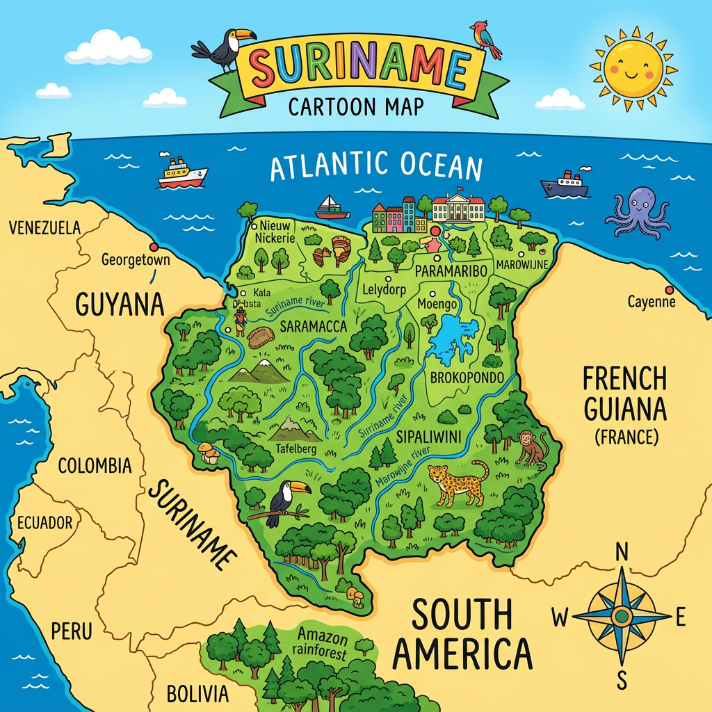
Exploring Suriname through its various maps is like diving into a mosaic of tropical landscapes, dense forests, and majestic rivers. Located on the northern coast of South America, this discreet country fascinates with the richness of its relief and the diversity of its regions. Whether you are looking for an administrative map or a physical map, each representation reveals the secrets of a largely preserved territory, with its capital Paramaribo, its districts with exotic accents, and its borders shared with Guyana, Brazil, and French Guiana. Let’s discover together all the aspects to know about maps of Suriname, their specificities, and their usefulness in understanding the reality of this unique country.
Why consult a map of Suriname?
Consulting a map of Suriname meets several needs, both for curious travelers and geography enthusiasts. The precise geolocation allows understanding the strategic position of the country within the South American continent and better grasping its links with its neighbors. Indeed, the map highlights the immediate proximity to Guyana to the west, Brazil to the south, and French Guiana to the east. This geographical specificity gives Suriname a pivotal role in understanding regional dynamics.
Mastering the different cartographic representations also offers the advantage of distinguishing the natural and administrative particularities of the territory. A physical map reveals the structure of the relief, the distribution of the Amazon rainforest, or the density of the hydrographic network, while an administrative map guides towards the main cities and the division into districts. These elements are valuable for organizing a trip, studying local biodiversity, or simply learning about this little-publicized corner of America.
The main types of maps of Suriname
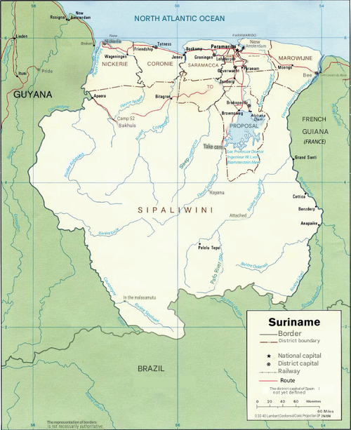
Suriname can be discovered from many angles thanks to different types of maps. Each presents a specific vision adapted to distinct needs. For example, exploring the administrative structure does not have the same scope as observing the natural wonders through a detailed physical map.
Here is a list of the main types of maps used to explore Suriname and their primary uses:
- General geographic map: provides an overview of the territory, borders, and major elements.
- Administrative map: shows the division into districts, the location of main cities, and the capital Paramaribo.
- Physical map: highlights the relief, rivers, streams, and predominant vegetation.
- Road map: useful for planning a route between different localities and understanding the transport network.
- Thematic map: focused on a specific aspect such as demographics, mineral resources, or ecology (protected areas, national parks).
What are the differences between an administrative map and a physical map?
An administrative map of Suriname will clearly segment the country into ten distinct districts. It will highlight the capital Paramaribo as well as other main cities such as Nieuw Nickerie, Albina, or Lelydorp. This type of document will also specify the boundaries of each district, useful for locating a city or organizing a stay around a specific area.
Conversely, the physical map is distinguished by its ability to emphasize natural features. One can spot the Guiana Shield, the extent of the tropical forests covering the interior of the country, not to mention the numerous watercourses. Famous rivers such as the Suriname, the Coppename, or the Maroni strongly mark the landscape; they appear clearly on these documents, alongside mountainous or swampy areas.
The contribution of thematic maps to better discover Suriname
Some thematic maps reveal aspects less visible at first glance. For example, a map highlighting nature reserves locates sites of high ecological value such as the Central Suriname Nature Reserve, listed as a UNESCO World Heritage site. Others offer a demographic reading of the population, concentrated mainly around the coastal area and the capital Paramaribo.
The advantage of using specialized maps also allows targeting certain activities, such as hiking, wildlife observation, or exploring indigenous lands. Maps focused on mineral resources serve to understand the industrial dynamics of the country, particularly oriented towards the exploitation of bauxite, gold, or tropical timber.
Focus on the administrative map of Suriname: districts, cities, and capitals
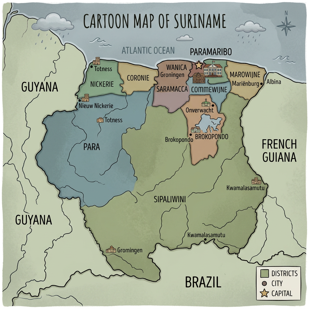
The administrative map of Suriname is as fascinating as it is structuring. It reflects the political organization of the country, which is based on a division into ten districts: Paramaribo, Wanica, Commewijne, Saramacca, Coronie, Nickerie, Marowijne, Para, Brokopondo, and Sipaliwini. Each district has its own economic, cultural, and natural specificities.
Looking at this distribution, it becomes evident that the economic and social heart of Suriname beats mainly around Paramaribo. This capital concentrates most of the industrial, commercial, and cultural activities. The districts of Wanica and Commewijne illustrate the gradual transition from city to countryside, with semi-urban areas and subsistence farming.
What are the respective roles of the districts?
Some districts, like Nickerie, play the role of Suriname’s agricultural granary, notably through the production of rice and bananas. To the east, Marowijne shares a river border with French Guiana and is home to Bushinengue and Amerindian communities rich in traditions.
Further south, Brokopondo and Sipaliwini stand out for their almost untouched wild expanses. There are isolated villages, but above all vast primary forests and many reserves. The Brokopondo dam shapes a whole part of the landscape thanks to its immense artificial lake.
How are the main cities evolving on the map of Suriname?
Among the agglomerations mentioned on the map, Paramaribo occupies a central place, but cities like Nieuw Nickerie (capital of the Nickerie district) or Albina (entry point to French Guiana) complete the panorama. Other smaller localities also appear depending on the level of detail of the maps, revealing the urban organization around the coastline and waterways.
A common point links many of these agglomerations: their location near the Atlantic Ocean, large rivers, or strategic communication points with neighboring countries. This is where most of the services, shops, and essential infrastructures for daily life in Suriname are concentrated.
Discovering suriname through its physical map: rivers, relief, and forests
Observing a physical map of Suriname opens a window onto a world dominated by wild nature. The country mostly belongs to the Guiana Shield, characterized by low elevation in the north and modest heights, such as the Wilhelmina Mountains in the southwest. This gentle relief favors great landscape homogeneity and explains the strong presence of lush flora.
On the hydrography side, Suriname displays one of the most extensive river networks in the region. Several major rivers and streams irrigate the country: among them, the Suriname, the Maroni on the eastern border, and the Coppename. These waterways are not only essential transport routes but also very rich natural habitats.
What place do rivers and streams occupy on the map?
Like forests, watercourses often define the internal boundaries of Suriname. The Maroni marks the border with French Guiana, while the Corantijn River marks the one with Guyana. These long and winding rivers serve as true natural borders and structure the migratory flows of humans and animals.
Other rivers, including the Saramacca or the Tapanahony, meander through the very heart of the territory. They play a vital role in supplying fresh water, traditional fishing, or the movement of populations living outside conventional road networks.
What do forests and national parks look like when seen from a map?
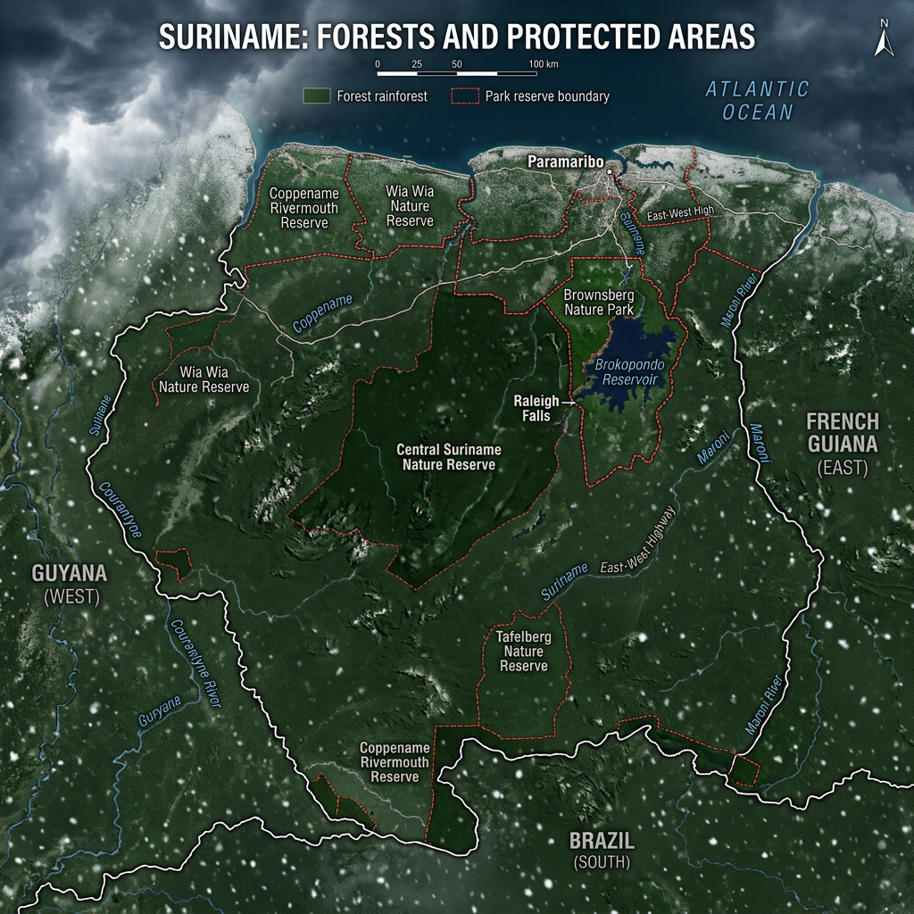
The forest area is among the most preserved in the world. A map of protected areas shows the vast expanse covered by the Central Suriname Nature Reserve, which is crossed by the Coppename River. But this is just one example, as there is also the Brownsberg Reserve near Brokopondo Lake or the Galibi Reserve in the far northeast, a sanctuary for sea turtles.
These spaces are depicted on dedicated maps as large green areas dotted with rivers, hiking trails, and rare habitats. Their ecological importance radiates beyond the country’s borders and makes Suriname a key player in conservation.
What details should you look for on a map of Suriname during an exploration?
When preparing a trip or a study, reading a map of Suriname carefully means paying attention to certain specific details. Checking the location of main roads, secondary tracks, or river access points offers a real advantage for logistical organization. Identifying large landscape units, forests, swamps, or plateaus, also facilitates understanding of natural diversity.
The map legend plays a fundamental role in correctly interpreting symbols, whether it is locating national parks, finding border crossings with Guyana, Brazil, or French Guiana, or spotting the distinctions between urban centers and remote villages. For those who want to go deeper, consulting different scales greatly enriches the vision of Suriname, from broad trends to the smallest geographic details.
Exploring the borders and regional environment of Suriname
The geographical location of Suriname gives it a unique identity, reinforced by the variety of its borders. Beyond its Atlantic shores, the country opens up to three key neighbors: Guyana, Brazil, and French Guiana. On a map, these boundary lines draw a rich cultural mosaic, where Caribbean, Brazilian, and French influences meet.
This neighborhood deeply influences the economy, human movement, and cross-border exchanges. The main roads and tracks connecting Paramaribo to border posts appear on most detailed road maps. As for the natural borders formed by rivers, they often determine the morphology of certain districts such as Marowijne in the east and Nickerie in the west.
The advantage of maps for understanding the uniqueness of Suriname
Ultimately, regularly consulting a map of Suriname restores the direct connection with little-altered landscapes and a unique administrative organization. Thanks to this tool, everyone can visualize the country’s main strengths: the urban concentration around Paramaribo, the little-known vastness of the southern forests, and the omnipresence of rivers structuring the daily life of many inhabitants.
Whether the interest lies in a complete geographic map, a zoom on the reserves, or a detailed study of river routes, the cartographic diversity accessible today offers multiple keys to explore, understand, and appreciate this fascinating and authentic territory of South America.
Suriname map FAQ
Suriname is located on the northeastern coast of South America. It borders Guyana, Brazil, French Guiana, and the Atlantic Ocean.
A map of Suriname helps locate the country’s major cities, districts, major rivers, and vast forested areas. It also highlights its Atlantic coastline and the importance of the Amazon rainforest.
A map is useful for understanding Suriname’s geography and administrative organization. It also helps when planning a trip or studying the country’s geographical and demographic characteristics.
