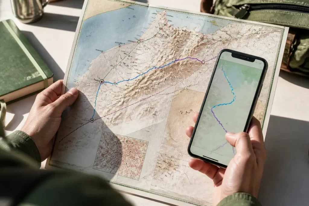
📋 Key point: Personally, I believe that choosing a good tourist map of Morocco is the essential first step to structure your itinerary and not miss out on must-see sites. An overall view on paper or screen allows you to effectively balance your travel time.
.synthesis h2, .synthesis .synthesis-header { font-size: 1.15em; font-weight: 700; margin-bottom: 0.6em; color: #47752c; }
.synthesis p, .synthesis li { font-size: 1em; line-height: 1.65; margin: 10px; }
.synthesis strong { color: #121e0b; }
.synthesis table { width: 100%; border-collapse: collapse; }
.synthesis th { background: rgba(91, 150, 56, 0.12); color: #47752c; text-align: left; }
.synthesis td, .synthesis th { padding: 8px 12px; border-bottom: 1px solid rgba(91, 150, 56, 0.18); vertical-align: top; }
.synthesis tbody tr:nth-child(even) { background: rgba(91, 150, 56, 0.05); }
.key-takeaways { max-width: 640px; margin: 2em auto; padding: 1.5em 1.8em; color: #1f3313; font-family: “Inter”, “Segoe UI”, sans-serif; text-align: left; position: relative; box-sizing: border-box; background: #f2f7ef; border: 1px solid #5b9638; border-left: 6px solid #5b9638; border-radius: 12px; box-shadow: 0 8px 24px rgba(251, 191, 36, 0.15); }
.key-takeaways h2, .key-takeaways .key-takeaways-header { font-size: 1.15em; font-weight: 700; margin-bottom: 0.6em; color: #47752c; }
.key-takeaways p, .key-takeaways li { font-size: 1em; line-height: 1.65; margin: 10px; }
.key-takeaways strong { color: #121e0b; }
.key-takeaways ul { list-style: none; padding-left: 0; }
.key-takeaways li { margin: 0.45em 0; padding-left: 0.2em; }
.mg-callout{margin:1.5em 0;padding:.9em 1.1em;border:1px solid;border-left-width:4px;border-radius:10px;font-size:.97em;line-height:1.65}.mg-callout>:first-child{margin-top:0}.mg-callout>:last-child{margin-bottom:0}.mg-callout__label{display:block;margin:0 0 .35em;font-weight:700;font-size:.82em;letter-spacing:.03em;text-transform:uppercase}.mg-callout__label::before{margin-right:.45em;font-size:1.05em;vertical-align:-.06em}.mg-callout–info{background:#eff6ff;border-color:#bfdbfe;color:#1e3a5f}.mg-callout–info .mg-callout__label{color:#2563eb}.mg-callout–info .mg-callout__label::before{content:”\2139\FE0F”}.mg-callout–tip{background:#f0fdf4;border-color:#bbf7d0;color:#14532d}.mg-callout–tip .mg-callout__label{color:#15803d}.mg-callout–tip .mg-callout__label::before{content:”\1F4A1″}.mg-callout–warning{background:#fffbeb;border-color:#fde68a;color:#7a4a10}.mg-callout–warning .mg-callout__label{color:#b45309}.mg-callout–warning .mg-callout__label::before{content:”\26A0\FE0F”}.mg-callout–danger{background:#fef2f2;border-color:#fecaca;color:#7f1d1d}.mg-callout–danger .mg-callout__label{color:#dc2626}.mg-callout–danger .mg-callout__label::before{content:”\1F6D1″}.mg-proscons{display:grid;grid-template-columns:1fr 1fr;gap:16px;margin:1.5em 0}@media(max-width:560px){.mg-proscons{grid-template-columns:1fr}}.mg-proscons__col{padding:.9em 1.1em;border:1px solid;border-radius:10px}.mg-proscons__title{display:flex;align-items:center;gap:.4em;margin:0 0 .5em;font-weight:700;font-size:.9em;letter-spacing:.02em}.mg-proscons__col ul{margin:.3em 0 0;padding-left:1.15em}.mg-proscons__col li{margin:.3em 0;line-height:1.55}.mg-proscons__col–pro{background:#f0fdf4;border-color:#bbf7d0;color:#14532d}.mg-proscons__col–pro .mg-proscons__title{color:#15803d}.mg-proscons__col–pro .mg-proscons__title::before{content:”\2705″}.mg-proscons__col–con{background:#fef2f2;border-color:#fecaca;color:#7f1d1d}.mg-proscons__col–con .mg-proscons__title{color:#dc2626}.mg-proscons__col–con .mg-proscons__title::before{content:”\274C”}ol.mg-steps{list-style:none!important;counter-reset:mgstep;margin:1.6em 0;padding-left:0!important}ol.mg-steps>li.mg-steps__item{counter-increment:mgstep;list-style:none!important;padding-left:0!important;padding-bottom:1.4em}ol.mg-steps>li.mg-steps__item:last-child{padding-bottom:0}ol.mg-steps>li.mg-steps__item>:last-child{margin-bottom:0}ol.mg-steps>li.mg-steps__item>.mg-steps__title{margin:0 0 .25em;font-weight:600}ol.mg-steps>li.mg-steps__item>.mg-steps__title::before{content:counter(mgstep) “. “;opacity:.45;font-weight:500;font-variant-numeric:tabular-nums}ol.mg-steps>li.mg-steps__item:not(:has(.mg-steps__title))::before{content:counter(mgstep) “. “;opacity:.45;font-weight:500;font-variant-numeric:tabular-nums}.mg-kpis{display:grid;grid-template-columns:repeat(auto-fit,minmax(140px,1fr));gap:14px;margin:1.5em 0}.mg-kpi{padding:1em .9em;border:1px solid #e5e7eb;border-radius:12px;background:#f9fafb;text-align:center}.mg-kpi__value{display:block;font-size:1.7em;font-weight:800;line-height:1.15;color:#111827}.mg-kpi__label{display:block;margin-top:.35em;font-size:.85em;color:#6b7280;line-height:1.35}
.wp-block-image,.ai-image{margin-bottom:1.75em}.wp-block-image>figcaption,.ai-image>figcaption{margin-top:.5em}
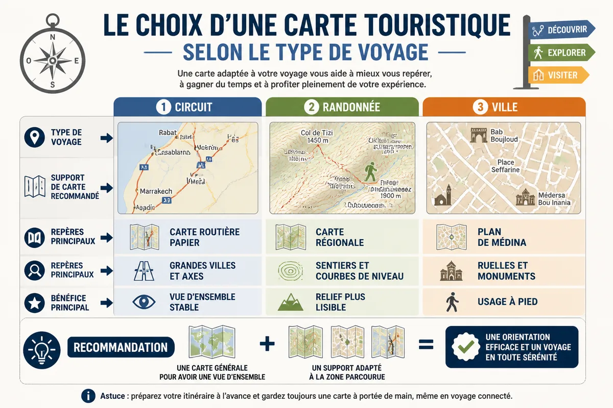
One road map is not always enough to prepare a trip to Morocco. To locate cities, sites, and regions, favor an interactive map of Morocco, then complement it with a paper map to visualize distances and routes. A regional or hiking map becomes useful in the desert, the Atlas, valleys, and trekking areas.
🌟 My experience: While preparing my first major tourist circuit through the imperial cities and southern oases, using a map dedicated to cultural attractions allowed me to identify panoramas and historic sites that GPS completely fails to indicate.
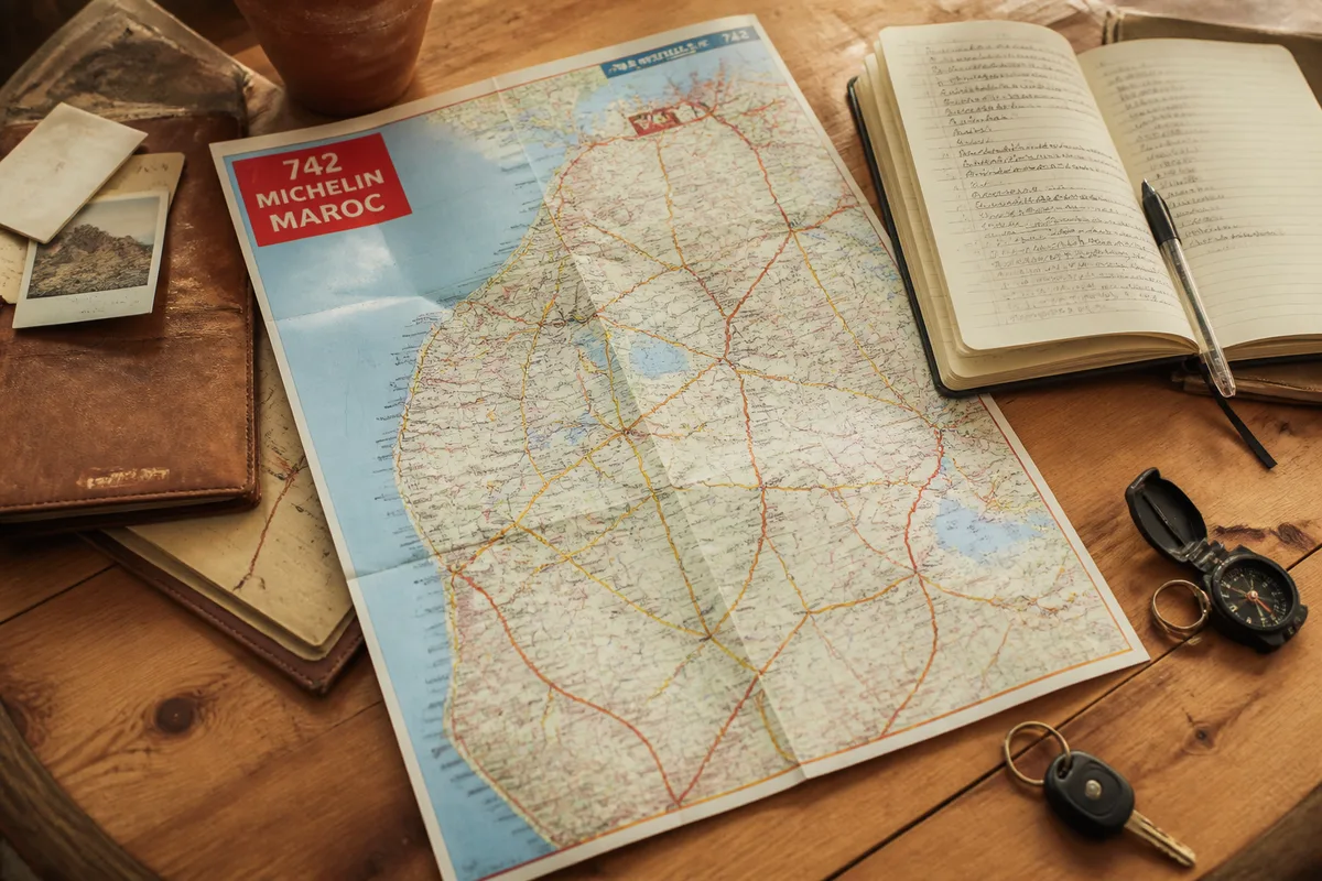
The right choice therefore depends on the main mode of travel: car circuit, urban visit, hiking, or desert itinerary. The Michelin Morocco 742 remains the most versatile solution for a first road circuit, while an IGN map, a Reise Know-How map, or a specialized medium meet more targeted needs.

| 🗺️ | Best overall choice: Michelin Morocco 742 to connect the main stages of a road circuit. |
| 📱 | Best digital complement: Organic Maps or an app based on OpenStreetMap with downloaded areas. |
| 🏔️ | For the Atlas: regional or hiking map indicating relief, passes, trails, and altitudes. |
| 🏜️ | For the desert: specialized map of tracks, oases, villages, and supply points. |
| 🏘️ | For the medinas: local urban plan, more readable than a national map in the alleys. |
| 📅 | Decisive criterion: check the scale, edition, availability, and actual coverage before purchase. |
To properly organize your stay, I invite you to prepare your trip to Morocco by cross-referencing these maps with our logistical advice. You can also consult some tips to discover Marrakech in detail, or read our inspiration guide to visit Morocco as part of an unforgettable trip.
Which tourist map of Morocco to choose for a first trip?
For a first itinerant trip, the most coherent combination pairs a paper road map for major connections and an offline app to find an address or a precise location. The Michelin 742 comes out on top for its easy reading, while specialized maps take over as soon as the terrain or isolation becomes central.
💡 Did you know? The first maps specifically designed for travelers in Morocco were published at the beginning of the 20th century to accompany the opening of the first major trans-Saharan and colonial roads.
The best choice for a road trip
The Michelin Morocco 742 is suitable for the traveler who wants to organize an itinerary between cities, coast, mountains, and pre-Saharan regions without relying entirely on a screen. It provides a continuous view of the country, useful when comparing several distant stages. For a first car circuit, choose it rather than an urban plan or a trekking map.
Its interest lies in the overview. It helps to connect Marrakech, Fès, Essaouira, or Ouarzazate and to spot the main roads before detailing the stages digitally.
However, the edition number, scale, and availability must be checked on the purchased product sheet, as an old road map may retain information that has become less useful after works, bypasses, or access changes. This point matters more for secondary roads than for simply locating major cities.
The best support for a targeted trip
⏱ Practical tip: Highlight with a marker the recommended scenic routes on your tourist map from the first evening at the hotel to visualize at a glance the guiding thread of your week.
A Reise Know-How map of Morocco may interest travelers looking for a durable paper support and a more detailed coverage of the territory. It becomes relevant when the itinerary includes more secondary roads or less touristic areas, provided the scale really matches the planned route.
The paper format remains readable without network or battery.
It is impossible to decide between Michelin and Reise Know-How without knowing the exact edition available, its scale, and its representation of tracks; these characteristics can vary from one product to another, and the publisher’s name alone is not enough to establish a definitive ranking.
General map of Morocco: regions, cities and major sites to locate
🍀 Advantages
• Ideal overall view to anticipate the steps
• Clear signage of cultural points of interest
• Total independence from electricity and the Web
🔻 Disadvantages
• Lack of precision for street-by-street navigation in the city
• Bulkiness of the paper format in pockets
• No real-time traffic alerts
A general map is first used to understand the geography of the country: Atlantic coast, Mediterranean coastline, Rif, imperial cities, High Atlas, pre-Saharan valleys, and Sahara. It should allow locating the 12 administrative regions of Morocco, the main airports, stopover cities, and major routes before calculating an itinerary.
North, Rif and historic cities
In the north, a tourist map must make Tangier, Tetouan, Chefchaouen, and the Rif reliefs readable, without reducing this area to a succession of points of interest. Fez, Meknes, and Rabat are then placed on a distinct historical and administrative axis, while Casablanca corresponds to a more urban and aerial use.

To understand the division of the territory before drawing a loop, the map of Morocco with cities provides a complementary reading focused on the main urban areas and regions.
A national map locates the stages.
Atlantic Coast, Atlas and Great South
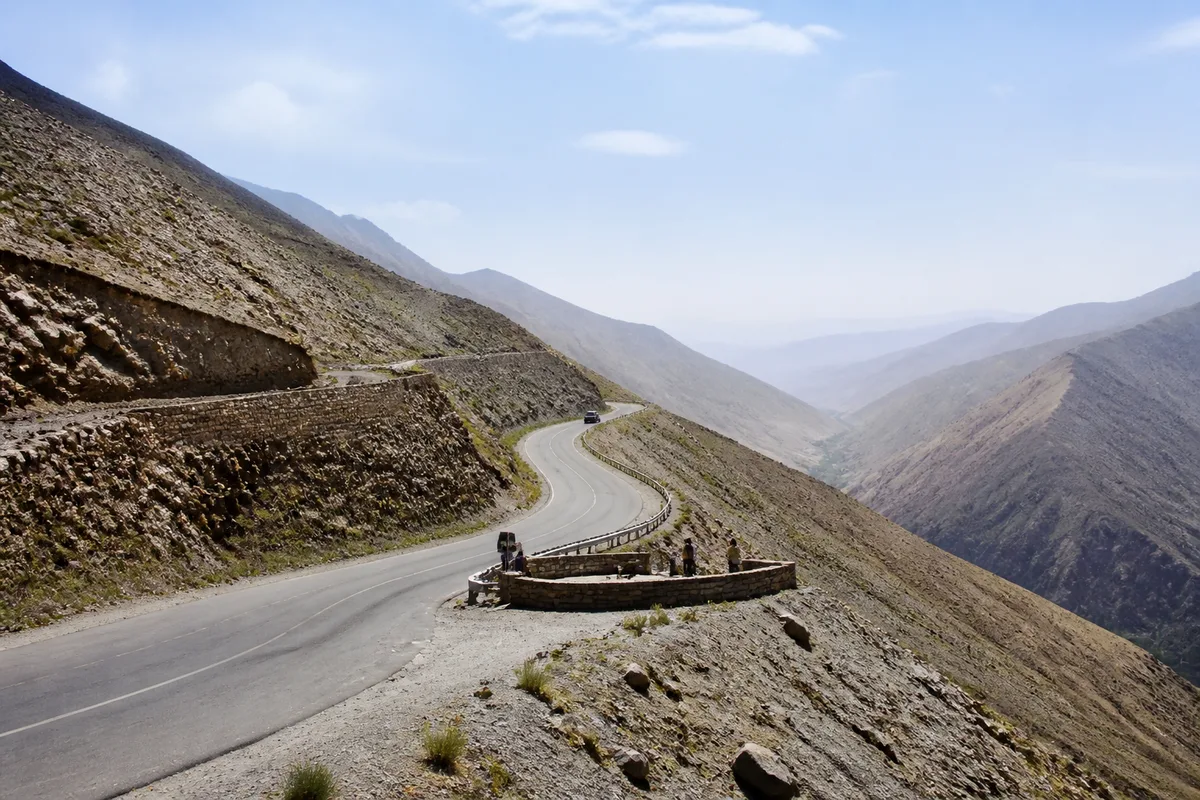
On the Atlantic coast, the map must connect Essaouira, Agadir, Legzira beach, and the southern roads, without giving the impression that visual proximity implies a short journey. Inland, the High Atlas greatly affects travel times: the Marrakech-Ouarzazate route is presented by a guide as about 200 kilometers long and requiring at least four hours via the Tizi n’Tichka pass, indicated at 2,260 meters.
To locate major landscapes, one can place Mount Toubkal at 4,167 meters, the Todra gorges in the southern valleys, and the Erg Chebbi near Erfoud, about 40 kilometers according to a published tourist selection. These values serve to organize a mental map; they do not turn a distance into a guaranteed duration.
How to use an interactive map of Morocco to build your itinerary?
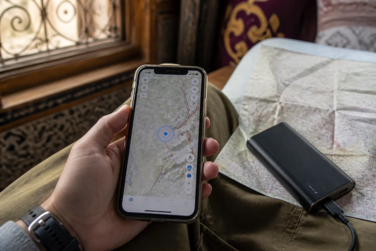
An interactive map is the most effective for searching for a place, moving stages, and calculating several variants before departure. It allows zooming in on a region, displaying tourist categories, and preparing offline zones, but it does not guarantee the condition of a track nor the accuracy of each point added by users.
Locating places, accommodations, and airports
Start by placing the arrival airport, the cities where you will sleep, and the sites that truly justify a detour. This method avoids filling the route with attractive points that are incompatible with the available time. Google Maps is useful for accommodations, restaurants, monuments, and displayed schedules.
An address can have several spellings.
Search for the French, Arabic, Amazigh, and transliterated variants of the same place, then compare the position, access route, and geographic context. A mis-transcribed name can place the result in another locality or show a homonymous establishment; coordinates then become the best check.
The vector map of Morocco can also help understand how zoom, layers, and digital display work before preparing a complex loop.
Preparing offline navigation
Organic Maps and applications based on OpenStreetMap allow you to download an area, search for streets and points of interest without an internet connection, then use the GPS signal to determine your position. The phone can therefore display a position without mobile network, while the battery remains a hardware constraint to manage separately.
Download the area before departure.
- Save the stages, accommodations, and important return points.
- Keep a paper map when the route passes through an isolated area.
- Never take a track shown as proof of passability, authorization, or safety.
Collaborative data can be very precise in a medina and much less detailed on a trail, a water point, or a remote track. For an unpaved road, the map shows geographic information; it does not necessarily describe works, seasonal closures, tolls, or local restrictions.
Road maps: distances, reliefs, and actual accessibility
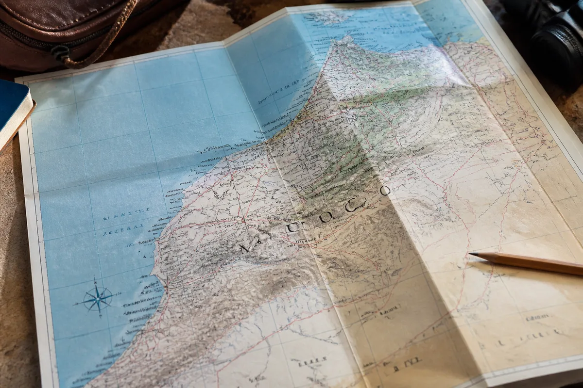
A road map is essential to compare major connections, but distance alone does not allow announcing a reliable travel time in Morocco. Mountain passes, winding roads, works, unpaved sections, stops, and weather conditions quickly turn a short itinerary on paper into a long day of travel.
Crossing the Atlas without underestimating the journey
The Tizi n’Tichka pass illustrates this constraint: a connection between Marrakech and Ouarzazate crosses a rugged terrain, with an altitude indicated at 2,260 meters and a duration announced as at least four hours for about 200 kilometers in a guidebook. The map serves to understand the shape of the route, not to promise an arrival time.
The straight line is often deceptive.
For a transfer day, plan a margin suitable for breaks, weather, and road conditions, then check local conditions before leaving. Traffic information, roadworks, or closures must come from an official channel or a local contact directly involved with the route.
Roads, tracks, and cartographic borders
Commercial, institutional, and collaborative maps do not always represent the same routes, especially near land borders or in sensitive areas of Western Sahara. The drawn border, the accessible road, and the authorized route are three distinct pieces of information; a tourist map alone does not resolve an administrative or security issue.
In a disputed area or near a border, keep the route of the competent authorities and the local instructions applicable to your travel. It is impossible to guarantee remotely access to a track, a checkpoint, or a viewpoint whose situation is evolving; this lack should lead to modifying the itinerary, not interpreting the drawing as permission.
To compare the Michelin support to a classic road map, the comparison of the Michelin map of Morocco details the criteria of scale, readability, and use.
Specialized maps for the Atlas, the desert, and the medinas
A specialized map becomes necessary as soon as the main objective is a hike, a desert track, or a walking visit in a medina. It then shows information that a national map simplifies: contour lines, trails, passes, alleys, gates, tracks, water points, or shelters when they actually appear on the chosen edition.
Atlas, trekking, and kasbah routes
For the High Atlas and the Toubkal massif, choose a regional map whose scale allows reading valleys, altitude changes, and route variations. A road map remains useful to reach the start of a hike, then quickly loses its relevance when the movement leaves the main road.
The relief must be readable.
The publication date matters for shelters, trails, and access, but it is not enough to certify the state of the terrain. Routes can be modified by landslides, floods, or works; on site, the presence of a mapped path does not guarantee that it is open or passable.
Desert, tracks, and resupply
Around Merzouga, Zagora, and the pre-Saharan valleys, a desert map must help distinguish tracks, oases, villages, bivouacs, and areas of scarce resupply. The Erg Chebbi is located near Erfoud, about 40 kilometers in a tourist presentation, while the actual routes depend on the chosen track and its access.
A visible track is never enough.
For the desert, leave with a specialized map, a coherent digital track, and recent local information on resupply points. The vehicle, weather, passage authorization, and terrain condition determine feasibility; no cartographic display replaces these concrete conditions.
Maps of Marrakech, Fès, and the medinas
In Marrakech, Fès, Essaouira, Chefchaouen, or Meknès, a local map makes walking in the historic districts easier. Gates, souks, museums, parking lots, and monuments are easier to connect with it than with a national map, which lacks space to represent alleys and pedestrian passages.
Maps printed by a tourist office, a local publisher, or an establishment may differ in accuracy. An offline copy of the visited neighborhood complements the paper map to find an address, but the name of an alley may vary depending on the language or transliteration used.
How to check a paper map before purchase?
Before buying, check four elements: the scale, the publication date, the geographic coverage, and the actual availability. A map can be excellent for locating regions yet unsuitable for a hike, while a specialized product may be suitable for a mountain range but become useless for a route crossing the country.
- Scale: a 1:800,000 map offers a national view, not the detail of an alley or a trail.
- Date: the IGN edition reference 85108 is dated September 3, 2018.
- Price: the IGN sheet showed €9.20 at the time of extraction, with the product indicated as permanently out of stock.
- Coverage: check for the presence of secondary roads, tracks, reliefs, or administrative boundaries that are actually useful.
- Medium: paper withstands a dead battery, but its folding and readability must suit the intended use.
The IGN sheet thus provides precise data for a specific reference: scale 1:800,000, edition of September 3, 2018, and displayed price of €9.20 at the time of extraction. It does not allow generalizing this information to all maps of Morocco, nor to conclude that a product still available in 2026 has the same edition.
The price should be confirmed at the time of purchase.
A map shown as available may be sold out, replaced, or offered under a new edition; the commercial offer changes faster than geography. For this reason, the final choice should be based on the exact product sheet and not just on the name Michelin, IGN, or Reise Know-How.
| Rank | Medium | Main advantage | For which trip? |
|---|---|---|---|
| 1 | Michelin Morocco 742 | Road reading and overview | First car trip |
| 2 | Offline interactive map | Search, GPS, and addresses | Preparation and daily navigation |
| 3 | Reise Know-How Morocco | Durable paper medium and detailed coverage | Secondary roads and frequent use |
| 4 | Atlas or trekking map | Relief, trails, and passes | Hiking and the Toubkal massif |
| 5 | Desert map or medina plan | Targeted local detail | Tracks, bivouac, or walking visit |
Verdict: which combination to choose according to your itinerary?
The belief that one app replaces all maps is therefore incomplete: it overlooks the battery, missing data, name variations, and the uncertainty of tracks. Conversely, paper alone is not enough to find every accommodation or recalculate a route. The best ranking is based on use, not on a medium declared superior in all cases.
Useful sources to consult
Cartographic guide of Morocco → published estimates for Marrakech-Ouarzazate, the Tizi n’Tichka pass and the Toubkal mountain → useful to measure the effect of relief on the route → these durations remain linked to the journey and traffic conditions.
.magic-lb-overlay.open{display:flex}
.magic-lb-overlay img{max-width:95vw;max-height:95vh;object-fit:contain;border-radius:8px;box-shadow:0 8px 32px rgba(0,0,0,.5)}
.magic-lb-close{position:absolute;top:16px;right:20px;color:#fff;background:rgba(0,0,0,.5);border:none;width:40px;height:40px;border-radius:50%;font-size:24px;cursor:pointer;display:flex;align-items:center;justify-content:center}
.magic-lb-close:hover{background:rgba(0,0,0,.8)}
.wp-block-image img{cursor:zoom-in;transition:transform .15s ease}
.wp-block-image img:hover{transform:scale(1.01)}
.magic-img-link{display:inline-block;text-decoration:none}
(function(){
var ov=document.getElementById(‘magic-lb’);if(!ov)return;
var img=ov.querySelector(‘img’),btn=ov.querySelector(‘.magic-lb-close’);
var L={fr:’Fermer’,es:’Cerrar’,en:’Close’,pt:’Fechar’,it:’Chiudi’,de:’Schlie\u00dfen’,nl:’Sluiten’,ca:’Tancar’};
btn.setAttribute(‘aria-label’,L[(document.documentElement.lang||”).slice(0,2).toLowerCase()]||’Close’);
function open(src){img.src=src;ov.classList.add(‘open’);document.body.style.overflow=’hidden’}
function close(){ov.classList.remove(‘open’);img.src=”;document.body.style.overflow=”}
document.addEventListener(‘click’,function(e){
var a=e.target.closest(‘a.magic-img-link’);
if(a){e.preventDefault();open(a.getAttribute(‘href’));return}
var i=e.target.closest(‘.wp-block-image img’);
if(i&&!e.target.closest(‘a’)){e.preventDefault();open(i.currentSrc||i.src)}
});
ov.addEventListener(‘click’,function(e){if(e.target===ov||e.target===btn)close()});
document.addEventListener(‘keydown’,function(e){if(e.key===’Escape’)close()});
})();