
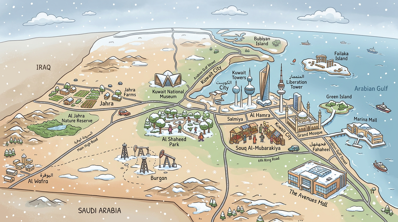
Exploring Kuwait through its geographical map allows one to discover its specificities, from vast deserts to the shores of the Arabian-Persian Gulf. Located in the northeast of the Arabian Peninsula, this small country reveals a unique history and administrative organization that are perfectly reflected on its maps. Between satellite images and photos, precise GPS coordinates and detailed descriptions, diving into the cartography of Kuwait is to grasp the very essence of its identity, from its dynamic capital to its rich natural and urban contrasts.
Where is Kuwait located on the world geographical map?
Kuwait occupies a strategic position north of the Arabian-Persian Gulf, bordered by Iraq to the north and west, and by Saudi Arabia to the south. The regional geographical map highlights the country’s proximity to some of the world’s main maritime and energy transit points. Thanks to its GPS coordinates near 29°30’ north and 47°45’ east, Kuwait appears as a focal point on trade routes connecting Asia, Africa, and Europe.
This position is no coincidence. For centuries, the lands of Kuwait have served as an interface between different civilizations. Ancient maps testify to this richness of influences, while current images and aerial photos highlight the development of its coastline and modern ports.
How is the geography of Kuwait organized?
At a glance on a detailed map, the Kuwaiti geography primarily evokes flat desert, punctuated by some modest elevations and relatively fertile coastal areas. No major mountainous relief interrupts these open landscapes where the sea reaches the gates of the capital and main urban centers.
Over the years, urban planners have transformed part of this environment to accommodate oil and residential infrastructures, drawing on maps a striking contrast between natural space and urban fabric. This opposition is also visible on night images and photos, where city lights sharply contrast with the darkness of the desert.
Key natural areas illustrated on the map
Several elements catch the eye when exploring natural spaces on a geographical map of Kuwait:
- The Kuwait Bay, a vast cove giving access to the sea.
- Bubiyan Island, the largest island of the country, famous for its salt marshes and biodiversity.
- Failaka Island, known for its historical remains and preserved landscapes.
- Sandy deserts covering nearly 70% of the national area.
Unlike some neighbors where mountains dominate, here, the natural spectacle plays out more around subtle terrain variations and changing coasts depending on tides or port developments.
Satellite images today offer a precise view of this fragile environment, notably allowing the location of protected areas and monitoring the coastline’s evolution in the face of growing urbanization.
Hydrography and water resources on the map
Examining the map of Kuwait reveals a particular aspect: the lack of surface freshwater sources. Only rare temporary wadis and some underground aquifers complement a landscape where every drop counts.
This quickly explains the abundance of desalination plants near the coastal zone, visible on some satellite images and photos as large white facilities lined along the coast.
In the absence of permanent rivers, the immediate proximity to the Arabian-Persian Gulf has determined not only water supply but also the country’s commercial and industrial influence.
What are the governorates and administrative divisions of Kuwait?
The Kuwaiti territory is divided into several governorates, each having its own political, economic, or demographic importance. On an administrative map, these divisions represent a way to better understand how daily and institutional life is structured in the country.
Currently, the official map shows six major territorial units, arranged quite evenly around the capital. To visualize their exact distribution, simply consult a recent administrative map or carefully observe their borders on numerous geographical images available online.
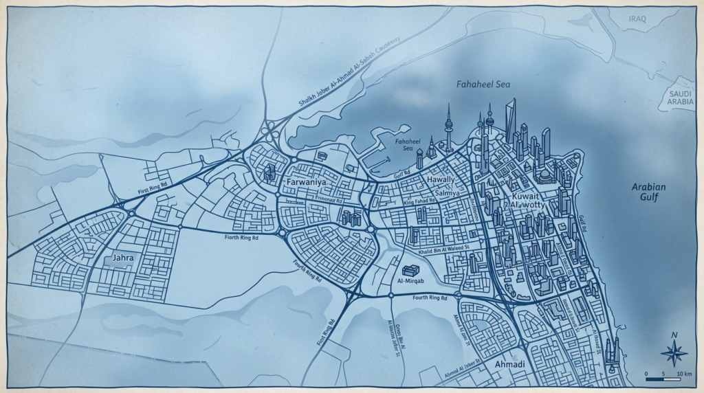
List of Kuwait’s governorates
Here are the main administrative divisions shown on the map of Kuwait:
- Al Asimah (Kuwait Capital)
- Hawalli
- Al Farwaniya
- Al Jahra
- Mubarak Al-Kabeer
- Ahmadi
Each governorate has its own economic, cultural, and social characteristics. Their boundaries respond both to historical logic and contemporary needs for land management.
Administrative map and local identity
Residents often strongly identify with their governorate, each division having representations and symbols attached to it, visible on certain decorative maps or during local events.
The metropolis of Kuwait, the true beating heart of the country, extends over several governorates, particularly Al Asimah and Hawalli. This organization promotes better management of services, whether in education, health, or public transportation.
Kuwait: capital, population, and area
It is difficult to talk about the map of Kuwait without mentioning its capital, which also gives its name to the country. A true administrative, cultural, and economic center, the city of Kuwait occupies a privileged position on the northern flank of the Arabian-Persian Gulf. From there, it radiates across the entire territory via a dense and well-organized road network, clearly visible on any modern map.
Exploring a detailed urban map, one notices the major concentration of activities around the port, government institutions, and international districts. This dynamism attracts new residents every year, contributing to continuous growth of the urban population.
Some key figures on population and area
To get a concrete idea, here are some statistical characteristics visible on thematic and demographic maps:
- Total area of the country: about 17,818 km², making it one of the smallest states in the region.
- Population estimated at nearly 4.5 million inhabitants according to the latest available data.
- High density around the capital and the coast, contrasting with vast, almost uninhabited interior desert areas.
- Large number of expatriates, sometimes represented by neighborhood or residential zone on certain specific maps.
Thus, despite its modest size, Kuwait stands out for a very uneven population distribution, mainly concentrated around urbanized areas.
This imbalance is reflected in images and photos at night where, from space, only the coastal agglomerations shine brightly, leaving large interior sectors in darkness.
GPS coordinates and notable points
Locating Kuwait using GPS coordinates becomes easy. The center of the capital is located slightly above the 29th parallel north, while the longitude is just below the 48th meridian east.
On all maps, the following are also shown:
- The Seif Palace, a historic monument marking political power.
- The Kuwait Towers, famous architectural landmarks on the edge of the Arabian-Persian Gulf.
- The large Mubarakiya souk, concentrating commercial traditions and local gatherings.
These points of interest are systematically indicated on tourist maps and highlight the cosmopolitan and heritage dimension of this small state.
Why consult a map of Kuwait?
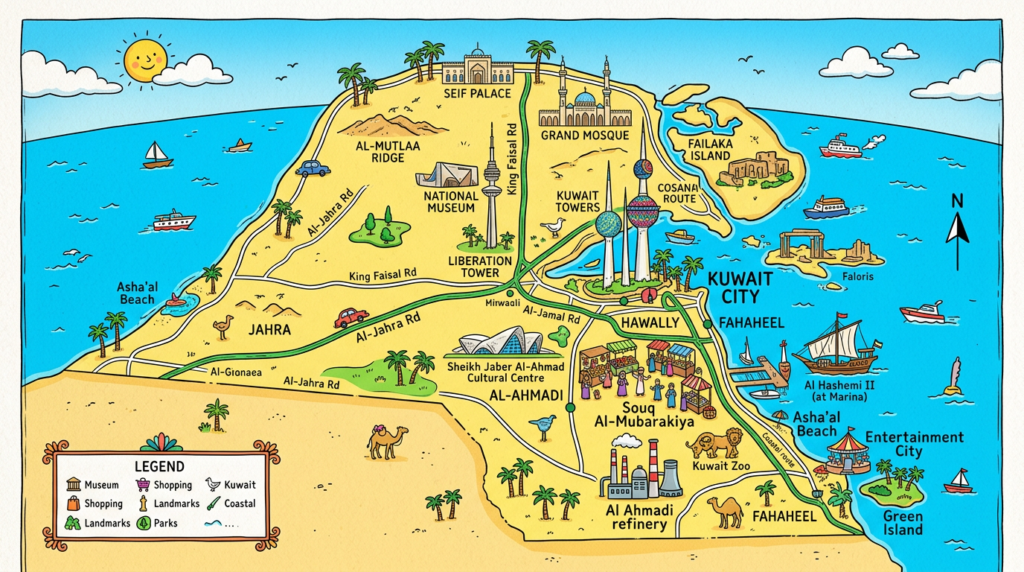
Whether to prepare for a trip, follow current events, compare urban developments, or simply admire the color nuances offered by images and satellite photos, the map of Kuwait remains an essential tool.
Thanks to it, one immediately understands the challenges posed by the presence of hydrocarbon deposits, rapid population growth, and the need to adapt infrastructure in such a limited and coveted space.
Practical applications and common uses
Analyzing the geographical map of Kuwait meets various needs:
- Visualize the distribution of the population and anticipate internal migration flows.
- Easily identify the governorates and understand their daily administrative role.
- Locate strategic infrastructures such as refineries, ports, and military bases.
- Monitor the impact of growing urbanization at the expense of natural areas.
Many also use these maps to virtually explore the region, notably by consulting recent images or conducting searches using GPS coordinates.
Digital cartography and new perspectives
Technological advances open the door to a renewed reading of the Kuwaiti territory. Interactive maps, high-resolution satellite imagery, GPS navigation tools accessible to all: so many innovations disrupting methods of representation and analysis.
We are witnessing the multiplication of platforms offering 3D views or animated models of relief and urban networks, allowing an unprecedented immersion into the cartographic world of this fascinating country.
Whether for research, resource management, tourism, or education, the map of Kuwait thus continues to reveal new facets and support the modernization of a nation in motion.
