
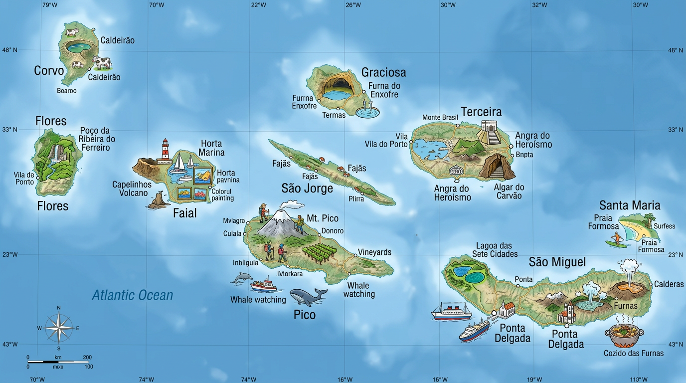
Do you dream of escaping to distant lands? The Azores archipelago, situated in the middle of the Atlantic Ocean, stands out as a pristine natural destination full of surprises. This group of islands, far from the crowds, fascinates with its wild landscapes, exceptional biodiversity, and unique history between Europe and the New World. Diving into the secrets of the Azores also means taking an interest in their representation on a map and knowing how to make the most of a plan or a tourist map during your trip. Discover what makes this Portuguese archipelago so rich, as well as all the resources to organize your explorations thanks to the magic of maps.
Understanding the Azores archipelago through maps
The Azores are often called the pearl of the Atlantic. Their geographical location in the heart of the Atlantic Ocean greatly influences their climate, vegetation, and even their culture. Visualizing these islands on a map helps better grasp the distance separating them from the European continent as well as their own organization.
While travelers readily rely on a classic tourist map, today there is a wide variety of representations: detailed plans suited for hiking, interactive online maps to prepare a personalized itinerary, and tools to locate beaches, volcanoes, or panoramic trails. Using a precise map quickly becomes essential to take advantage of the hidden treasures of each island.
Where exactly are the Azores located on a map?
It is hard to imagine these islands without looking at the map of Portugal and the Atlantic Ocean. Located around the 38th parallel north, they lie about 1,400 kilometers from the Portuguese coast and nearly 2,000 kilometers from the American continent. This central positioning explains why these isolated lands sometimes serve as a maritime link.
On most world maps, these lands appear as tiny spots lost in the vast blue. But as soon as you move to a local scale, you discover a myriad of main and secondary islets organized into three distinct groups, easily identifiable on any detailed map of the archipelago.
The different types of maps to explore the archipelago
Choosing the right map often depends on the type of exploration desired. A general plan is enough to understand the distribution of the islands, whereas a topographic map will reveal, for example, the impressive slopes of Pico volcano or the rugged relief of São Miguel. Tourist guides also offer maps highlighting must-see sites, while some mobile applications allow real-time visualization of points of interest.
To organize your movements, it can be useful to combine several supports: a paper map for orientation during walks and digital solutions to estimate distances or discover little-known routes. Know that there are also specific plans for nature lovers, diving enthusiasts, or for pilgrimage paths crossing the archipelago.
The organization of the nine Azores islands on a map
The Azores archipelago consists of nine main islands divided into three geographical groups. Each displays unique characteristics, perceptible when detailing a regional map. This diversity enhances the appeal of the trip, inspiring a desire to move from one universe to another… while staying within the same archipelago.
Discovery, guided by an adapted map, facilitates understanding of these natural and human contrasts, offers precise landmarks, and encourages going off the beaten path. Whether you choose a quick getaway or an immersive stay, having a detailed plan ensures varied and enriching experiences.
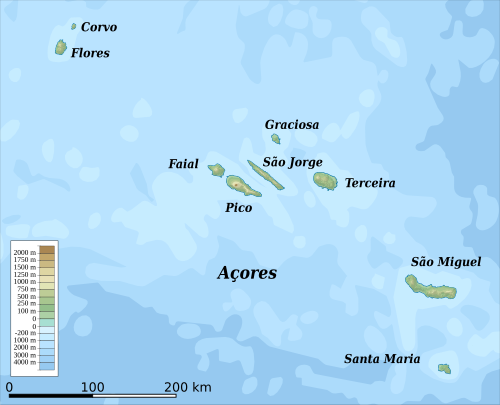
Which Azores islands should be prioritized on a tourist map?
Among the nine islands, some particularly attract attention when consulting a tourist map. This is the case for São Miguel, often nicknamed “the green island” thanks to its lush landscapes, or Pico, famous for hosting the highest mountain in Portugal with its iconic volcano. Faial offers a lively port much appreciated by boaters, and Terceira charms with Angra do Heroísmo, a city listed as a World Heritage site.
Other lands hide lesser-known but equally fascinating gems: Flores, Corvo, Graciosa, São Jorge, and Santa Maria. Each reveals a different face of the archipelago, alternating between majestic cliffs, volcanic lakes, and traditional villages nestled in pastoral landscapes. Consulting a map before departure helps to plan an itinerary suited to one’s desires and personal interests.
Spatial organization of island groups
By observing a basic map of the archipelago, three groups clearly appear. The eastern group includes São Miguel and Santa Maria, two nearby islands that share a cultural influence due to their advanced position towards Europe. In the center, we find Faial, Pico, São Jorge, Graciosa, and Terceira, forming a lively island core marked by historical exchanges between each of these lands. Finally, the western group includes Flores and Corvo, more isolated and characterized by direct contact with the wild Atlantic.
This organization helps shape different atmospheres, both climatic and cultural, which travelers quickly notice when moving from one island to another. For hiking enthusiasts or thematic tours, an interactive map proves useful to customize each stage of the journey.
Using a practical map to organize a trip to the Azores
Before a trip to the Azores, nothing beats careful planning facilitated by accurate maps. Thanks to the multiple resources available today, everyone can build a stay perfectly adapted to their interests, whether they are passionate about volcanism, whale watching enthusiasts, or curious about local traditions.
Since the islands are far from each other, it is important to prepare travel well. A clear plan showing ports, ferries, and airports simplifies the coordination between stages. Infrastructure varies and there is no direct road connection between the islands, so thinking through every detail of the itinerary helps avoid unpleasant surprises during the stay.
What to spot first on a tourist map?
A well-designed tourist map is full of resources to maximize the experience on site. It generally highlights major attractions, such as calderas, miradouros (viewpoints), typical villages, and beaches to relax after excursions. It also includes:
- Marked hiking trails, accessible to all or reserved for the more experienced.
- Dolphin and whale watching points, a flagship activity of the archipelago.
- Dormant or active volcanoes, perfect for fans of geological phenomena.
- Protected areas and nature reserves, ideal for discovering the fauna and flora of the Azores.
- Large cities and villages with heritage value, often accompanied by a brief historical description.
Adapting the use of the map according to the season also improves the comfort of the trip. For example, some mountain roads may close in winter, while in summer, enjoying religious or traditional festivities on each island is among the highlights featured by event maps, available at the tourist office.
How to maximize your stay using modern cartographic resources?
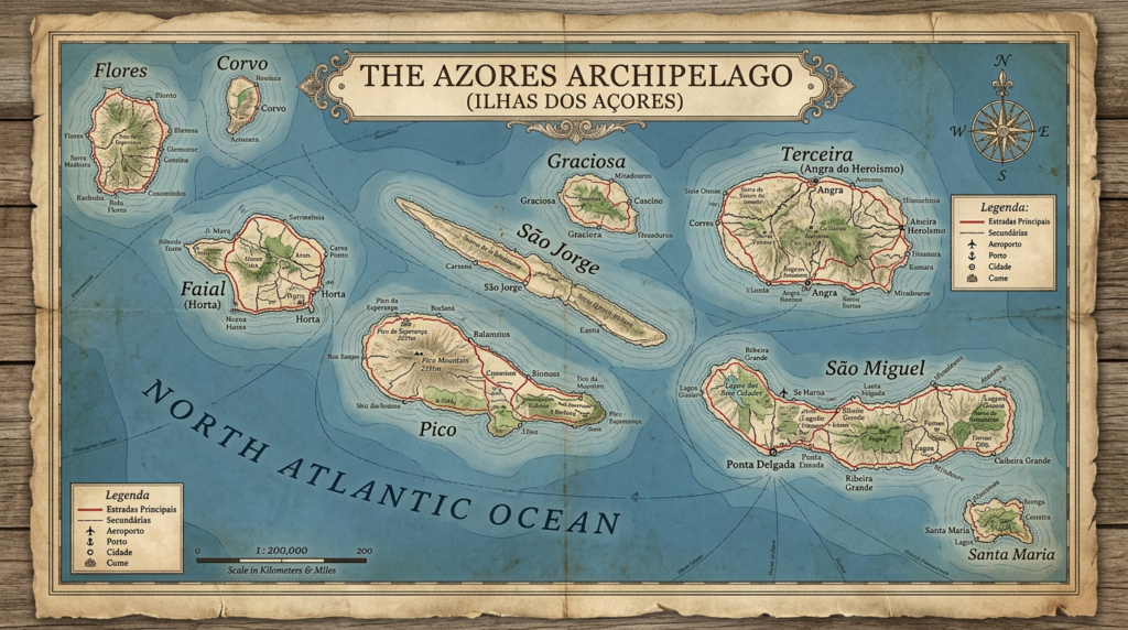
Connected travelers now have interactive maps and applications capable of locating every key point in real time, offering personalized routes, and even suggestions based on their preferences. Some platforms combine photos, reviews, schedules, and frequent updates to avoid missing an unmissable activity or a spectacular panorama.
It is also observed that many tourists mix digital tools with traditional paper documents. This allows anticipating any loss of internet connection in isolated areas of the archipelago, while benefiting from a global view of distances and terrain. Taking advantage of multiple sources of information often remains the best formula to respond to unforeseen events that punctuate extraordinary travels.
A brief history of the Azores through old maps
Taking an interest in ancient cartographic representations gives another dimension to the exploration of the archipelago. At the end of the Middle Ages, Portuguese navigators were the first Europeans to record the existence of these islands on their marine charts. The first maps were approximate and filled with legends, some even attributing the formation of the Azores to mythical lost civilizations.
Over the centuries, the improvement of nautical and terrestrial surveys has allowed refining knowledge of these territories. Modern cartography today benefits from satellite techniques and GIS (geographic information system). Studying these evolutions offers a beautiful panorama not only of the history of navigation but also of the natural and human richness of the Azores.
What was the contribution of maps in the history of the settlement of the Azores?
From the first medieval sketches to the precise surveys carried out from the 19th century onwards, maps proved essential for organizing the progressive colonization of the archipelago. They guided the first immigrants from mainland Portugal, then served to plan agricultural crops and the implementation of new internal roads on the main islands.
Even today, collective memory maintains a strong link with these initial layouts and the way island geography structures local life and exchanges. Observing old tourist maps allows measuring landscape changes as well as the progressive enhancement of natural heritage.
The role of maps in the protection of the island environment
With the growth of sustainable tourism and the desire to preserve fragile Atlantic ecosystems, maps are now also used to delimit protected areas or spaces allowing certain sporting activities. By precisely locating biosphere reserves, visitors know how to adapt their behavior to establish a balance between discovery and environmental responsibility.
Some local initiatives regularly publish updated maps identifying new ecological trails, anti-erosion devices, or restrictions concerning fishing and motorized traffic. Field agents also make extensive use of these materials to raise visitors’ awareness about respecting natural environments.
From São Miguel to Corvo: choosing your destination using the Azores map
Faced with the extent and diversity of the archipelago, selecting “your” island becomes a key moment in preparing a trip to the Azores. São Miguel attracts those seeking mild temperatures, natural thermal baths, and enchanting crater lakes. Bettencourt, Lagoa das Sete Cidades, or Furnas are among the most appreciated panoramas.
On the opposite end, Corvo charms with its tiny size, peaceful atmosphere, and classified biosphere reserve. Each potential stop invites following one’s own plan to explore caves, waterfalls, deserted beaches, or picturesque markets according to desires and length of stay. Browsing the archipelago map helps make informed choices and compose a balanced itinerary between nature, culture, and relaxation.
