
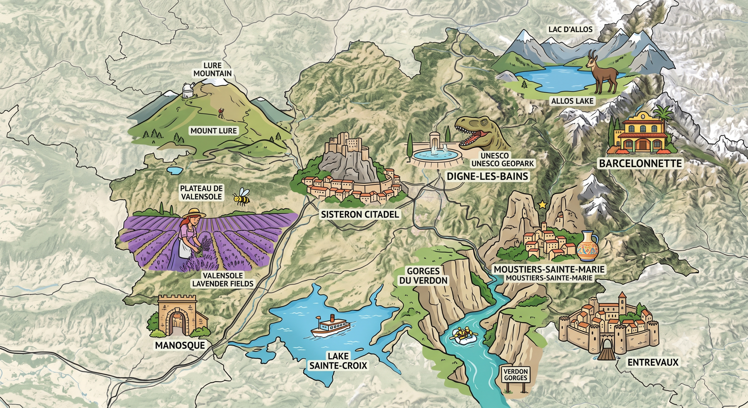
What you need to know about Alpes-de-Haute-Provence ?
Located in the Provence-Alpes-Côte d’Azur region, the Alpes-de-Haute-Provence department is identified by the number 04 in France. It has around 166,000 inhabitants spread over an area of 6,925 km², representing an average population density of 24 inhabitants per km². Created on 4 March 1790 during the French Revolution, this department has Digne-les-Bains as its capital (prefecture). Its inhabitants are known as the Bas-Alpins, and the territory is organized into 4 districts, 15 cantons and 198 municipalities.
The climate of this Alpes-de-Haute-Provence department is characterized as subtropical. This climate is marked by a generally humid year and little to no dry season. Temperatures fluctuate throughout the year around 12.4°C. And the amount of rainfall is about 636.3 mm annually. The hottest months are from June to September.

Which departments border Alpes-de-Haute-Provence?
Bordered by Île-de-France, Nord Pas-de-Calais, Champagne-Ardenne, and Picardie, the Alpes-de-Haute-Provence department also shares a border with the following departments: Ardennes, Marne, Seine-et-Marne, Oise, and Somme. In fact, Belgium also shares a common border with Alpes-de-Haute-Provence.
What are the best places to visit in Alpes-de-Haute-Provence?
Annot
Located in the northeastern part of the department, the town of Annot is favored by terrain interspersed with streams and rivers. Take the train and enjoy the breathtaking view while traveling to Nice from Digne-les-Bains. In the lowest area of the town, you can see the Vaire river, one of the most popular. You will also see in Annot a donjon and a congregation, not to mention the town center square also called the “dark square.”
Barcelonnette
Located in the Ubaye valley, the town named Barcelonnette is dominated by mountains that characterize the Alpes-de-Haute-Provence department. The best place to visit is a tall tower called the Clock Tower, dating from the 15th century. This tower was once part of a religious circle. You will also see the Paul Reynaud House and Honorat Street. Finally, there are old architectures made up of “Mexican houses” in a style dating from the 1890s.
What are the towns of the Alpes-de-Haute-Provence department?

The largest towns in the Alpes-de-Haute-Provence department, by population, are: Manosque, Digne-les-Bains, Sisteron, Château-Arnoux-Saint-Auban, Oraison, Forcalquier, Pierrevert, Villeneuve, Les Mées, Sainte-Tulle, Volx, Barcelonnette, Valensole, Peyruis, Gréoux-les-Bains, Malijai, Riez, Volonne.
FAQ-Map of Alpes-de-Haute-Provence
The Alpes-de-Haute-Provence are located in the Provence-Alpes-Côte d’Azur region, in southeastern France. This department is appreciated for its natural landscapes, mountains, typical villages, and vast preserved areas.
The prefecture of the Alpes-de-Haute-Provence is Digne-les-Bains, a town known for its thermal heritage and natural surroundings. It is the main administrative and cultural center of the department.
A map of the Alpes-de-Haute-Provence helps locate the towns, mountain areas, main roads, and tourist attractions of the department. It is particularly useful for planning a trip, discovering Provençal landscapes, and preparing outdoor activities.
