
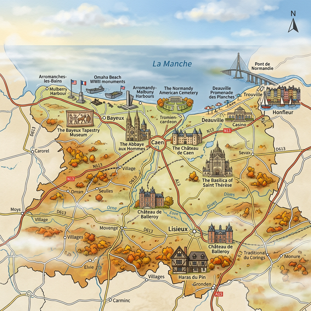
What you need to know about the Calvados department ?
Together with the departments of Manche and Orne, department 14 is part of the Normandy region. This department is called Calvados. Its inhabitants, known as the Calvadosiens, now number around 705,000. The department covers an area of 5,548 km², giving it an average population density of approximately 127 inhabitants per km². The capital and prefecture of Calvados is Caen, while its sub-prefectures are Bayeux, Lisieux, and Vire Normandie.

This said department is located in the northeastern part of Lower Normandy. Originally, this department was an artificially created area and there are many cultural and geographical zones. Thus, Calvados is divided into 4 distinct regions including: the Bessin region located in the west of the department, then there is the southwestern part called the Norman Switzerland.
In fact, Calvados is what one might call an original department. The reason is that there are a total of 83 departments (including Calvados, of course) which were established in the year 1790 during the revolution.
Formerly, Calvados was a territory of Normandy, when the latter was still a province. But during that time, Calvados was still called “Orne-Inférieure.” The name Calvados was given to the department because it has two sparsely vegetated hills that resemble bare backs. (Calva Dorsa in Spanish)
What are the neighboring departments of the Calvados department?
The Calvados department being part of the Normandy region, its neighboring departments are: Seine-Maritime which is connected to it to the northeast. Then there is the Eure department which shares a common border with Calvados to the east, and finally, there is Orne and Manche which border it respectively to the south and west.
What is the climate like in the Calvados department?
When talking about the climate of Calvados, it varies depending on the region you are in. Moving towards the coast, such as in the city of Caen, the climate is strongly influenced by the tide. This actually means that the climate is mild in both summer and winter. When going south, especially near the border with Orne, the climate becomes increasingly harsh. In other words, winters are very cold and summers are very hot.
What are the most important ities in the Calvados department?
Based on the population density per km2, here are the most important cities in the Aude department:
- Caen
- Lisieux
- Hérouville-Saint-Clair
- Bayeux
- Vire
- Ifs
- Mondeville
- Ouistreham
- Falaise
- Honfleur
- Dives-sur-Mer
- Colombelles
- Condé-sur-Noireau
- Blainville-sur-Orne
- Trouville-sur-Mer
- Douvres-la-Délivrande
- Giberville
- Mézidon-Canon

What are the most important municipalities in the Calvados department?
Here are the 10 municipalities with the largest areas in the Calvados department
- Saint-Gatien-des-Bois
- Valdallière
- Noues de Sienne
- Le Molay-Littry
- Vendeuvre
- Caen
- Landelles-et-Coupigny
- Clécy
- La Hoguette
- Cahagnes
Here are the 10 municipalities with the highest population in the Calvados department
- Caen
- Hérouville-Saint-Clair
- Lisieux
- Bayeux
- Vire Normandie
- Ifs
- Mondeville
- Ouistreham
- Falaise
FAQ-Map of Calvados
Calvados is a department located in the Normandy region, in northwestern France. It is renowned for its coastline, the D-Day landing beaches, its seaside resorts, and its historical heritage.
The prefecture of Calvados is Caen, a city known for its rich medieval heritage and its important role in the history of Normandy. It serves as the department’s main administrative, economic, and cultural center.
A map of Calvados helps locate the main towns, roads, coastline, and must-see tourist attractions. It is especially useful for planning a trip, visiting the D-Day beaches, or discovering the landscapes of Normandy.
