
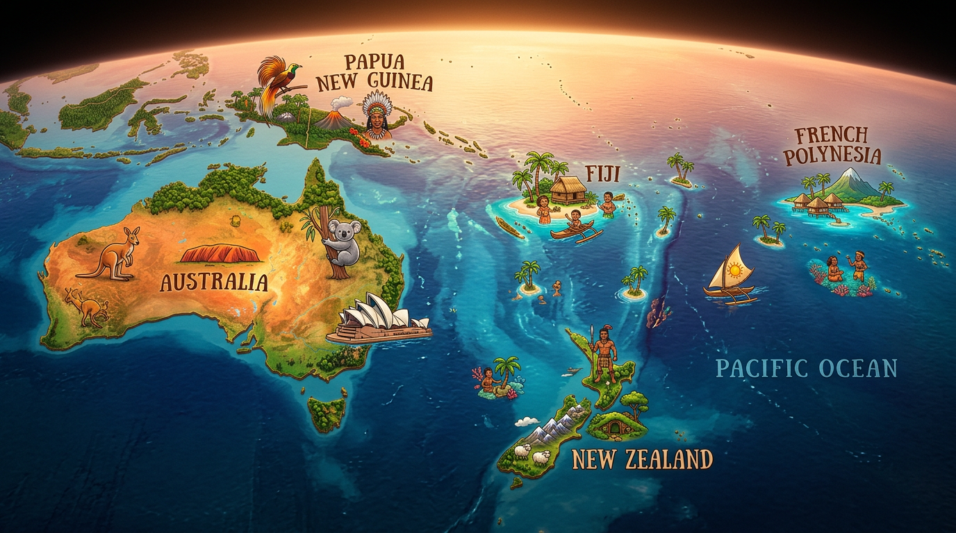
Oceania fascinates as much by its geographical as by its cultural diversity. This region of the world stretches over thousands of kilometers from east to west in the heart of the Pacific Ocean. To fully grasp the vastness and richness of this territory, a map of Oceania is essential. Whether one is interested in the major regional groups such as Australasia, Melanesia, Micronesia, or Polynesia, or seeks to identify each country of Oceania, there are many tools available to visualize everything that makes up this unique continent. Let’s detail together the specificities of a map of Oceania and how it helps to better understand this part of the globe.
What are the main characteristics of a map of Oceania?
Accurately representing Oceania is no small feat. With more than 20,000 islands scattered from Australia to the small atolls of Polynesia, cartography here requires increased precision. There are several types of maps, each highlighting different aspects of this vast island group.
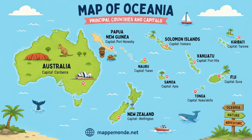
The political map of Oceania is often preferred by those who want to clearly distinguish the countries of Oceania and their capitals, whereas a physical map focuses more on reliefs, climate, and local natural features. Finally, detailed maps include cities, river networks, or mountains, providing an additional informative dimension, ideal for both the curious and travelers.
Political map: where are the countries of Oceania located?
At first glance, a political map easily distinguishes the borders of each country of Oceania. Australia and New Zealand stand out due to their size but actually represent only part of the island richness of the region. Archipelagos such as Fiji, the Solomon Islands, Kiribati, and the Marshall Islands are scattered across the Pacific Ocean over vast distances. Some political maps also show associated territories, such as Hawaii or French Polynesia, offering a global view of multiple cultural influences.
The main capitals are also mentioned, making them easy to locate for those preparing a trip or wishing to deepen their geographical knowledge. This type of map helps better understand the sometimes complex naming issues around the notion of countries and dependencies in this vast region.
General presentation of the physical map of Oceania
A complementary approach to discovering the entire continent is to consult a physical map of Oceania. On these representations, one can observe the details of the mountain ranges of Australia, the vast coastal plains, or the rugged reliefs of New Guinea. The archipelagos of Melanesia and Polynesia, composed of active volcanoes and coral atolls, take shape before the reader’s eyes, who thus discovers the natural diversity behind each country of Oceania.
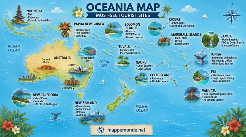
The physical map also offers a valuable reading of the climate: tropical rainforests, arid zones of the Australian interior, or subtropical highlands all give each region a strong identity. It therefore allows for a better understanding of the natural environment in which the populations of Oceania live.
How to read a detailed map of Oceania?
The richness of a detailed map lies in the abundance of information provided. Whether it is locating key cities, major rivers, iconic lakes, or mountain ranges, these maps offer a level of precision suited both to geography enthusiasts and casual curious readers.
Discovering the vast expanse of the Pacific through a map of Oceania also informs about the impressive distances separating certain countries and the logistical challenge that travel within the area represents.
Main cities and points of interest to spot
Several cities naturally stand out when observing the detailed map of Oceania. Sydney and Melbourne, in Australia, are widely recognized; Wellington and Auckland mark New Zealand. In the central Pacific, Suva (Fiji), Honiara (Solomon Islands), and Tarawa (Kiribati) serve as essential landmarks to quickly locate a multitude of archipelagos.
A complete map will also not forget Port-Vila in Vanuatu, Papeete in French Polynesia, or the legendary waters surrounding Hawaii, paying tribute to the diversity of urban centers established in this part of the world.
Lakes, rivers, and mountain ranges of Oceania
While Oceania is often associated with its paradisiacal beaches, the continent’s interior beauty also deserves to be highlighted. In Australia lies the famous Lake Eyre, known for its spectacular water level changes depending on the seasons. The Murray and Darling rivers cross the territory over hundreds of kilometers, structuring large agricultural areas.
In other parts of Oceania, Papua New Guinea stands out with its mountain ranges, while remarkable volcanic formations punctuate most of the islands in the region, especially in the South Pacific.
Focus on the regions of Oceania: spotlight on Australasia, Melanesia, Micronesia, and Polynesia
Oceania is classically divided into four major regions: Australasia, Melanesia, Micronesia, and Polynesia. Each has a unique identity, historically, culturally, and environmentally. A good map of Oceania should allow for understanding these contrasts.
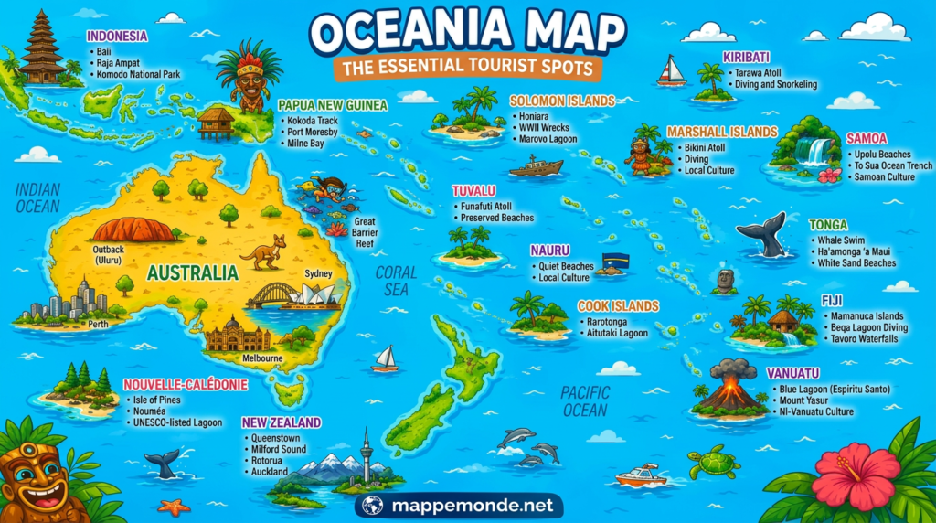
Exploration of these areas is not limited to administrative borders. Their boundaries reflect an exceptional human, linguistic, and ecological history, a true regional puzzle that makes the continent so rich.
Australasia and its continental diversity
Mainly consisting of Australia and New Zealand, Australasia also covers the large island of Tasmania. The landscapes vary greatly: red deserts of central Australia, dense forests of Queensland, majestic fjords of southern New Zealand. This area attracts many travelers each year who come to enjoy some of the most renowned natural sites on the planet.
On a detailed map, Australasia occupies the widest part of Oceania and alone contains endemic fauna and flora. Kangaroos, koalas, as well as kiwis are living symbols of this fascinating region.
Melanesia, Micronesia, and Polynesia: Archipelagos and Multiple Cultures
To the northeast lies the large island mosaic of the South Pacific archipelagos. Melanesia notably includes Papua New Guinea, the Solomon Islands, Vanuatu, and New Caledonia. These islands are home to some of the oldest Oceanian civilizations, with traditions passed down from generation to generation.
A little further north, Micronesia consists of a myriad of scattered small islands, including the Palau, the Marshall Islands, and the Federated States of Micronesia. Finally, Polynesia, a vast triangle formed between Hawaii, New Zealand, and Easter Island, encompasses many beach paradises, including Tahiti and the American Samoa.
What Themes to Explore with a Map of Oceania?
The use of a suitable map opens the way to several educational and practical themes. It allows addressing varied topics, ranging from the migration of peoples to ecological issues, as well as discovering places suitable for water activities or hiking.
Here is a list of topics commonly explored using a map of Oceania:
- Location of the main countries and capitals of Oceania
- Understanding regional subdivisions (Australasia, Melanesia, Micronesia, Polynesia)
- Identifying major cities and economic centers
- Identification of protected natural areas or UNESCO sites
- Study of major climatic phenomena (cyclones, ocean currents)
- Organization of travel and tourist circuits within the islands
Some users also seek to cross-reference different information, for example overlaying demographic data with geographical features, to better understand the impact of the environment on local daily life.
What to consider when choosing a map of Oceania?
Given the variety of available models, selecting a relevant map of Oceania depends on several criteria. First of all, it is necessary to define the needs: does one want a political map showing only borders, a physical map illustrating reliefs, or a hybrid map encompassing both cities and natural elements?
Your objective will play a decisive role. For example, a school will likely favor a clear wall map showing the regions of Oceania, while a traveler might prefer a foldable format featuring roads, ports, and precise logistical information.
Available media and formats
Many options exist, from large-format posters ideal for teaching to interactive maps accessible on smartphones or tablets. Some maps particularly highlight details, such as the names of all the islands and secondary archipelagos, or the hydrological networks too often overshadowed in simplified versions.
It can also be useful to compare the scales offered, some maps opting for an overview, others providing a specific zoom on Melanesia, Micronesia, or Polynesia. Careful examination thus prevents missing essential information for preparing a personal or professional project.
The evolution of Oceania cartography
The visual representation of the continent has continuously evolved, notably thanks to technological advances and better knowledge of remote territories. Today, it is possible to access digital maps constantly updated, integrating satellite photos and interactive descriptions.
This evolution benefits all audiences, offering an immersive exploration of each country or island group, and helping to strengthen our understanding of Oceania as a whole.
Discovering Oceania differently through maps
Browsing a map of Oceania immediately invites travel and discovery. Between crystalline seas, islands lost in vastness, bustling cities, or wild territories, each part of the continent tells a unique story. Learning through cartography nurtures a healthy curiosity and offers the possibility to concretely prepare one’s adventure, answer personal questions, or simply broaden one’s horizons.
Diving into this incredible island patchwork reminds us how the diversity and richness of Oceania continue to ignite dreams of exploration in many geography enthusiasts and lovers of wide-open spaces.
FAQ: Oceania map
Online world atlases or specialized cartography websites offer detailed representations including the Pacific archipelagos. These tools allow you to visualize the vast maritime expanse and the distribution of Oceanian countries and territories.
Yes, modern maps often include time zone differences to distinguish between Australia, New Zealand, and the Pacific islands. This greatly facilitates planning your communications or intercontinental travel.
Thematic maps are available from regional tourist offices to target specific areas such as Polynesia or Melanesia. They highlight air connections and major visitor infrastructure.
