
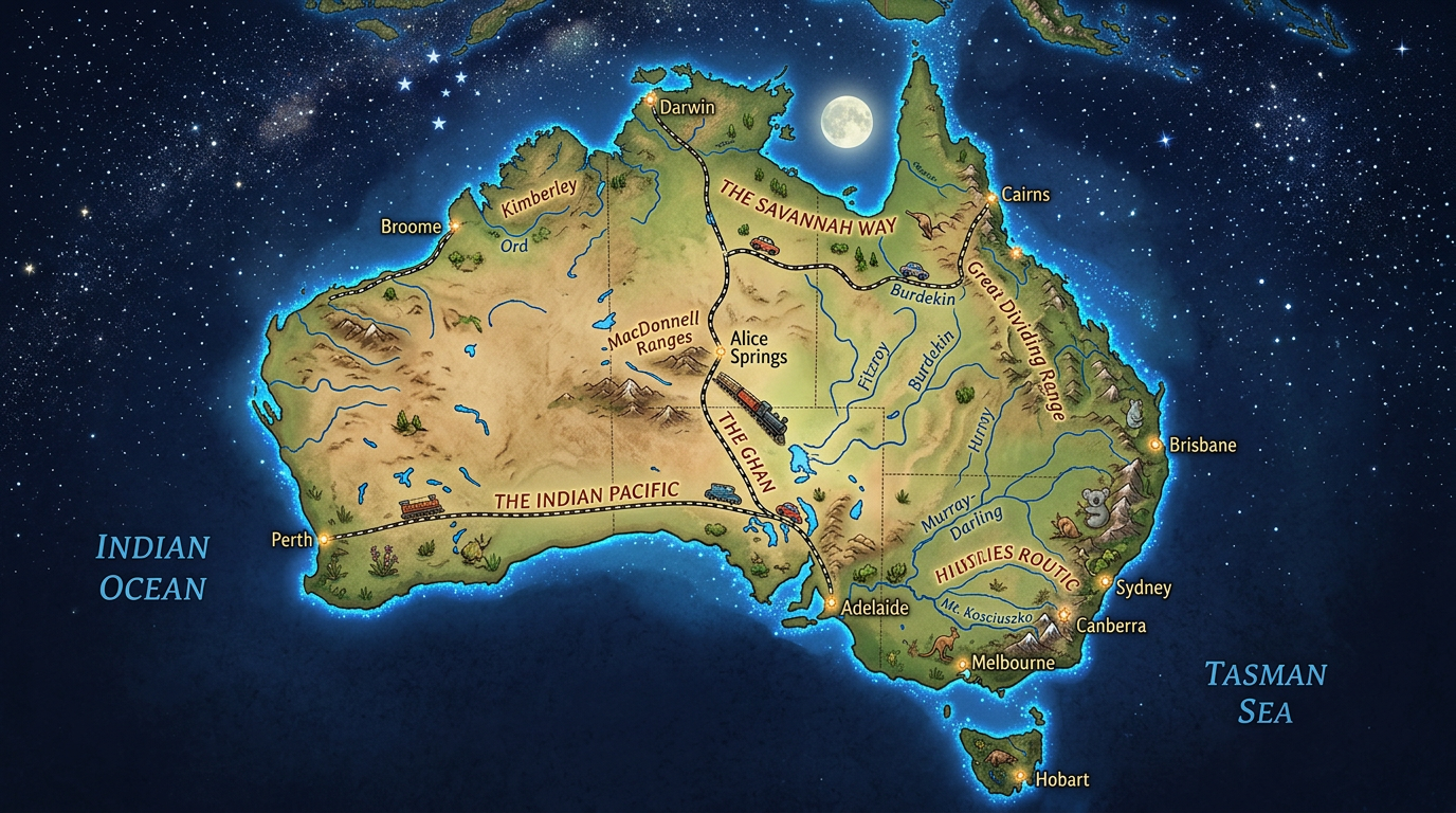
When Australia is mentioned, an image immediately comes to mind: that of a vast territory surrounded by oceans, with landscapes as varied as they are spectacular. Whether organizing a trip, preparing a road trip, or satisfying geographical curiosity, using an Australia map is essential to grasp the full richness of the continent country. This article proposes to dive into the world of Australian maps to reveal their multiple facets, from locating cities and regions to adventures along tourist routes.
The different types of maps to discover Australia
Exploring Australia often requires several cartographic supports: a classic geographical map, an online interactive map, detailed plans of major cities, or tourist diagrams. The choice of tool will primarily depend on the planned project: tourist stay, business trip, road trip, or simple information search.
Some travelers prefer the paper map for its durability during hikes, while others opt for an interactive map on their smartphone to track their progress, search for points of interest, or calculate their routes more easily. Beyond their practical aspect, these supports reveal valuable information that facilitates discovery and enhances the travel experience.
What does a geographical map of Australia reveal?
By studying a geographical map of Australia, one immediately realizes how vast this country is: nearly 7.7 million square kilometers, making it the sixth largest nation in the world. On this territory, maps highlight the diversity of regions: from the desert areas dominating the central Outback, to the tropical forests of Queensland, passing through snowy mountains and vast coastal plains. Numerous rivers like the Murray meander inland, while the Pacific and Indian Oceans form the country’s natural borders.
Careful reading of a geographical map also allows understanding the distribution of inhabitants, mainly concentrated on the southeast and southwest coasts, leaving vast wild spaces completely preserved inland.
The usefulness of interactive maps for preparing your trip
Today, many visitors prefer to consult an interactive map when preparing their stay. These online tools display not only the main roads but also tourist points of interest, nature reserves, and accommodation options. It thus becomes easier to determine the best routes to travel from one city to another, compare distances, or spot attractions not to be missed along the way.
Thanks to interactivity and regular data updates, it is possible to take into account weather conditions, seasonal road closures, and even specific schedules for visited sites. Manipulating different layers of information also allows customizing the display according to one’s needs: beaches, museums, hiking trails, or panoramic viewpoints along the Australian coastline.
Discovering major cities and regions on a map of Australia
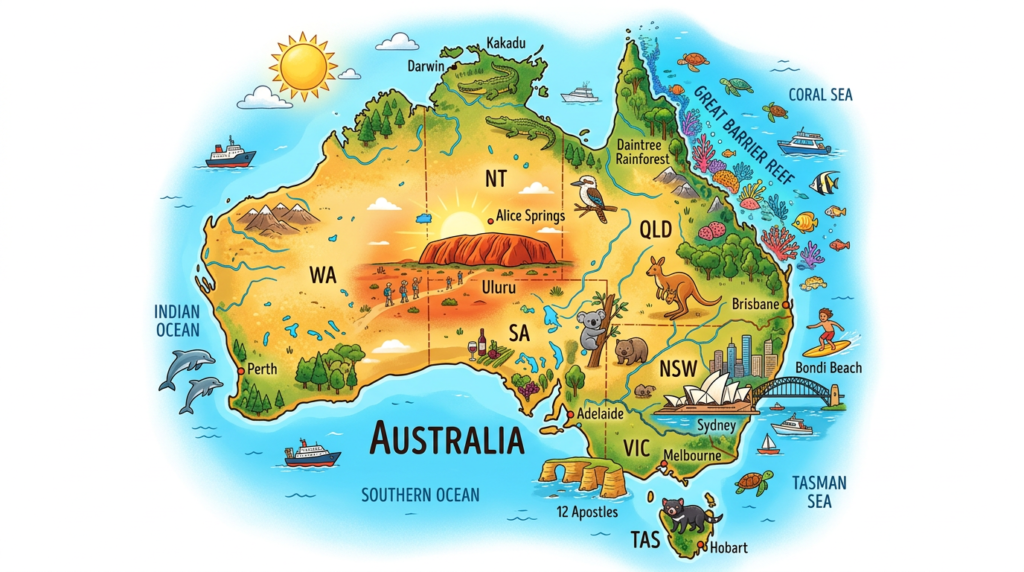
Australia is made up of six main states and two major territories, each with its cultural, natural, or climatic particularities. Identifying these regions on a map helps to better understand the human geography of the country, as well as administrative boundaries.
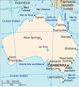
Major cities such as Sydney, Melbourne, Brisbane, Perth, or Adelaide are clearly shown on maps, each located near the oceans offering direct access to beautiful beaches and a dynamic urban life. Other urban areas, though smaller, like Darwin or Hobart, also deserve special attention for both their history and their exceptional setting.
Focus on some iconic regions
In the northeast part, Queensland captivates with its incredible biodiversity, including the famous Great Barrier Reef. On tourism maps, this region is teeming with tourist attractions connected by well-marked road circuits.
To the west, the state of Western Australia impresses with its vast wild and sparsely populated areas. Port cities like Perth serve as starting points for long explorations to the Pinnacles Desert or the spectacular rock formations of Karijini National Park.
Locating must-see cities
A quick look at an Australian map gives an immediate overview of the strategic position of certain cities, close to major roadways or scattered along the coasts. Sydney attracts with its iconic opera house and splendid bay, while Melbourne is renowned for its unique cultural atmosphere and impressive architectural evolution. Each metropolis has its own attraction area and often surpasses the countryside in terms of activity.
To explore these environments optimally, it is advisable to combine the use of a general map with local plans, especially if you want to walk through certain historic areas or enjoy lively neighborhoods every evening.
Preparing your itineraries with thematic maps
Beyond traditional maps, there are now many specialized supports focusing on routes, attractions, or unique tourist trails. Using this type of map allows you to create your own circuit according to your interests, without risking missing remarkable places.
For example, a national parks map highlights must-see routes through the wild nature or guides to the best spots for observing Australian wildlife, such as the emblematic kangaroos and koalas.
- Scenic road maps, ideal for planning a road trip
- Detailed plans of bike paths around cities and beaches
- Diagrams showing the location of main attractions
- Thematic maps on wine, gastronomy, or local festivals
- Tools to calculate distances between major cities or identify possible stops
How to optimize travel time?
With a gigantic area, Australia requires careful selection of stops to avoid losing long hours on the road. Interactive maps are widely used because they allow adapting the route in real time according to mood, weather, or desire to change itinerary. Estimating average travel times between Sydney and Cairns or between Perth and Broome helps avoid unpleasant surprises during a car or train journey.
Some applications combine geographical data and user feedback to recommend a smooth route, for example to reach isolated water points or access discreet Aboriginal villages, rarely indicated on classic itineraries.
Identifying the best periods to visit certain places
Climate maps add an important dimension to trip planning. They show, month by month, the favorable seasons to explore the major regions of Australia. For example, it may be preferable to plan a stay in the Northern Territory during the dry periods, and to favor the southern coast during the Australian summer.
Having such information prevents being stuck by sudden floods or extreme heat that characterize certain parts of this unique continent. Combining these maps with a calendar of festivals or local events enhances the discovery and promises memorable memories.
The Australia map as an educational and cultural tool
Using a map of Australia provides much more than just a navigation tool: it is also a means to understand the historical, demographic, and cultural evolution of the country. The distribution of indigenous populations, the creation of states, or the main exploration routes clearly appear through these documents.
It is not uncommon for schools to use wall maps to present in detail the geography of the country, locate mineral resources, or work on the ecological specificities of each region. They are powerful vectors of knowledge and openness to the world.
The Role of Oceans in Australian Identity
On every Australia map, the oceans play a fundamental role, marking the natural isolation of the country and its connection with the entire Asia-Pacific region. The Indian Ocean borders the west, the Pacific touches the eastern coast, and the Southern Ocean encircles the south, shaping climates, ecosystems, and ways of life that are radically distinct.
This maritime presence also influences major ports, international trade, beach tourism, and sea-related traditions. Observing the maritime map of the continent thus brings out a new perspective on the exchanges and wealth that have built modern Australia.
How many maps and plans to consult to know Australia?
No map can contain all the complexity of the Australian continent on its own. Depending on the objectives – preparing for a trip, school study, or simply a desire to deepen knowledge – it is useful to cross-reference several sources: detailed atlases, specialized plans, evolving digital media, but also illustrated tourist guides.
Each new tool consulted sharpens the perspective and encourages stepping off the beaten path. Exploring regional variations, comparing old polar maps with current interactive versions, or simply drawing your own route on paper, these are all ways to travel already, from home, even before setting foot on this fascinating piece of southern land.
FAQ : Australia map
You can view interactive maps on official Australian tourism websites or through online mapping services. These tools allow you to zoom in precisely on specific regions and cities.
Yes, most road maps display the major routes connecting state capitals and national highways. However, it is recommended to check the condition of remote roads before traveling in the Outback.
Most mobile navigation apps allow you to download geographic areas to view them without an internet connection. This option is essential for exploring remote areas where network coverage is limited.
