
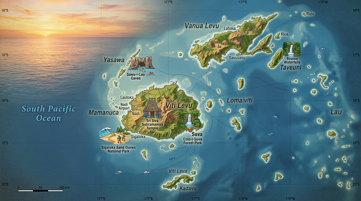
Exploring the map of the Fiji Islands means embarking on a journey to discover a fascinating Fiji archipelago, nestled in the heart of the South Pacific. Along the blue lines winding across a geographical map, a multitude of islands emerge, offering a diversity of landscapes and cultures unique to the Oceania region. Simply consulting a map is enough to awaken curiosity and inspire a desire to learn more about the geography of Fiji and its very special location.
This vast group of islands stretches over thousands of square kilometers, blending large volcanic lands, coral islets, and paradisiacal beaches. Grasping the essence of this territory means understanding how its number of islands, their distribution, and their specificities have shaped its cultural and natural identity. Let us discover together what a map of the Fiji Islands reveals and how it guides the experience of travelers or geography enthusiasts.
The geographical location of Fiji: at the crossroads of the South Pacific
The Fiji archipelago is located northeast of New Zealand and east of New Caledonia. Fiji’s strategic position places these islands at the center of Melanesia, a major cultural and geographical subdivision in Oceania. This natural crossroads has long attracted sailors, explorers, merchants, and travelers in search of new horizons.
Referring to the map of the Fiji Islands immediately allows one to visualize the importance of this geographical location in the South Pacific. The main maritime routes pass not far from the Fijian coasts, strengthening their historical and commercial ties with other island territories in the region. This centrality still influences the cultural and economic influence of the archipelago today.
Geography of Fiji: an archipelago with many faces
Studying the geography of Fiji means observing a patchwork of islands all different in size, relief, and natural features. The Fiji archipelago counts more than 300 islands and about 500 islets, both inhabited and uninhabited, forming a complex but fascinating map.
On a detailed map, one can easily distinguish the main islands located at the center of the archipelago, while a myriad of secondary lands scatter all around, dispersed like a shower of stars over the ocean. The entire territory extends nearly 1,000 kilometers from west to east, from the Yasawa reef to the far reaches of the Lau Islands, clearly showing the richness of this oceanic space.
The two main islands: Viti Levu and Vanua Levu
Reading a geographical map easily highlights Viti Levu and Vanua Levu, true pillars of the Fiji archipelago. Viti Levu concentrates the majority of the population, houses Suva (the capital), as well as Lautoka and Nadi, major economic and tourist centers.
Vanua Levu, the second largest island by area, features mountainous terrain, dense forests, and significant agricultural activity. Each of these main islands benefits from lush nature, impressive mountain ranges, fertile plains, and coasts dotted with mangroves or magnificent beaches. Their central presence shapes not only the number of islands permanently inhabited but also the political and social organization of the archipelago.
Secondary islands and little-known pearls
Around the two giants orbit secondary islands grouped into distinct chains. Among them are the Mamanucas, prized for their luxury hotels and diving spots; the Yasawas, known for their wild landscapes and secluded beaches; and the Lau Islands, located at the easternmost edge, where a preserved atmosphere typical of Melanesia prevails.
The map of the Fiji Islands also reveals tiny islets accessible only by boat or seaplane. These confidential destinations attract those seeking calm, far from the main routes. Some serve as refuges for rare birds, sacred sites, or havens of underwater biodiversity. While most visitors generally discover the main islands during a first stay, many eventually explore these hidden treasures, guided by the fascinating topography highlighted by the geographical map.
Understanding the number of islands and their uniqueness
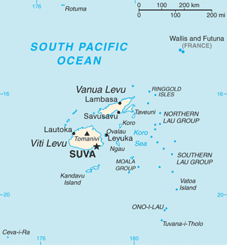
The Fiji archipelago features an impressive number of islands, but only about a hundred are actually inhabited. This contrast offers an extraordinary variety of living environments, ranging from lively traditional villages to deserted atolls where nature reigns supreme.
This configuration promotes the protection of natural environments and perpetuates ancestral ways of life, often adapted to the isolation of certain secondary islands. Throughout most of the territory, there are no land routes connecting the islands to each other; boats, ferries, and small planes serve as links. A quick glance at a detailed map highlights how deceptive distances can be depending on the terrain, density, and the specific configuration of each island group.
The specificities of Fijian cartography
Creating a map of the Fiji islands requires taking into account both physical and cultural aspects. The Fiji archipelago is mainly composed of volcanic islands, bordered by coral reefs among the richest and best-preserved in the South Pacific.
Some maps prioritize the representation of coastal areas where tourist and inhabited infrastructures are concentrated, while others highlight the internal geography, revealing rivers, valleys, mountains, and forest reserves. Between simplified plans intended for visitors and detailed surveys for scientific use, each representation tells a different story of the islands, whether for the traveler or the researcher.
What information to read on a map of the Fiji islands?
A well-designed map of the Fiji islands always indicates the location of the main and secondary islands, the distribution of major island groups (Yasawa, Mamanuca, Lau…), and essential access points such as airports or ports.
In daily use, also discover some useful landmarks:
- Altitude and relief to prepare hikes or ecotourism circuits.
- Marine currents and coral reefs, especially appreciated by divers, kite surfers, or sailing enthusiasts.
- The location of protected areas where it is possible to encounter endemic species.
- Marine distances between archipelagos to organize multi-island excursions.
Each of these pieces of information informs about the possibilities offered and guides the discovery of contrasting landscape units.
What influence does geography have on Fijian culture?
The fragmented configuration of the Fiji archipelago has profoundly marked the historical and social development of the country. The absence of road links between the main and secondary islands has maintained great linguistic, artisanal, and culinary diversity, noticeable from the first moments spent in a local village.
To understand why a particular custom or dialect survives better here than elsewhere, sometimes it is enough to look at a map; distance or proximity often explains the uniqueness of traditions. This fragmentation also contributes to the ecological resilience of many communities, capable of preserving a way of life adapted to their specific environment.
Modern tools to explore the Fiji archipelago
Long reserved for navigators or specialists, consulting a map of the Fiji islands has never been as accessible as it is today. Thanks to specialized mobile applications and global interactive platforms, anyone can view the entirety of the Fiji geography in just a few clicks.
These technological advances allow virtual travel within the South Pacific, to plan itineraries, expeditions, or dives even before departure. Updated satellite data not only facilitate preparation but also weather monitoring, very useful for optimizing your island-to-island movements.
Essential Applications and Local Uses
Today, several interactive mapping applications include features tailored to the specific needs of stays in the Fiji archipelago. Some offer layers dedicated to maritime navigation, others provide a detailed view of hiking trails or protected areas. These tools significantly enhance safety and autonomy during off-the-beaten-path travels.
Moreover, many locals and guides have their own geographic maps, often annotated with practical advice passed down through generations. Comparing these valuable paper maps with digital resources enriches the experience and opens the door to authentic discoveries, far from the standardized routes offered by mass tourism.
The future of Fijian cartography
At a time when climate issues are intensifying, mapping the Fiji Islands is also becoming a major monitoring tool to track changes in the territory. Scientists use precise satellite surveys to anticipate the impact of rising waters, erosion, or extreme events throughout the Fiji archipelago.
This dynamic monitoring influences local and international policies, helping to protect the unique mosaic formed by the main and secondary islands. Thanks to the combination of ground observations and evolving cartographies, Fiji is now among the best-studied island territories in the South Pacific.
A world to explore, between tradition and modernity
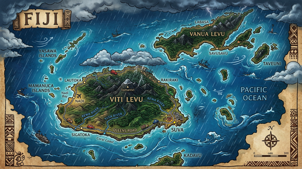
Consulting a map of the Fiji Islands is not limited to observing shapes or calculating a route. This gesture invites the discovery of a Fiji archipelago where each island, large or small, holds a universe of its own. Let yourself be guided by the multiple facets displayed on the geographic map, between Melanesian influences, natural diversity, and the dynamism of the South Pacific.
Whether preparing an adventurer’s journey, satisfying a thirst for knowledge, or simply dreaming before the immense potential of this corner of Oceania, the map reveals a living and shifting territory. Each exploration, real or virtual, promises an adventure beyond the borders drawn on paper.
FAQ: Fiji islands map
Online mapping platforms offer detailed views of the Fijian archipelago. You can also access tourist maps through the websites of local tourism boards.
Most maps indicate the main ferry terminals and airports connecting the major islands. However, travel to smaller islands often requires private transfers not listed on standard maps.
Yes, you can save areas of Fiji in your navigation apps to view them without an internet connection. This solution is ideal for moving freely between islands without relying on mobile network.
