
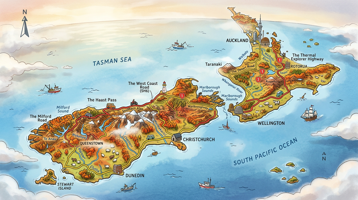
Discovering New Zealand on a map is already a journey through the mountains, beaches, and forests of this iconic corner of Oceania. With its isolated geography and its two main islands, the country attracts travelers each year seeking adventure and a change of scenery. Identifying cities, regions, and tourist attractions on the map sheds light on the magic of this unique destination. How can you make the most of the best maps to explore New Zealand? Here is a detailed overview to visualize and prepare an unforgettable trip to the ends of the earth.
The unique location of New Zealand on the world map
Located nearly 2,000 kilometers southeast of Australia and more than 10,000 kilometers from Western Europe, New Zealand is situated in Oceania, far from its direct neighbors. Its isolation is an integral part of its identity, preserving endemic fauna and flora absent elsewhere on the planet. On a world map, the country stands out by its position at the edge of the South Pacific, bordered by vast oceanic expanses.
The Pacific Ocean almost entirely surrounds the territory, giving it an atmosphere of the ends of the earth appreciated both by travelers and by those who dream of wild nature. Access to New Zealand heavily depends on international flights, as no road or railway line connects the country directly to the rest of the continent.
The major islands of New Zealand and their geographical specificities
Mentioning New Zealand immediately brings up the notion of islands: the North Island, the South Island, and, less known, Stewart Island. Each contributes to the national map with its landscapes, key cities, and major tourist attractions.
The North Island and the South Island stretch over more than 1,600 kilometers from north to south, offering very different climates and atmospheres. This contrast offers lovers of wide open spaces an unparalleled diversity in Oceania.
What to see on the North Island?
The North Island is home to Auckland, the most populous city and the main gateway for many visitors. Wellington, the political capital located at the southern tip of the island, offers a vibrant cultural scene. Between active volcanoes, golden beaches, and subtropical forests, this part of New Zealand concentrates many tourist attractions easily identifiable on a map.
Among the main attractions, Tongariro National Park captivates with the Tongariro Alpine Crossing hike, while the geothermal region of Rotorua enchants with its geysers and steaming lakes. The bays of Coromandel or Bay of Islands complete this unique sea and mountain setting in the world.
Why is the South Island so fascinating?
The South Island captivates with its steep mountains and pristine beaches. Christchurch, a major urban center, and Queenstown, a hotspot for thrill-seekers, are among the cities essential on the New Zealand map. Fiordland National Park and the sublime Milford Sound embody the raw beauty of the region.
Franz Josef and Fox glaciers, the pastures of the Southern Alps, and the vineyards of Marlborough mark the South Island, offering travelers a range of experiences rarely matched. Exploring the map of this island is like composing your own adventure itinerary, punctuated by surprising stops.
Stewart Island, this discreet gem
The third largest island but often forgotten on classic maps, Stewart Island (Rakiura) remains a well-kept secret. Located south of the South Island, it mainly charms travelers eager for wild trails and wildlife observation, notably the famous nocturnal kiwis. The scarcity of its infrastructure further reinforces the feeling of isolation so characteristic of New Zealand.
This small piece of land is generally discovered on foot, thanks to the Rakiura Track listed among the “Great Walks.” This multi-day hike reveals primary forests and untouched coasts where time seems suspended.
How to read and choose a map of New Zealand to prepare your trip?
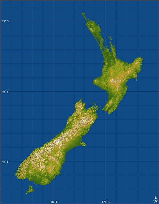
Optimizing your trip always involves using a good map of New Zealand. Several formats exist to satisfy all desires, whether it is planning a road trip, selecting tourist points of interest, or simply understanding the isolated geography of the country.
Between paper versions and interactive digital media, everyone can adapt their tool to their exploration habits. Mobile applications now offer advanced features, such as augmented reality, displaying exact distances, or real-time indication of available accommodations and campsites.
Which maps to prioritize before departure?
To start an itinerary, nothing beats a global view thanks to a detailed orographic map, highlighting reliefs and road networks. These allow anticipating travel times and necessary stops according to the sometimes rugged topography of the country. Favoring recent editions limits the risk of unpleasant surprises when traveling on secondary roads or access paths to certain national parks.
Completing the preparation with a tourist map enriched with information on famous or lesser-known sites encourages spontaneous discoveries. This multicolored reading also guides towards places suited to specific desires: dolphin watching, wine tasting, alpine hiking, or urban exploration.
Once on site, how to optimize navigation?
Using GPS mapping applications greatly facilitates movement in a New Zealand sometimes lacking mobile signal, especially on the South Island or on certain coastal stretches. Downloading offline maps reduces uncertainties and makes the trip more peaceful.
Seeking advice at tourist information centers also allows you to leave with precise and local maps, often adapted to the season as well as the actual state of trail or activity openings. Navigating smartly thus avoids wasting precious time on the road.
Major cities and points of interest to spot on the map of New Zealand
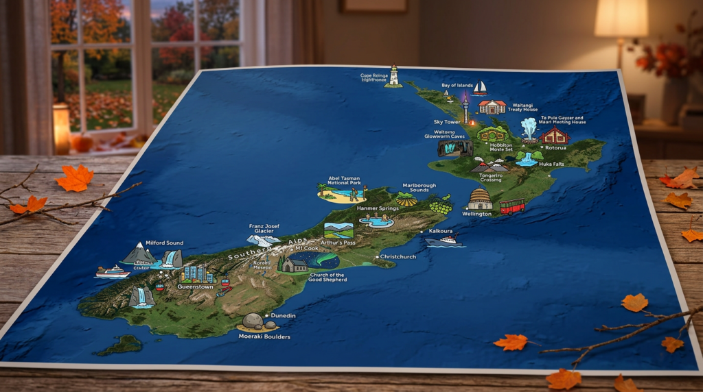
Besides its natural landscapes, New Zealand has several dynamic cities and unexpected destinations. Spotting these major points on the map helps establish balanced stages between culture and immersion in the surrounding nature.
From Wellington’s urban museums to Dunedin’s secret beaches, each locality offers its share of unique discoveries. Adapting your route according to the precise location of desired activities guarantees a personalized and efficient adventure.
- Auckland: cosmopolitan metropolis and international gateway
- Wellington: cultural and political heart bustling with events
- Queenstown: hotspot for extreme sports and starting point to the fjords
- Rotorua: popular volcanic spa resort
- Dunedin: city of Scottish inspiration open to the Otago Peninsula and its marine wildlife
Some smaller towns are also worth a detour for their history or their immediate proximity to nature reserves. From Gisborne on the east coast, reputed to be the first to see the sun rise each day, to Invercargill in the south, the feeling of traveling through a puzzle of unique identities prevails throughout the stay.
Practical exploration and useful tips for building a New Zealand itinerary
Building a coherent itinerary on the map of New Zealand requires taking into account not only distances but also means of transport and the desired pace for the trip. Some roads, like the legendary State Highway 1, offer an almost continuous crossing from north to south, while other segments require crossing hills and steep passes.
It is better to include some strategic breaks in rural villages or protected areas to fully enjoy the visual diversity offered by this land. This provides the opportunity to interact with locals, discover their hospitality, and gather unique information about the country’s hidden treasures.
- Prefer renting self-driven vehicles (van, campervan) to explore off the beaten track
- Vary modes of transportation: ferry between the islands, cycling in certain valleys, or panoramic train rides
- Plan to purchase a local SIM card to access the internet even in remote areas
- Allow enough time in each area, as some journeys take longer than expected due to winding roads
Including backup options depending on the weather, which can change even in the middle of summer, also helps maintain the necessary flexibility in the face of the unexpected. Each stage tells a new facet of this archipelago unlike any other.
Finding your way and understanding the richness of New Zealand through the map
The New Zealand experience is nourished as much by its landscapes as by its ability to surprise through a detailed map. From the subtropical bay of Northland to the snowy highlands of Canterbury, every pencil stroke, every curve, offers an invitation to venture even further. By carefully examining the location of volcanoes, glaciers, and fjords, each future trip takes shape according to individual affinities.
Navigating the map of New Zealand is much more than finding your way; it becomes an explorer’s game where you freely compose your own memories, from the urban maze of Auckland to the extreme isolation of Stewart Island. Who knows what surprises will emerge around a bend or a forgotten cove?
FAQ: New Zealand map
Official New Zealand tourism portals offer highly detailed interactive maps. You can also use standard online mapping tools to explore both main islands.
Yes, specialized maps highlight hiking trails and national parks. It is recommended to check these specific resources to plan your walking routes safely.
It is perfectly possible to download offline maps via your usual navigation apps. This ensures constant access to routes, even in the country’s wild and remote regions.
