
What you need to know about Norway?
Norway is a constitutional monarchy officially known as the Kingdom of Norway. Located in Northern Europe, it has a population of around 5.6 million inhabitants. Its total area is 385,207 km², making it one of the largest countries in Scandinavia.
This area includes the Arctic islands notably Jan Mayen and Svalbard (archipelagos). There is also Peter I Island and Queen Maud Land both located in Antarctica. Norway’s population density is the lowest in Europe. The largest city in the country and also its capital is Oslo. The Norwegian telephone code is 47 or 0047 or +47.
Which countries border Norway?
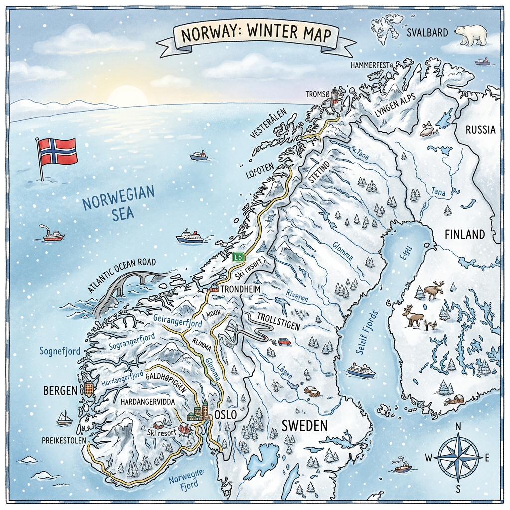
The neighboring countries of Norway are: Finland, Russia, Denmark, Iceland, and the United Kingdom. In total, Norway’s borders measure 2,566 km (including maritime borders)

- Finland – Norway: measures about 736 km, it is the only neighboring country of Norway located in the Nordic section.
- Russia – Norway: Separating the Finnmark county from the Murmansk Oblast of the Russian Federation. This border is outside Schengen.
- The border between Norway and Russia is the border separating Finnmark county, the northernmost county of the Kingdom of Norway, and Murmansk Oblast, an oblast of the Russian Federation. It is also one of the external borders of the Schengen area.
- Norway and EU: Separating the Nordic countries from the Kingdom of Norway. Measures about 2348 km.
- Norway – Denmark: exclusively maritime border split in two, that of the North Sea and between the atolls Jan Mayen and Greenland.
- Iceland – Norway: exclusively maritime international border separating the Kingdom of Iceland
- Norway – United Kingdom: exclusively maritime.
Population of Norway
Norway’s population is currently estimated at around 5.7 million inhabitants according to the latest estimates. It represents about 0.07% of the world’s population.
With an area of 385,207 km², Norway has a low population density of around 15 inhabitants per km², one of the lowest in Europe. Most of the population lives in urban areas, accounting for nearly 84% of all inhabitants.
Finally, the Norwegian population enjoys a high standard of living and a long life expectancy. The median age is around 40 years, reflecting a relatively mature population.
What are the colors of the country?

Norway has a rectangular flag with a red background and a blue cross outlined in white filling the flag over its entire surface. The vertical stripe is shifted to the hoist side.
The colors have a particular meaning: white represents uprightness and serenity, red represents the firmness and courage of the people. Finally, the blue of the cross represents sincerity, determination, and uprightness.
What are the best cities to visit in Norway ?

Stavanger
Stavanger is an oil city, with several fields exploited by the country’s companies. Moreover, it is a very large urban area extending even to the outskirts of the city. Currently, living in this area is somewhat expensive because it is a highly developed zone.
When you visit this city, you will see several modernized European architectures alongside wooden buildings which together give charm to the city. Let us not forget that it is also a very active port city with some pleasant restaurants known for their seafood specialties. The nightlife is lively, and you can go out for a walk at night to discover the best bistros in the city open 24 hours a day.
Ålesund
Ålesund is a unique city in Norway; indeed, its architectures are a mix of old and new. The city was completely rebuilt after a colossal fire that took place in 1904. You will find Gothic architecture and contemporary infrastructures mixed among the alleys of Ålesund.
The city is mainly built on several interlocking islands. Moreover, there is a functional and international port on its coastline. The best attractions of Ålesund are especially its hills that offer a 360° view of the fjords and mountains. It is an interesting city mainly because of its nightlife ensured by several bars and restaurants open at night.
Trondheim
One of the unique cities in the country, Trondheim is ideal for forest and nature walks. You can see navigable rivers bordered by modern pastel-colored buildings. The old port is also an interesting attraction and draws many visitors. It is a city that reflects the ancient culture of Norway. So go there to see the famous medieval cathedral.
The city of Trondheim also has several interesting museums, refined restaurants, and friendly cafés. In addition to these tourist attractions, there are also cultural attractions such as music scenes and various festivals organized by university campus students.
Oslo
Oslo is the capital of Norway and the one that has several architectures representing the ancient culture of the country. You can see interesting museums, art galleries, and shops with artworks from both old and modern artists. Oslo is a port city surrounded by mountain ranges and several forests.
This allows tourists to enjoy nature and walks by the sea or inside protected natural forests. There is also the famous ski resort accessible to tourists. The capital is very lively at night and restaurants, bars, and bistros remain open all the time.
Where are the cities located on the Norway map ?

Stavanger
On the map of Norway, the city is located in the southwest section. Geographic coordinates: 58° 58′ 10″ north, 5° 43′ 56″ east
Ålesund
On the Norway map, the city of Ålesund is located in the western part of the country. The city includes the islands Heissa, Aspøy, and Nørvøy. Geographic coordinates: 62° 28′ 15″ north, 6° 09′ 17″ east
Trondheim
On the map, this city is situated inland in the central section. Geographic coordinates: 63° 25′ 00″ north, 10° 23′ 00″ east
Oslo
The Norwegian capital is located in the southern part of the country. It includes the fjords of the same name. Geographic coordinates: 59° 54′ 40″ north, 10° 45′ 10″ east
Norway climate map
The Norwegian climate is strongly influenced by the northern ocean current called the Gulf Stream. It is a climate similar to that of all northern countries. It is also called a temperate continental climate. The Norwegian coasts are strongly influenced by the current, especially the western section of the coastline. Sea temperatures hover around 5 to 6°C in winter, sometimes even below.
In summer, however, maritime temperatures gradually rise and become milder. Since Norway is mainly made up of steep terrain, temperatures are warmer inland. The days are longer in summer and at night, temperatures are cooler.
Western coastline
This part of the country is influenced by sea breezes. The climate is therefore cooler during summer, with storms occurring frequently due to cloud formations over the sea. In winter, rain becomes almost absent and temperatures drop, leading to frost and snowfall. Summer appears mild but temperatures can rise sharply inside the fjords. The average annual rainfall on the western coastline is between 2200 and 3000 mm.
The northern zone
This region is colder than the rest of the country. This type of climate is called subpolar climate due to its proximity to the Arctic Circle. Winter temperatures hover around 0°C or even lower. The coldest periods are between January and February, when temperatures can reach -8°C.
Temperatures in autumn fluctuate around 10°C and increase gradually depending on the duration of sunlight. Indeed, this duration is very long in summer as it lasts more than 12 hours and there are periods when the sun never sets. The average annual rainfall in this area is 800 mm.
Capital climate
The climate in the capital is quite different from other regions. Indeed, the geographical location of the capital, divided among several fjords, influences the temperatures. Sunlight durations are low during the months from November to January. However, in summer periods, the sun shines more and more but only for half the day. Average summer temperatures hover around 17°C while winter is quite cold and temperatures fluctuate around 0°C.
Norway economic map
With a population of around 5.7 million people and a vast territory, Norway has one of the strongest economies in Europe. Its nominal GDP exceeds USD 500 billion, while GDP per capita is above USD 100,000, placing the country among the richest in the world.
Revenue generated from natural resources is largely invested through the Government Pension Fund Global (GPFG), the world’s largest sovereign wealth fund. It helps ensure long-term financial stability and supports future generations.
The Norwegian economy is mainly based on oil and natural gas production, while also relying on advanced industries and renewable energy. Hydrocarbon exports continue to account for a significant share of the country’s export revenue.
- Official currency: Norwegian krone
- GDP per capita rank: among the top 5 countries in nominal terms.
- GDP growth (percentage per year): around 2.1
- GDP ranking:around 29th in nominal GDP and 49th in purchasing power parity (PPP).
Administrative subdivisions and demo-linguistic data
Administrative subdivisions
Three subdivisions make up Norway. The first is the Landsdel or large region. There are 5 of them.
- Sørlandet
- Østlandet
- Vestlandet
- Trøndelag
- Nord-Norge
The second division is the fylker which is similar to a county. Each county has its own administrative autonomy. There are 19 of these counties:
- Østfold
- Akershus
- Oslo
- Hedmark
- Oppland
- Buskerud
- Vestfold
- Telemark
- Aust-Agder
- Vest-Agder
- Rogaland
- Hordaland
- Sogn og Fjordane
- Møre og Romsdal
- Sør-Trøndelag
- Nord-Trøndelag
- Nordland
- Troms
- Finnmark
The last subdivision is the municipality. There are 433 Norwegian municipalities.
Demo-linguistic data
Two official Norwegian languages are spoken in the country: bokmål spoken by 80% of the population and nynorsk spoken by 17.5% of the population.
- Bokmål originates from the Danish language and is mainly spoken in the large cities
- Nynorsk originates from old dialects and is mainly spoken in rural areas.
There are also 5 minority languages which are
- The Sami (Lapps),
- The Roma,
- The Kvens
- The Forest Finns
- The Jews.
English FAQ – Norway Map: Geographic and demographic information
Norway is a Northern European country located on the western part of the Scandinavian Peninsula. It is famous for its fjords, mountains, glaciers, and deeply indented coastline stretching for thousands of kilometers.
Norway has a population of more than 5.5 million people, with a relatively low population density due to its vast territory. Most people live in the southern part of the country, particularly around Oslo, Bergen, Trondheim, and Stavanger.
The capital of Norway is Oslo, which serves as the country’s main political, economic, and cultural center. Norwegian is the official language, with two recognized written forms, Bokmål and Nynorsk, while English is widely understood.
