.synthesis { max-width: 640px; margin: 2em auto; padding: 1.5em 1.8em; color: #1f3313; font-family: “Inter”, “Segoe UI”, sans-serif; text-align: left; position: relative; box-sizing: border-box; background: #f2f7ef; border: 1px solid #5b9638; border-left: 6px solid #5b9638; border-radius: 12px; box-shadow: 0 8px 24px rgba(251, 191, 36, 0.15); }
.synthesis h2, .synthesis .synthesis-header { font-size: 1.15em; font-weight: 700; margin-bottom: 0.6em; color: #47752c; }
.synthesis p, .synthesis li { font-size: 1em; line-height: 1.65; margin: 10px; }
.synthesis strong { color: #121e0b; }
.synthesis table { width: 100%; border-collapse: collapse; }
.synthesis th { background: rgba(91, 150, 56, 0.12); color: #47752c; text-align: left; }
.synthesis td, .synthesis th { padding: 8px 12px; border-bottom: 1px solid rgba(91, 150, 56, 0.18); vertical-align: top; }
.synthesis tbody tr:nth-child(even) { background: rgba(91, 150, 56, 0.05); }
.key-takeaways { max-width: 640px; margin: 2em auto; padding: 1.5em 1.8em; color: #1f3313; font-family: “Inter”, “Segoe UI”, sans-serif; text-align: left; position: relative; box-sizing: border-box; background: #f2f7ef; border: 1px solid #5b9638; border-left: 6px solid #5b9638; border-radius: 12px; box-shadow: 0 8px 24px rgba(251, 191, 36, 0.15); }
.key-takeaways h2, .key-takeaways .key-takeaways-header { font-size: 1.15em; font-weight: 700; margin-bottom: 0.6em; color: #47752c; }
.key-takeaways p, .key-takeaways li { font-size: 1em; line-height: 1.65; margin: 10px; }
.key-takeaways strong { color: #121e0b; }
.key-takeaways ul { list-style: none; padding-left: 0; }
.key-takeaways li { margin: 0.45em 0; padding-left: 0.2em; }
.mg-callout{margin:1.5em 0;padding:.9em 1.1em;border:1px solid;border-left-width:4px;border-radius:10px;font-size:.97em;line-height:1.65}.mg-callout>:first-child{margin-top:0}.mg-callout>:last-child{margin-bottom:0}.mg-callout__label{display:block;margin:0 0 .35em;font-weight:700;font-size:.82em;letter-spacing:.03em;text-transform:uppercase}.mg-callout__label::before{margin-right:.45em;font-size:1.05em;vertical-align:-.06em}.mg-callout–info{background:#eff6ff;border-color:#bfdbfe;color:#1e3a5f}.mg-callout–info .mg-callout__label{color:#2563eb}.mg-callout–info .mg-callout__label::before{content:”\2139\FE0F”}.mg-callout–tip{background:#f0fdf4;border-color:#bbf7d0;color:#14532d}.mg-callout–tip .mg-callout__label{color:#15803d}.mg-callout–tip .mg-callout__label::before{content:”\1F4A1″}.mg-callout–warning{background:#fffbeb;border-color:#fde68a;color:#7a4a10}.mg-callout–warning .mg-callout__label{color:#b45309}.mg-callout–warning .mg-callout__label::before{content:”\26A0\FE0F”}.mg-callout–danger{background:#fef2f2;border-color:#fecaca;color:#7f1d1d}.mg-callout–danger .mg-callout__label{color:#dc2626}.mg-callout–danger .mg-callout__label::before{content:”\1F6D1″}.mg-proscons{display:grid;grid-template-columns:1fr 1fr;gap:16px;margin:1.5em 0}@media(max-width:560px){.mg-proscons{grid-template-columns:1fr}}.mg-proscons__col{padding:.9em 1.1em;border:1px solid;border-radius:10px}.mg-proscons__title{display:flex;align-items:center;gap:.4em;margin:0 0 .5em;font-weight:700;font-size:.9em;letter-spacing:.02em}.mg-proscons__col ul{margin:.3em 0 0;padding-left:1.15em}.mg-proscons__col li{margin:.3em 0;line-height:1.55}.mg-proscons__col–pro{background:#f0fdf4;border-color:#bbf7d0;color:#14532d}.mg-proscons__col–pro .mg-proscons__title{color:#15803d}.mg-proscons__col–pro .mg-proscons__title::before{content:”\2705″}.mg-proscons__col–con{background:#fef2f2;border-color:#fecaca;color:#7f1d1d}.mg-proscons__col–con .mg-proscons__title{color:#dc2626}.mg-proscons__col–con .mg-proscons__title::before{content:”\274C”}ol.mg-steps{list-style:none!important;counter-reset:mgstep;margin:1.6em 0;padding-left:0!important}ol.mg-steps>li.mg-steps__item{counter-increment:mgstep;list-style:none!important;padding-left:0!important;padding-bottom:1.4em}ol.mg-steps>li.mg-steps__item:last-child{padding-bottom:0}ol.mg-steps>li.mg-steps__item>:last-child{margin-bottom:0}ol.mg-steps>li.mg-steps__item>.mg-steps__title{margin:0 0 .25em;font-weight:600}ol.mg-steps>li.mg-steps__item>.mg-steps__title::before{content:counter(mgstep) “. “;opacity:.45;font-weight:500;font-variant-numeric:tabular-nums}ol.mg-steps>li.mg-steps__item:not(:has(.mg-steps__title))::before{content:counter(mgstep) “. “;opacity:.45;font-weight:500;font-variant-numeric:tabular-nums}.mg-kpis{display:grid;grid-template-columns:repeat(auto-fit,minmax(140px,1fr));gap:14px;margin:1.5em 0}.mg-kpi{padding:1em .9em;border:1px solid #e5e7eb;border-radius:12px;background:#f9fafb;text-align:center}.mg-kpi__value{display:block;font-size:1.7em;font-weight:800;line-height:1.15;color:#111827}.mg-kpi__label{display:block;margin-top:.35em;font-size:.85em;color:#6b7280;line-height:1.35}
.wp-block-image,.ai-image{margin-bottom:1.75em}.wp-block-image>figcaption,.ai-image>figcaption{margin-top:.5em}
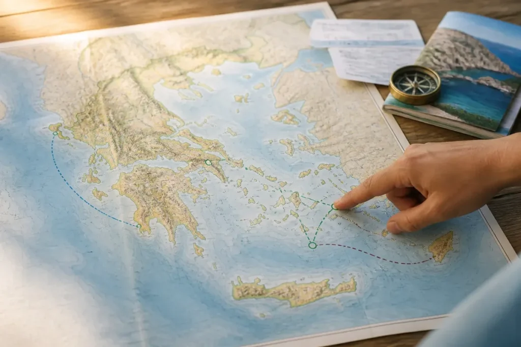
Six major groups structure a map of the Greek islands: Cyclades, Ionian Islands, Dodecanese, Saronic Islands, Sporades, and Crete. To read the Greece island map without confusing visual proximity with realistic travel routes, first locate Athens and Piraeus, then position each maritime group: Santorini, Mykonos, Paros, Naxos, and Milos belong to the Cyclades; Corfu is to the west, Rhodes to the southeast, and Crete to the south.

The choice mainly depends on the available time and the type of image sought. Santorini concentrates volcanic panoramas in a small area, Crete offers a much more varied itinerary, while an archipelago suits travelers ready to change ports and atmosphere.
| 🧭 | Starting point: Athens and Piraeus allow locating access to several islands. |
| 🌋 | Santorini: caldera panoramas, white villages, and short stays. |
| 🏔️ | Crete: beaches, mountains, heritage, and regional itinerary. |
| ⛵ | Cyclades: possible combination between Santorini, Naxos, Paros, or Milos. |
| 🌿 | Ionian Islands: dense vegetation, coves, and marine landscapes. |
| 🏛️ | Dodecanese: Rhodes, Kos, Karpathos, and Patmos in the southeastern Aegean. |
| ⚠️ | Map limit: a short distance does not indicate ferry frequency or duration. |
How to read the map of the Greek islands before choosing?

A useful map starts with the seas and access points, not with the most famous islands. From Athens, Piraeus mainly opens towards the Cyclades and the Saronic Islands; the western coast faces the Ionian Islands, while the southeastern Aegean leads to Rhodes and other islands of the Dodecanese.

The Aegean Sea reads as a vast space between mainland Greece and Turkey. The Ionian Sea borders the west of the country. Crete forms a southern autonomous entity, large enough to impose a different circuit logic than that of the small Cycladic islands.
However, a tourist map often simplifies the scale. A projection can enlarge certain areas and visually bring closer islands separated by infrequent maritime connections. A distance measured on a marine chart converts with the following reference: one nautical mile equals 1.852 kilometers.
To deepen the reliefs, borders, and cities of the country, the geographic map of Greece usefully complements a map focused on the islands.
Inhabited island, islet, or simple point on the map
A map also represents lands that do not play the same role for a trip. An inhabited island may have a port, roads, and accommodations; an uninhabited island sometimes appears as an excursion destination; an islet often offers no autonomous tourist access.
This distinction avoids turning every spotted name into a potential stop. A navigation chart, a tourist map, and a road map do not serve the same purpose.
What are the main Greek archipelagos on the map?
The Cyclades occupy the center of the Aegean Sea, the Ionian Islands align to the west, the Dodecanese extends towards the Turkish coast, and Crete closes the space to the south. The Saronic Islands are close to the mainland, while the Sporades are located in the northwest Aegean.
| Area | Landmark Islands | Landscape reading | Access logic |
|---|---|---|---|
| Cyclades | Santorini, Mykonos, Naxos, Paros, Milos | White villages, dry reliefs, volcanic coasts | Maritime itinerary around Athens and between islands |
| Ionian | Corfu, Cephalonia, Zakynthos, Lefkada | Vegetation, cliffs, turquoise waters | Access via ports and airports of the west |
| Dodecanese | Rhodes, Kos, Karpathos, Patmos | Medieval heritage, beaches, eastern influences | Archipelago distant from Piraeus |
| Saronic | Aegina, Poros, Hydra | Escapes close to the mainland | Departures from Piraeus |
| Sporades | Skiathos, Skopelos | Forests, coves, and beaches | Area distinct from the Cyclades |
| Crete | Heraklion, Chania, Rethymnon | Mountains, gorges, beaches, and ancient sites | Large island with airports and ports |

The Cyclades: the most readable group for a first itinerary
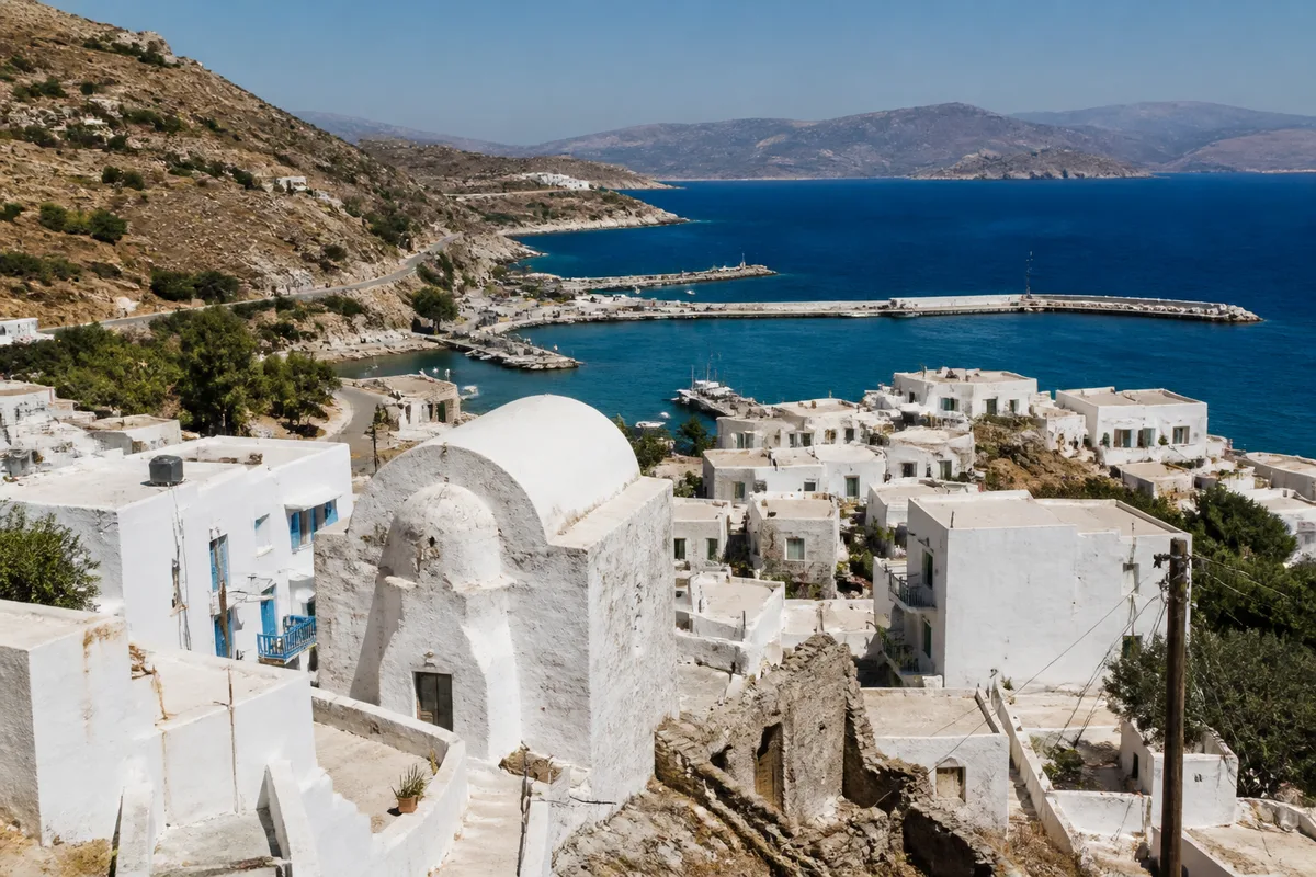
The Cyclades bring together nearby islands within the same maritime area, without offering a uniform experience. Naxos and Paros balance beaches, villages, and activities; Milos favors coastal shapes; Mykonos concentrates festive spots, and Santorini offers volcanic viewpoints.
Proximity between two islands is not enough to guarantee a simple connection. On travel days, the port used and stops change the actual duration, which is given in some itinerary offers between two and six hours depending on the line and the boat.
The Ionian Islands: a different, greener geography
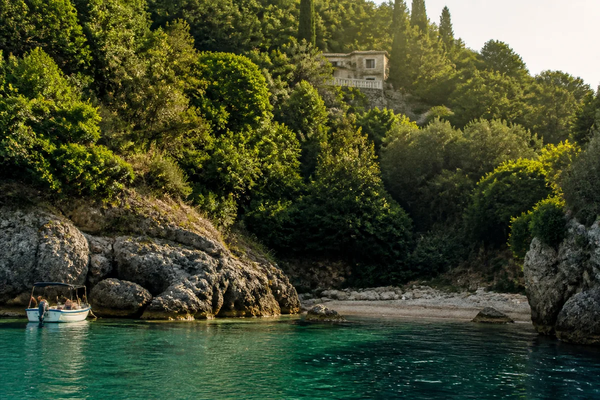
Corfu, Cephalonia, Zakynthos, and Lefkada belong to the west of insular Greece. The scenery changes markedly: the reliefs are more vegetated, the coves take an important place, and the routes are built more around the car and local ports.

Dodecanese, Saronic Islands, and Sporades
The Dodecanese combines Rhodes, Kos, Karpathos, and Patmos in the southeastern Aegean, near Turkey. Rhodes is suitable for a trip mixing old town and seaside resorts. The Saronic Islands, on the other hand, are suited for an excursion from the continental capital, while the Sporades bring forests and beaches in the northwestern Aegean.

A frequently mentioned connection between Piraeus and Aegina lasts about 40 minutes by fast catamaran; this value concerns this specific mode of transport, not all boats nor all periods.
Where are Santorini, Crete, Rhodes, and Corfu located?

Santorini fits here, Crete does not.
This decision applies for three or four days focused on panoramas, white villages, and the volcanic atmosphere. Fira, Oia, Imerovigli, and Akrotiri do not produce the same image: the first favor caldera views, the last adds archaeological interest and dark beaches.
Crete becomes more relevant as soon as the trip goes beyond a simple getaway. Heraklion, Chania, and Rethymnon offer different stops, with beaches, gorges, villages, and historical sites. However, it requires longer land journeys.

- Santorini: panoramas, photography, short stay, and a very visual first discovery.
- Crete: diversity, car, hiking, heritage, and a stay of one week or more.
- Rhodes: old town, beaches, and heritage in the Dodecanese.
- Corfu: vegetation, architecture, coves, and Ionian atmosphere.
What itinerary to build depending on the length of the trip?
For four or five days, stay on a single island or combine two nearby islands within the same group. One week allows two or three stops in the Cyclades; ten days or more make Crete more comfortable than an itinerary that multiplies embarkations.
| Duration | Coherent choice | To avoid |
|---|---|---|
| 4 to 5 days | Santorini alone, or Santorini and Naxos | Adding a distant island after a late arrival |
| 7 days | Naxos and Paros, or Santorini and Milos | Multiplying port changes |
| 10 days | Regional circuit in Crete, or extended Cyclades | Combining Crete, Corfu, and Rhodes |
| 14 days | Only two maritime zones, with buffer days | Turning every spotted island into a mandatory stop |
A commercial offer of island-to-island circuits presents formats ranging from 3 to 20 days, with a typical duration announced of 5 to 11 days. These formats describe organized products; they do not set the pace suitable for an independent trip.
For air access, the map of Greek airports allows distinguishing direct arrival on an island from passing through Athens. This difference sometimes completely changes the interest of a maritime itinerary.
The best combination is therefore not the one that lines up the most names. It is the one that keeps a dominant maritime zone and reserves a margin for delays, wind, or a port change.
What mistakes to avoid with a map of the Greek islands?
A map gives a structure, not a ferry schedule. The most costly mistakes come from a change of scale, confusion between airport and port, or a stop added because it seems nearby on paper.
- Confusing distance and duration: two nearby islands may be connected only on certain days or by a route with a stopover. The actual schedule takes precedence over visual measurement.
- Associating distant archipelagos: Corfu, Rhodes, and Crete form distinct areas. On a short stay, transfers eat into visiting time.
- Booking accommodation before the port: an island may have several docks or depend on a port located on the opposite side of the lodging.
- Reading an islet as a destination: the absence of roads, accommodation, or regular maritime service completely changes the status of the place.
- Printing a map that is too detailed: the names become illegible. A general map is used to understand the archipelagos; a local map is used to get around.
FAQ on the map of the Greek islands
Which islands are closest to Athens?
The Saronic Islands, including Aegina and Poros, are the ones most directly connected to departures from Piraeus. The Cyclades are also accessible from this port, with durations varying depending on the route and type of vessel.

Can you visit several archipelagos during the same trip?
Yes, especially on a long stay with a transition day. For less than a week, choose a single group; otherwise, transfers replace visits.
Which map should be used for driving in Crete?
A general map locates the island in the Mediterranean, while a local road map shows roads, passes, and travel times. Both scales are complementary.

The map becomes truly useful when it reduces detours: first choose a maritime area, then a main island, and finally the connections compatible with your dates. If the promised image requires too many ports and waiting times, the neighboring island is often the most solid choice.
.magic-lb-overlay{position:fixed;inset:0;background:rgba(15,23,42,.92);display:none;align-items:center;justify-content:center;z-index:99999;cursor:zoom-out;padding:20px}
.magic-lb-overlay.open{display:flex}
.magic-lb-overlay img{max-width:95vw;max-height:95vh;object-fit:contain;border-radius:8px;box-shadow:0 8px 32px rgba(0,0,0,.5)}
.magic-lb-close{position:absolute;top:16px;right:20px;color:#fff;background:rgba(0,0,0,.5);border:none;width:40px;height:40px;border-radius:50%;font-size:24px;cursor:pointer;display:flex;align-items:center;justify-content:center}
.magic-lb-close:hover{background:rgba(0,0,0,.8)}
.wp-block-image img{cursor:zoom-in;transition:transform .15s ease}
.wp-block-image img:hover{transform:scale(1.01)}
.magic-img-link{display:inline-block;text-decoration:none}
(function(){
var ov=document.getElementById(‘magic-lb’);if(!ov)return;
var img=ov.querySelector(‘img’),btn=ov.querySelector(‘.magic-lb-close’);
var L={fr:’Fermer’,es:’Cerrar’,en:’Close’,pt:’Fechar’,it:’Chiudi’,de:’Schlie\u00dfen’,nl:’Sluiten’,ca:’Tancar’};
btn.setAttribute(‘aria-label’,L[(document.documentElement.lang||”).slice(0,2).toLowerCase()]||’Close’);
function open(src){img.src=src;ov.classList.add(‘open’);document.body.style.overflow=’hidden’}
function close(){ov.classList.remove(‘open’);img.src=”;document.body.style.overflow=”}
document.addEventListener(‘click’,function(e){
var a=e.target.closest(‘a.magic-img-link’);
if(a){e.preventDefault();open(a.getAttribute(‘href’));return}
var i=e.target.closest(‘.wp-block-image img’);
if(i&&!e.target.closest(‘a’)){e.preventDefault();open(i.currentSrc||i.src)}
});
ov.addEventListener(‘click’,function(e){if(e.target===ov||e.target===btn)close()});
document.addEventListener(‘keydown’,function(e){if(e.key===’Escape’)close()});
})();