
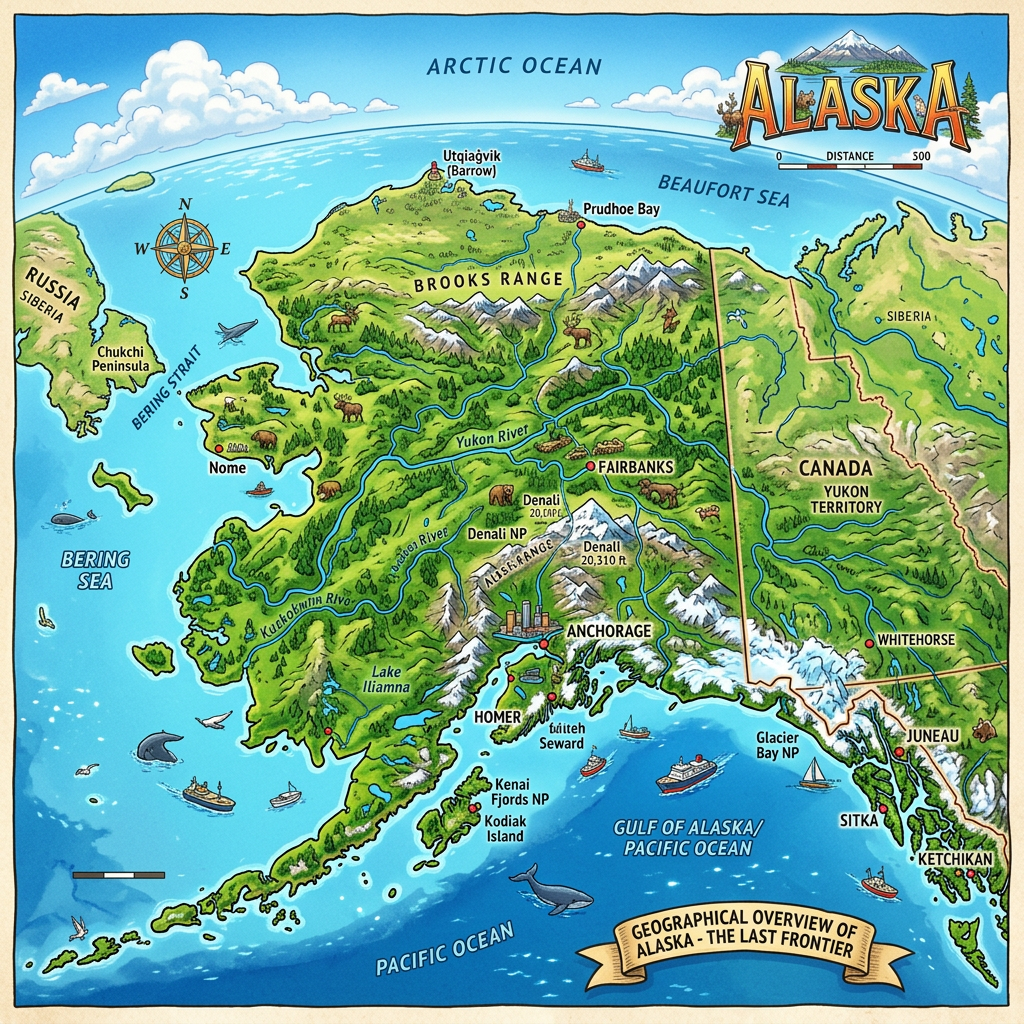
Alaska fascinates with its wild landscapes and its unique position between the Arctic Circle and the North American continent. When it comes to discovering this magnificent territory, consulting a geographical map quickly becomes essential. Travel enthusiasts or nature adventure lovers appreciate a detailed map to explore snowy peaks, locate iconic rivers and streams, or spot must-see national parks. Whether the goal is to prepare a travel guide or simply to better understand the geographical location of the state, the “Alaska map” stands out as an essential tool.
Why use a geographical map of Alaska?
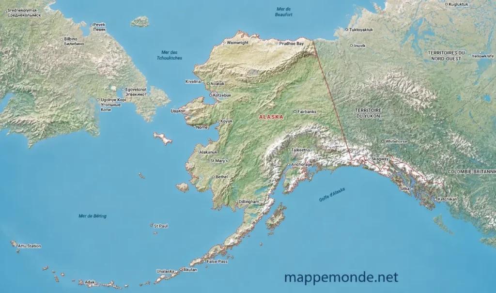
Visualizing the entirety of this vast American state is not easy without a clear representation. A geographical map offers an immediate view of the borders, the distribution of major cities, and allows situating each region according to its relief or its access to vast natural spaces. At a glance, it becomes possible to grasp the topographical diversity between the Pacific beaches, the high mountains in the center, and the tundras in the north.
Relying on a detailed map helps anticipate distances often underestimated in this region. For example, Anchorage and Fairbanks, two of the largest cities, are several hours apart by road. Furthermore, the map allows identifying areas accessible only by air or sea, a specificity frequently encountered during a stay in Alaska.
Key elements present on a map of Alaska
Analyzing a map of Alaska is not limited to spotting a few urban points. There are multiple elements that enrich a cartographic representation and help everyone navigate this XXL territory. Here are some of these fundamental aspects to observe.
Border delimitation
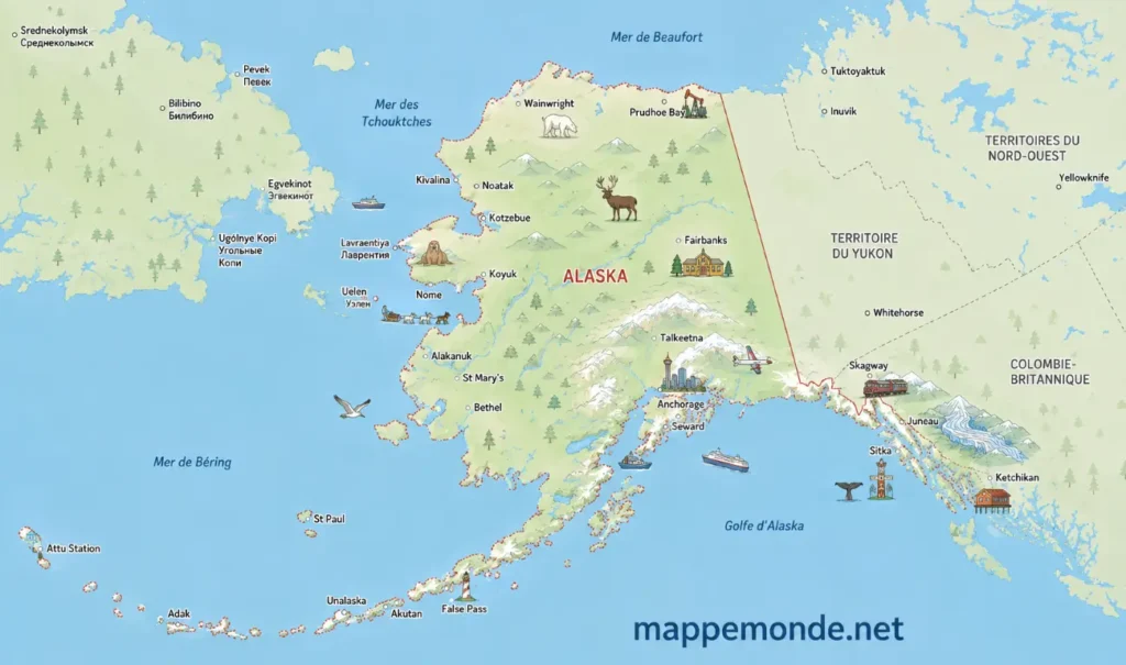
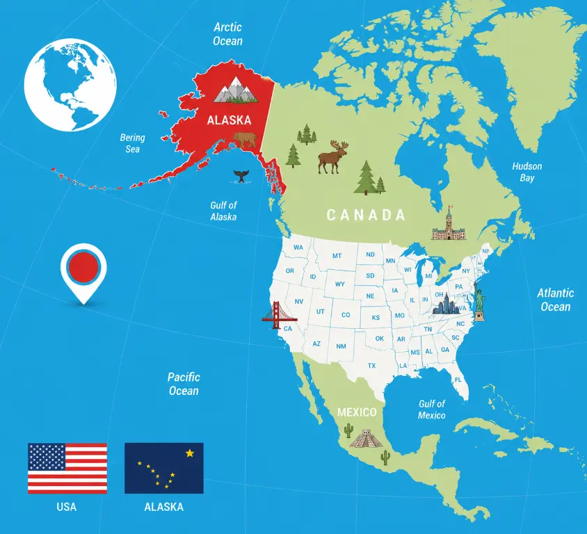
Alaska has a unique geographical location: separated from the rest of the United States by Canada, it shares long land borders with Yukon and British Columbia. To the west, the coasts bathed by the Bering Sea highlight the proximity to Russia, only four kilometers away at the Bering Strait. The maritime outlines offer privileged access to the Gulf of Alaska, known for its steep fjords and spectacular landscapes.
A well-designed map generally highlights the exceptional length of the borders, a strong point for those wishing to plan a cross-border itinerary or grasp the isolated nature of certain villages.
Major cities not to be missed
Anchorage is the largest urban area in the state and always appears prominently on a geographical map. It is here that the main road and rail routes converge. Further north, Fairbanks plays a central role thanks to its proximity to the Arctic and its university dynamism.
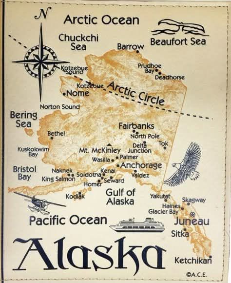
Other urban centers include Juneau, the landlocked capital accessible only by boat or plane, as well as Nome and Barrow (Utqiaġvik), both known for their location on polar lands offering a striking glimpse into traditional ways of life. Depending on the type of detailed map used, residential neighborhoods, major roads, and even the regular ferry docks are easily distinguishable.
National parks and nature reserves
Alaska boasts a surface area of national parks unmatched elsewhere in the United States. On a map, Denali National Park stands out clearly with its 24,000 km² around the famous Mount Denali, the highest peak in North America. Katmai, famous for its brown bears and active volcanoes, is also among the remarkable sites widely represented on specialized maps.
Other protected areas like Gates of the Arctic or Kenai Fjords invite exploration of trails, glaciers, and preserved fjords. The presence of these national parks often encourages choosing a map specially oriented towards hiking or wildlife observation, to facilitate the preparations for an ecotourism trip.
Rivers, streams, and lakes illustrating hydrographic diversity
The hydrographic network deeply marks the Alaskan landscape. The Yukon River runs over 3,000 kilometers before emptying into the Bering Sea, illustrating the power of inland waters. Other waterways like the Copper River, the Kuskokwim, or the Susitna are also highlighted on most maps, emphasizing their importance in the history of trade routes and indigenous travel.
Many detailed maps also feature large lakes such as Iliamna and Teshekpuk, which serve as landmarks both for local navigation and sport fishing. This abundance of rivers and lakes attracts many enthusiasts each year wishing to prepare their canoeing, fishing, or even wildlife photography expeditions.
How to effectively read a detailed map of Alaska?
The vastness of the territory requires appropriate tools to avoid route errors or to easily locate a point of interest. Correctly reading a detailed map therefore demands a certain know-how and attention to several essential criteria.
Familiarizing oneself with the structure and symbols of a geographical map allows for greater autonomy, whether one is setting out to discover the wilderness or exploring the main cities.
Scale, legend, and visual markers
The scale chosen influences the perception of distances between two places, a crucial factor given the vastness of the region. Furthermore, the legend facilitates understanding: the symbols used indicate the location of airports, drivable roads, or protected areas. Without careful reading of the legend, a traveler might poorly anticipate their routes.
Some maps also include numerical markers that help estimate travel time or administrative boundaries. These data promote mobility in a territory marked by the absence of continuous infrastructure at the national level, enhancing the usefulness of the images and photos found in certain tourist publications dedicated to Alaska.
Images and photos as visual support
Many travel guides now offer maps enriched with visuals: photographs of iconic viewpoints, drawings of local wildlife, or aerial images of glaciers. These supports facilitate the identification of places and inspire the choice of an unexpected stopover.
Using a map adorned with images also helps to more easily memorize indigenous names, still very present in the local toponymy. The use of panoramic photos contextualizes the geographical situation of each attraction, from the national park to the small river hidden between two mountain ranges.
Choosing the geographic map suited to your project in Alaska
Faced with the variety of available formats, selecting a relevant map depends mainly on specific needs and the intended mode of discovery. A printed travel guide will suit those who prefer a calm reading, while a mobile application will be favored by those who prioritize agility in the field.
Explorers seeking nature will willingly turn to detailed maps of trails or maps listing the exact locations of shelters, rivers, and favorite fishing or adventuring rivers. As for urban visitors, they will appreciate a detailed representation of transportation, commercial districts, and cultural sites of each major city.
- Classic road maps: useful for planning a road trip and locating gas stations or campgrounds.
- Topographic maps: perfect for orientation during hikes or mountain excursions.
- Interactive or digital maps: combine practicality and updated information, sometimes including weather or local alerts.
Relying on varied supports allows adapting one’s movements to the unpredictable conditions typical of Alaska, while fully enjoying the landscape’s assets and the rich biodiversity observed on site.
Between orientation and travel, the advantage of a precise map
Browsing an Alaska map holds wonderful surprises for anyone curious about new horizons. Throughout the exploration, each contour line or pictogram tells a story, that of a land inviting one to push their limits, to imagine a thousand itineraries. For those aspiring to design the perfect travel guide, mastering these cartographic tools opens the door to an immersive experience, whether it is contemplating century-old glaciers, traversing boreal forests, or simply organizing a city getaway in Anchorage.
Diving into a detailed map helps to realize dreams and ambitions of adventure, and turns every journey into a true discovery. Alaska, rich in its contrasts and vast, lightly inhabited territories, deserves that one takes the time to decode its map, slowly revealing all its secrets through the subtle play of borders, main cities, national parks, and majestic waterways.
Alaska Map FAQ
Alaska is located in the far northwestern part of North America. It is separated from the rest of the United States by Canada and is bordered by the Arctic and Pacific Oceans.
A map helps you locate the state’s major cities, mountain ranges, national parks, and major rivers. It also provides a better understanding of Alaska’s vast territory and diverse landscapes.
A physical map highlights Alaska’s mountain ranges, glaciers, rivers, and vast natural areas. It also illustrates the varied terrain that makes Alaska one of the wildest regions in North America.
