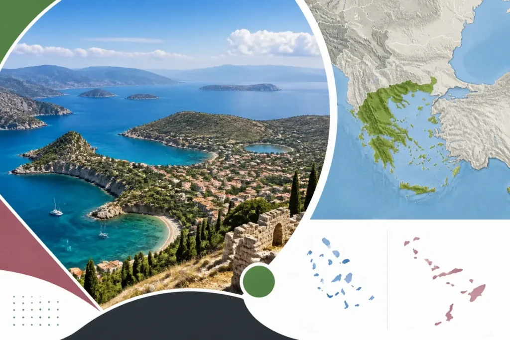
4 land borders surround Greece: Albania, North Macedonia, Bulgaria, and Turkey. Greece is located in southeastern Europe, on the edge of the Mediterranean Sea, between the Ionian and Aegean seas. A general map should show mainland Greece, the Peloponnese, Crete, the main archipelagos, and neighboring countries.

On a map of Europe, the country forms a geographical bridge between the Balkans, the Eastern Mediterranean, and Asia Minor. Athens serves as a landmark in the southeast of the mainland territory, while Thessaloniki marks the north; the islands then extend the view towards the east and south.

| 🧭 | Location: southeastern Europe, in the Balkan Peninsula |
| 🗺️ | Land neighbors: Albania, North Macedonia, Bulgaria, and Turkey |
| 🌊 | Main seas: Ionian Sea to the west and Aegean Sea to the east |
| 🏝️ | Island groups: Ionian Islands, Cyclades, Dodecanese, and Crete |
| 🏙️ | Landmark cities: Athens in the southeast and Thessaloniki in the north |
| 📐 | Area: approximately 131,340 km² according to geographic data compiled by the French Ministry for Europe and Foreign Affairs |
Where is Greece located on the map of Europe?
Greece occupies the southernmost tip of the Balkan Peninsula, in Southeastern Europe. It opens onto the Mediterranean and stretches from the northern mainland down to Crete, with a territory highly fragmented by gulfs and archipelagos. To locate it quickly, look for Italy to the west, Turkey to the east, and the Balkans to the north.

Its central coordinates are often given around 39° north latitude and 22° east longitude, while the entire country extends approximately between the 34th and 42nd degrees of north latitude. These values help to understand the general orientation, without replacing a detailed map of the islands and borders.
Greece is European and Balkan. This geographical fact avoids a common confusion: its proximity to Asia Minor and its Mediterranean openness do not exclude it from the European framework. The political map places it in Southeast Europe; the physical map then shows its mountains, peninsulas, and maritime basins.
The seas bordering Greek territory
To the west, the Ionian Sea separates Greece from Italy and notably borders Corfu, Cephalonia, and Zakynthos. To the east, the Aegean Sea stretches between mainland Greece and Turkey, with the Cyclades and the islands of the eastern Aegean. To the south, the Mediterranean connects Crete to the maritime areas of North Africa and the Near East.
A map of Greece must therefore be read at two scales. The European scale situates the Balkans and neighboring countries; the Mediterranean scale explains the scattering of the islands, the place of Crete, and the maritime routes that extend the territory.
What are the land borders and neighboring countries of Greece?
Greece shares a land border with four states: Albania to the northwest, North Macedonia to the north, Bulgaria to the northeast, and Turkey to the east. These borders concern the continental territory, mainly in Epirus, Greek Macedonia, and Western Thrace; the countries located across the sea belong to another cartographic interpretation.

| Neighboring country | Position on the map | Published value |
|---|---|---|
| Albania | Northwest, around Epirus | Approximately 282 km according to compiled geographic data |
| North Macedonia | North, between Albania and Bulgaria | Approximately 246 km according to the same data |
| Bulgaria | Northeast, above Thrace | Approximately 494 km according to the same data |
| Turkey | East, around Western Thrace | Approximately 206 km according to the same data |
These lengths should be read as geographical measurements attributed to a given method: the chosen route, watercourses, and calculation scale can alter the result. The Greek-Turkish border notably follows the Evros river in its land part, before the two countries face each other in the Aegean Sea.
However, “Greece’s neighboring countries number seven” sometimes mixes land borders and maritime neighbors. For a classic political map, retain four land neighbors. Italy, Cyprus, and other states may appear on an expanded maritime map without sharing a land border with Athens.
To deepen the reading of borders and cities, a map of Greece with cities usefully complements the European map, especially when the names of Greek regions become too crowded at a small scale.
How to read mainland Greece, the Peloponnese, and the archipelagos?
The Greek territory is visually divided into a continental part south of the Balkans, peninsulas including the Peloponnese, and island groups spread across several seas. This organization explains why a map of Greece seems larger and more fragmented than a simple continental outline: the islands shift the country’s center of gravity towards the sea.
Mainland Greece and the Peloponnese
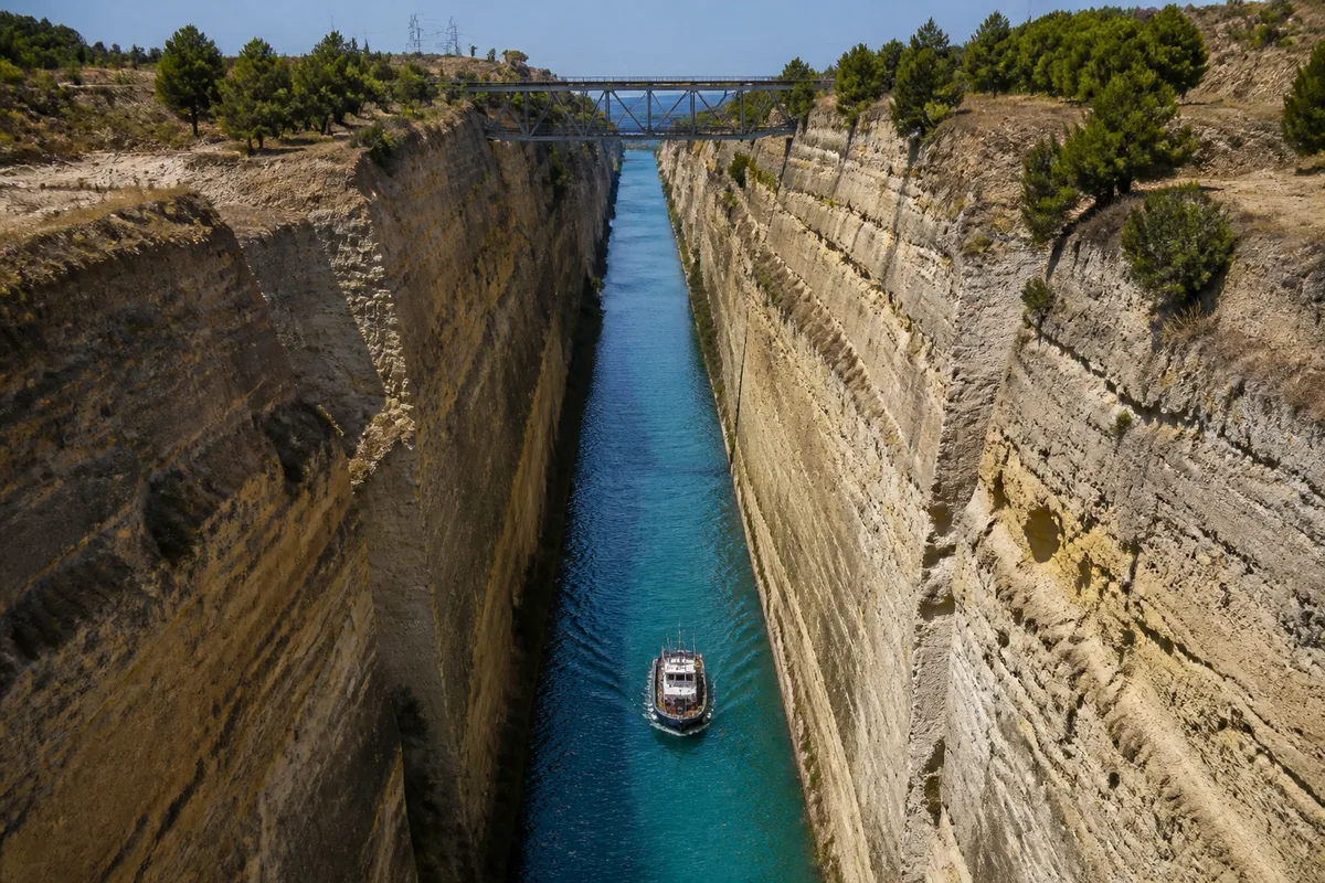
Mainland Greece includes Greek Macedonia, Western Thrace, Epirus, Thessaly, Central Greece, and Attica, where Athens is located. The Peloponnese lies to the south, separated from the mainland by the Gulf of Corinth and connected by the Isthmus of Corinth; on a map, it looks like a large peninsula attached by a narrow passage.

The relief reinforces this structure. Mount Olympus reaches 2,917 meters and is the highest point in the country; mountain ranges occupy a significant place inland, while plains are concentrated around certain basins and coastal fronts. A physical map is therefore more informative than a simple road map to understand the shape of the territory.

Crete, Cyclades, Dodecanese, and Ionian Islands
Crete closes off the Greek space to the south and marks the transition between the Aegean Sea and the Eastern Mediterranean. The Cyclades form a group around the central Aegean Sea; the Dodecanese stretches near the Turkish coast, with Rhodes as a major landmark; the Ionian Islands line the western front, facing Italy.


The belief that “all the Greek islands are in the same place” does not hold up well against a general map. Corfu faces Italy, Santorini belongs to the Cyclades, Rhodes is located to the east near Turkey, and Crete occupies the far south. The route, the sea crossed, and the departure city therefore change completely depending on the chosen island.
For cities, major sites, and historical regions, the map of ancient Greece meets another need: it places locations in their historical context, without confusing them with the borders of the contemporary Greek state.
Which cities and which maps to use for orientation?
Athens and Thessaloniki are the two most effective urban landmarks on a map of Greece. Athens is located in Attica, in the southeast of the mainland, while Thessaloniki occupies the north, at the end of the Thermaic Gulf. Their position is enough to quickly orient a map before adding islands or tourist sites.

Around these two cities, a tourist map can place the Acropolis, Delphi, the Meteora, Olympia, and Knossos. These sites do not all serve the same type of travel: Delphi is read along the axis of central Greece, Olympia in the Peloponnese, the Meteora in the northwest of Thessaly, and Knossos in Crete.
To choose the right medium, start from the use rather than the displayed image. A political map corresponds to borders; a physical map shows reliefs and seas; a road map helps measure routes; a tourist map adds places of interest, sometimes at the cost of a less faithful representation of distances.
— comparison: Political, Physical, Road, Tourist.Which map to choose?The right medium depends on the decision to be made.PoliticalBorders andneighboring countriesEuropeanreadingPhysicalRelief and seasUnderstanding theterritoryRoadRoutes and journeysPrepare atripTouristSites and islandsChoosestopsTo beginUse a general map, then zoom in with a regional orroad map.
Map projection also changes the perception of the country. A flat map necessarily distorts areas, distances, or shapes; islands may appear closer, larger, or more aligned than they actually are. To compare a route between Athens, Rhodes, and Crete, scale and projection matter more than the decorative aspect of the map.
By way of comparison, the road distances announced from Athens reach about 1,346 km to Rome, 2,765 km to Brussels, 3,082 km to Barcelona, and 3,361 km to Oslo; these values describe land routes, not straight-line distances. Greece is therefore close to Italy on a Mediterranean scale, while remaining distant from the capitals of Northern Europe.
- To locate the country: choose a map of Europe with the Balkans, Italy, and Turkey.
- To understand the territory: add the Ionian and Aegean seas, the Peloponnese, and Crete.
- To prepare an itinerary: switch to a road or regional map showing routes and ferries.
A detailed map of Greece to print in French becomes relevant when the screen is no longer sufficient, especially to compare several islands or follow a route outside major urban centers. On site, the printed scale remains useful if it clearly distinguishes roads, ports, and regional boundaries.

Useful sources to consult
Area data and general information about the territory can be cross-checked with the geographic sheet from France Diplomacy on Greece. For administrative subdivisions, Greek law no. 3852/2010 establishes thirteen administrative regions; this organization should not be confused with archipelagos or former historical regions.
Coordinates and distances remain reading tools, not travel guarantees. If a tourist map contradicts a political map on a border or a road map on a route, keep the map adapted to the question asked and check the scale, update date, and measurement method.