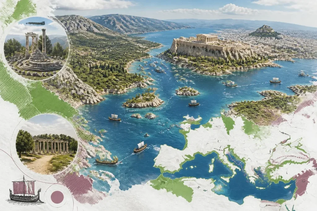
📋 Key takeaway: Personally, I consider the cartographic study of ancient Greece essential to fully grasp the geopolitical rivalries between city-states and the influence of terrain on the political fragmentation of the Hellenic world.
.synthesis h2, .synthesis .synthesis-header { font-size: 1.15em; font-weight: 700; margin-bottom: 0.6em; color: #47752c; }
.synthesis p, .synthesis li { font-size: 1em; line-height: 1.65; margin: 10px; }
.synthesis strong { color: #121e0b; }
.synthesis table { width: 100%; border-collapse: collapse; }
.synthesis th { background: rgba(91, 150, 56, 0.12); color: #47752c; text-align: left; }
.synthesis td, .synthesis th { padding: 8px 12px; border-bottom: 1px solid rgba(91, 150, 56, 0.18); vertical-align: top; }
.synthesis tbody tr:nth-child(even) { background: rgba(91, 150, 56, 0.05); }
.key-takeaways { max-width: 640px; margin: 2em auto; padding: 1.5em 1.8em; color: #1f3313; font-family: “Inter”, “Segoe UI”, sans-serif; text-align: left; position: relative; box-sizing: border-box; background: #f2f7ef; border: 1px solid #5b9638; border-left: 6px solid #5b9638; border-radius: 12px; box-shadow: 0 8px 24px rgba(251, 191, 36, 0.15); }
.key-takeaways h2, .key-takeaways .key-takeaways-header { font-size: 1.15em; font-weight: 700; margin-bottom: 0.6em; color: #47752c; }
.key-takeaways p, .key-takeaways li { font-size: 1em; line-height: 1.65; margin: 10px; }
.key-takeaways strong { color: #121e0b; }
.key-takeaways ul { list-style: none; padding-left: 0; }
.key-takeaways li { margin: 0.45em 0; padding-left: 0.2em; }
.mg-callout{margin:1.5em 0;padding:.9em 1.1em;border:1px solid;border-left-width:4px;border-radius:10px;font-size:.97em;line-height:1.65}.mg-callout>:first-child{margin-top:0}.mg-callout>:last-child{margin-bottom:0}.mg-callout__label{display:block;margin:0 0 .35em;font-weight:700;font-size:.82em;letter-spacing:.03em;text-transform:uppercase}.mg-callout__label::before{margin-right:.45em;font-size:1.05em;vertical-align:-.06em}.mg-callout–info{background:#eff6ff;border-color:#bfdbfe;color:#1e3a5f}.mg-callout–info .mg-callout__label{color:#2563eb}.mg-callout–info .mg-callout__label::before{content:”\2139\FE0F”}.mg-callout–tip{background:#f0fdf4;border-color:#bbf7d0;color:#14532d}.mg-callout–tip .mg-callout__label{color:#15803d}.mg-callout–tip .mg-callout__label::before{content:”\1F4A1″}.mg-callout–warning{background:#fffbeb;border-color:#fde68a;color:#7a4a10}.mg-callout–warning .mg-callout__label{color:#b45309}.mg-callout–warning .mg-callout__label::before{content:”\26A0\FE0F”}.mg-callout–danger{background:#fef2f2;border-color:#fecaca;color:#7f1d1d}.mg-callout–danger .mg-callout__label{color:#dc2626}.mg-callout–danger .mg-callout__label::before{content:”\1F6D1″}.mg-proscons{display:grid;grid-template-columns:1fr 1fr;gap:16px;margin:1.5em 0}@media(max-width:560px){.mg-proscons{grid-template-columns:1fr}}.mg-proscons__col{padding:.9em 1.1em;border:1px solid;border-radius:10px}.mg-proscons__title{display:flex;align-items:center;gap:.4em;margin:0 0 .5em;font-weight:700;font-size:.9em;letter-spacing:.02em}.mg-proscons__col ul{margin:.3em 0 0;padding-left:1.15em}.mg-proscons__col li{margin:.3em 0;line-height:1.55}.mg-proscons__col–pro{background:#f0fdf4;border-color:#bbf7d0;color:#14532d}.mg-proscons__col–pro .mg-proscons__title{color:#15803d}.mg-proscons__col–pro .mg-proscons__title::before{content:”\2705″}.mg-proscons__col–con{background:#fef2f2;border-color:#fecaca;color:#7f1d1d}.mg-proscons__col–con .mg-proscons__title{color:#dc2626}.mg-proscons__col–con .mg-proscons__title::before{content:”\274C”}ol.mg-steps{list-style:none!important;counter-reset:mgstep;margin:1.6em 0;padding-left:0!important}ol.mg-steps>li.mg-steps__item{counter-increment:mgstep;list-style:none!important;padding-left:0!important;padding-bottom:1.4em}ol.mg-steps>li.mg-steps__item:last-child{padding-bottom:0}ol.mg-steps>li.mg-steps__item>:last-child{margin-bottom:0}ol.mg-steps>li.mg-steps__item>.mg-steps__title{margin:0 0 .25em;font-weight:600}ol.mg-steps>li.mg-steps__item>.mg-steps__title::before{content:counter(mgstep) “. “;opacity:.45;font-weight:500;font-variant-numeric:tabular-nums}ol.mg-steps>li.mg-steps__item:not(:has(.mg-steps__title))::before{content:counter(mgstep) “. “;opacity:.45;font-weight:500;font-variant-numeric:tabular-nums}.mg-kpis{display:grid;grid-template-columns:repeat(auto-fit,minmax(140px,1fr));gap:14px;margin:1.5em 0}.mg-kpi{padding:1em .9em;border:1px solid #e5e7eb;border-radius:12px;background:#f9fafb;text-align:center}.mg-kpi__value{display:block;font-size:1.7em;font-weight:800;line-height:1.15;color:#111827}.mg-kpi__label{display:block;margin-top:.35em;font-size:.85em;color:#6b7280;line-height:1.35}
.wp-block-image,.ai-image{margin-bottom:1.75em}.wp-block-image>figcaption,.ai-image>figcaption{margin-top:.5em}
A map of ancient Greece becomes readable with 5 starting points: the regions, the seas, the islands, the cities, and the period represented. The map of ancient Greece therefore does not show a fixed territory comparable to a modern state: it can depict classical Greece, the Greek colonies, or the Hellenistic world.
To orient yourself, start with Attica and the Peloponnese, then expand towards Macedonia, the Cyclades, Crete, Asia Minor, and the western Mediterranean. A useful map also distinguishes a city from its territory, a sanctuary from a town, and a colony from a kingdom controlled after Alexander’s conquests.
🌟 My experience: Walking through the ruins of Delphi and Olympia, I realized how much the natural layout of the panhellenic sanctuaries in the heart of the mountain ranges dictated the communication routes and pilgrimages of Antiquity.
| 🧭 | Scope: a map must specify the period and space represented. |
|---|---|
| 🏛️ | Major cities: Athens, Sparta, Corinth, Thebes, and Argos structure the main political landmarks. |
| ⛰️ | Regions: Macedonia, Thessaly, Boeotia, Phocis, Attica, and the Peloponnese organize the terrestrial reading. |
| 🌊 | Seas and islands: the Aegean Sea, Ionian Sea, Euboea, the Cyclades, and Crete connect the Greek spaces. |
| 🏺 | Historical sites: Delphi, Olympia, Mycenae, Epidaurus, and Knossos do not all play the same role. |
| 🗺️ | Boundaries: political borders, zones of influence, and colonies change depending on the date chosen. |
To extend your journey through history and civilizations, I invite you to discover our tips for preparing your trip to Morocco, to explore some recommendations for discovering Marrakech, or to get inspired by our guide to visiting Morocco as part of an unforgettable trip.
The major regions of ancient Greece on the map
🍀 Advantages
• Clear understanding of geographical influences on history
• Precise location of major archaeological sites
• Global vision of ancient exchange networks
🔻 Disadvantages
• Constant evolution of borders over the centuries
• Complexity of ancient names sometimes difficult to place
• Scarcity of archaeological sources for certain landlocked areas
The map is read first from north to south: Macedonia and Thessaly in the north, central Greece around Boeotia and Phocis, then Attica and the Peloponnese. To the west, Epirus faces the Ionian Sea; to the east, Euboea and the Aegean islands extend the peninsula towards Asia Minor.

Mainland Greece and its principal regions
Macedonia occupies the northern part of the peninsula, while Thessaly extends across a large plain surrounded by reliefs. This contrast between open basins and mountainous massifs explains why land routes remain concentrated through a few passages.
Central Greece includes Boeotia, Phocis, and Attica. Thebes appears in Boeotia, Delphi on the slopes of Mount Parnassus in Phocis, and Athens in Attica, to the southeast of this group.
However, Epirus is less a continuous plain than a mountainous region facing the Ionian Sea. To locate modern Greece before returning to ancient divisions, the map of Greece in Europe provides a modern framework, not to be confused with the territories of ancient cities.
⏱ Practical tip: First locate the Isthmus of Corinth and the major gulfs on your historical map; these coastal landmarks greatly facilitate understanding of ancient maritime routes.
The Peloponnese and the southern territories
The Peloponnese forms a vast peninsula connected to the mainland by the Isthmus of Corinth. Argolis occupies the northeast, Arcadia the mountainous interior, Laconia the southeast, while Messenia and Elis extend to the west.
💡 Did you know? The term “Hellas” designated for the Ancients the entire Greek cultural world, which extended far beyond modern Greece, from the coasts of the Black Sea to Sicily and Spain.
Corinth controls the passage of the isthmus and connects routes coming from central Greece to the southern ports. Sparta is located in the Eurotas valley, in Laconia; Argos, Mycenae, and Epidaurus belong to Argolis.
A map of the cities and regions of modern Greece helps compare current names, but it is not sufficient to reconstruct the borders of an ancient polis: the boundaries must always be dated.
Which cities and historical sites to locate?
The most useful cities to place are Athens, Sparta, and Corinth, to which are added Thebes, Argos, Delphi, and Olympia. They do not represent a single category: some are political powers, others sanctuaries or regional centers whose importance exceeds their urban area.
⚠️ Classic trap: Imagining that ancient Greece formed a unified, homogeneous state. Historical maps instead show a fragmented set of territories in perpetual alliance or confrontation.
The Cities of Mainland Greece
Athens is located in Attica, near Piraeus, its major maritime outlet. Piraeus is not a second Athens: it constitutes a port integrated into the naval and commercial power of the city.
Thebes is situated northwest of Athens, in Boeotia. Delphi, in Phocis, should be represented with a sanctuary symbol rather than the same icon as a political city.

The Cities and Sanctuaries of the Peloponnese
Sparta dominates Laconia from the Eurotas valley, while Corinth controls the isthmus. Olympia is located in Elis: its sanctuary of Zeus and its panhellenic contests make it a religious site shared by rival cities.
Mycenae and Tiryns refer to the Mycenaean civilization of the Bronze Age, while Epidaurus is associated with the sanctuary of Asclepius and its theater. Placing them close on a map does not mean they belong to the same historical period.

For a school map, first place Athens, Sparta, Corinth, Delphi, and Olympia. These five points provide a clear framework before adding Mycenaean or island sites.

How do the seas, islands, and colonies expand the Greek world?
The Greek world extends far beyond the Balkan peninsula: the Aegean Sea connects Attica, Euboea, the Cyclades, and the Ionian coast, while the Ionian Sea opens routes to Epirus, southern Italy, and Sicily. The map must therefore show the circulations as much as the lands.

The axes of the Aegean Sea and the Ionian Sea
The Cyclades form a string of islands between mainland Greece and Asia Minor. Delos, at the center of the Cyclades, is an important sanctuary; Rhodes and Samos lie further east, while Miletus and Ephesus belong to the Ionian coast.

http://www.geographicus.com/mm5/cartographers/homannheirs.txt / Wikimedia Commons
Crete closes off the Aegean space to the south. Knossos there recalls the Minoan civilization, which predates the political balances of the classical period.

Colonies, diasporas, and the Hellenistic world
From the 8th century BC, Greek colonization extends settlements around the Mediterranean and the Black Sea for more than two hundred years, according to a specialized presentation of the Greek world. Syracuse, in Sicily, and Marseille, in Gaul, show why a map limited to the peninsula gives an incomplete picture.
A specialized source mentions more than a thousand Greek cities in the classical era and about 400 colonies; these numbers remain estimates attributed to this publication, not a universally stabilized count. The same source states that nearly 40% of Greeks lived outside the Balkans Greece at the beginning of the 4th century BC.

After Alexander’s conquests, from 323 BC onwards, the mapped perimeter can include Alexandria and the Hellenistic kingdoms. Here, the historical scale really decides: a map of classical Greece should not automatically receive the borders of a later kingdom.
How to read the legend and boundaries of an ancient map?
A good legend separates regions, cities, sanctuaries, colonies, seas, and reliefs. It also indicates the reference date, because a point placed on the map can represent an urban location, the territory of a polis, or a much wider area of influence.
The position of a site is sometimes better established than its political boundaries. For a disputed or hypothetical place, the map should use a different symbol, a dashed line, or an explanatory note instead of showing a definite border.

Geography itself has changed. The sea and mountains dominate the Greek landscapes, mountain ranges isolate coastal plains, and the shores do not always appear as they do today; a modern map superimposed without caution can therefore give a false sense of precision.
Finally, scale and projection alter the reading of distances. A small map compresses reliefs and visually distances islands, while a maritime projection can emphasize certain navigation routes.
To print a map in French, choose a version where the legend remains readable after reduction, then check the author, date, and reuse rights. The encyclopedic file dedicated to ancient Greece, dated September 16, 2017, measures 1,802 × 1,439 pixels and is indicated under a Creative Commons BY-SA 4.0 license; this information concerns this specific file, not all available maps.

Xuan Che / Wikimedia Commons
Do not choose a 5th century BC map to explain the entire Greek Antiquity. Choose it if the classical period suffices; otherwise, add a map of the colonies or the Hellenistic world, so that cities, regions, and borders remain coherent.
.magic-lb-overlay.open{display:flex}
.magic-lb-overlay img{max-width:95vw;max-height:95vh;object-fit:contain;border-radius:8px;box-shadow:0 8px 32px rgba(0,0,0,.5)}
.magic-lb-close{position:absolute;top:16px;right:20px;color:#fff;background:rgba(0,0,0,.5);border:none;width:40px;height:40px;border-radius:50%;font-size:24px;cursor:pointer;display:flex;align-items:center;justify-content:center}
.magic-lb-close:hover{background:rgba(0,0,0,.8)}
.wp-block-image img{cursor:zoom-in;transition:transform .15s ease}
.wp-block-image img:hover{transform:scale(1.01)}
.magic-img-link{display:inline-block;text-decoration:none}
What were the main regions of ancient Greece on a map?
The ancient Greek world was mainly centered around mainland Greece (Attica, Peloponnese, Boeotia, Thessaly), the islands of the Aegean Sea, and the colonies of Magna Graecia (Southern Italy).
How did geography influence the organization of city-states?
The very mountainous and compartmentalized terrain of Greece favored the emergence of independent city-states (the poleis) that jealously guarded their sovereignty rather than a vast centralized empire.
What are the essential panhellenic sanctuaries to locate on the map?
The major sanctuaries where all the Greeks gathered were Delphi (seat of the oracle of Apollo), Olympia (Olympic Games), and Epidaurus.
(function(){
var ov=document.getElementById(‘magic-lb’);if(!ov)return;
var img=ov.querySelector(‘img’),btn=ov.querySelector(‘.magic-lb-close’);
var L={fr:’Fermer’,es:’Cerrar’,en:’Close’,pt:’Fechar’,it:’Chiudi’,de:’Schlie\u00dfen’,nl:’Sluiten’,ca:’Tancar’};
btn.setAttribute(‘aria-label’,L[(document.documentElement.lang||”).slice(0,2).toLowerCase()]||’Close’);
function open(src){img.src=src;ov.classList.add(‘open’);document.body.style.overflow=’hidden’}
function close(){ov.classList.remove(‘open’);img.src=”;document.body.style.overflow=”}
document.addEventListener(‘click’,function(e){
var a=e.target.closest(‘a.magic-img-link’);
if(a){e.preventDefault();open(a.getAttribute(‘href’));return}
var i=e.target.closest(‘.wp-block-image img’);
if(i&&!e.target.closest(‘a’)){e.preventDefault();open(i.currentSrc||i.src)}
});
ov.addEventListener(‘click’,function(e){if(e.target===ov||e.target===btn)close()});
document.addEventListener(‘keydown’,function(e){if(e.key===’Escape’)close()});
})();