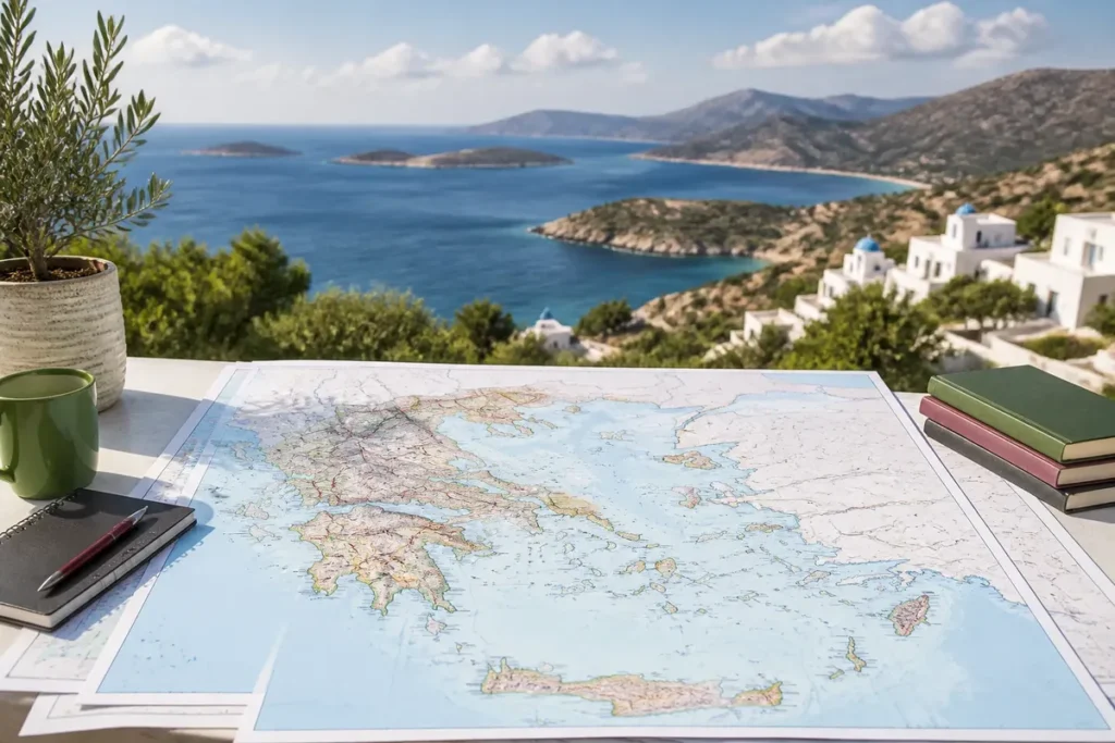
📋 Key point: Personally, I consider having a detailed map of Greece in French, ready to be printed, essential for anticipating maritime connections between the islands, locating major ancient sites, and structuring your itinerary without relying on an Internet connection.
.synthesis h2, .synthesis .synthesis-header { font-size: 1.15em; font-weight: 700; margin-bottom: 0.6em; color: #47752c; }
.synthesis p, .synthesis li { font-size: 1em; line-height: 1.65; margin: 10px; }
.synthesis strong { color: #121e0b; }
.synthesis table { width: 100%; border-collapse: collapse; }
.synthesis th { background: rgba(91, 150, 56, 0.12); color: #47752c; text-align: left; }
.synthesis td, .synthesis th { padding: 8px 12px; border-bottom: 1px solid rgba(91, 150, 56, 0.18); vertical-align: top; }
.synthesis tbody tr:nth-child(even) { background: rgba(91, 150, 56, 0.05); }
.key-takeaways { max-width: 640px; margin: 2em auto; padding: 1.5em 1.8em; color: #1f3313; font-family: “Inter”, “Segoe UI”, sans-serif; text-align: left; position: relative; box-sizing: border-box; background: #f2f7ef; border: 1px solid #5b9638; border-left: 6px solid #5b9638; border-radius: 12px; box-shadow: 0 8px 24px rgba(251, 191, 36, 0.15); }
.key-takeaways h2, .key-takeaways .key-takeaways-header { font-size: 1.15em; font-weight: 700; margin-bottom: 0.6em; color: #47752c; }
.key-takeaways p, .key-takeaways li { font-size: 1em; line-height: 1.65; margin: 10px; }
.key-takeaways strong { color: #121e0b; }
.key-takeaways ul { list-style: none; padding-left: 0; }
.key-takeaways li { margin: 0.45em 0; padding-left: 0.2em; }
.mg-callout{margin:1.5em 0;padding:.9em 1.1em;border:1px solid;border-left-width:4px;border-radius:10px;font-size:.97em;line-height:1.65}.mg-callout>:first-child{margin-top:0}.mg-callout>:last-child{margin-bottom:0}.mg-callout__label{display:block;margin:0 0 .35em;font-weight:700;font-size:.82em;letter-spacing:.03em;text-transform:uppercase}.mg-callout__label::before{margin-right:.45em;font-size:1.05em;vertical-align:-.06em}.mg-callout–info{background:#eff6ff;border-color:#bfdbfe;color:#1e3a5f}.mg-callout–info .mg-callout__label{color:#2563eb}.mg-callout–info .mg-callout__label::before{content:”\2139\FE0F”}.mg-callout–tip{background:#f0fdf4;border-color:#bbf7d0;color:#14532d}.mg-callout–tip .mg-callout__label{color:#15803d}.mg-callout–tip .mg-callout__label::before{content:”\1F4A1″}.mg-callout–warning{background:#fffbeb;border-color:#fde68a;color:#7a4a10}.mg-callout–warning .mg-callout__label{color:#b45309}.mg-callout–warning .mg-callout__label::before{content:”\26A0\FE0F”}.mg-callout–danger{background:#fef2f2;border-color:#fecaca;color:#7f1d1d}.mg-callout–danger .mg-callout__label{color:#dc2626}.mg-callout–danger .mg-callout__label::before{content:”\1F6D1″}.mg-proscons{display:grid;grid-template-columns:1fr 1fr;gap:16px;margin:1.5em 0}@media(max-width:560px){.mg-proscons{grid-template-columns:1fr}}.mg-proscons__col{padding:.9em 1.1em;border:1px solid;border-radius:10px}.mg-proscons__title{display:flex;align-items:center;gap:.4em;margin:0 0 .5em;font-weight:700;font-size:.9em;letter-spacing:.02em}.mg-proscons__col ul{margin:.3em 0 0;padding-left:1.15em}.mg-proscons__col li{margin:.3em 0;line-height:1.55}.mg-proscons__col–pro{background:#f0fdf4;border-color:#bbf7d0;color:#14532d}.mg-proscons__col–pro .mg-proscons__title{color:#15803d}.mg-proscons__col–pro .mg-proscons__title::before{content:”\2705″}.mg-proscons__col–con{background:#fef2f2;border-color:#fecaca;color:#7f1d1d}.mg-proscons__col–con .mg-proscons__title{color:#dc2626}.mg-proscons__col–con .mg-proscons__title::before{content:”\274C”}ol.mg-steps{list-style:none!important;counter-reset:mgstep;margin:1.6em 0;padding-left:0!important}ol.mg-steps>li.mg-steps__item{counter-increment:mgstep;list-style:none!important;padding-left:0!important;padding-bottom:1.4em}ol.mg-steps>li.mg-steps__item:last-child{padding-bottom:0}ol.mg-steps>li.mg-steps__item>:last-child{margin-bottom:0}ol.mg-steps>li.mg-steps__item>.mg-steps__title{margin:0 0 .25em;font-weight:600}ol.mg-steps>li.mg-steps__item>.mg-steps__title::before{content:counter(mgstep) “. “;opacity:.45;font-weight:500;font-variant-numeric:tabular-nums}ol.mg-steps>li.mg-steps__item:not(:has(.mg-steps__title))::before{content:counter(mgstep) “. “;opacity:.45;font-weight:500;font-variant-numeric:tabular-nums}.mg-kpis{display:grid;grid-template-columns:repeat(auto-fit,minmax(140px,1fr));gap:14px;margin:1.5em 0}.mg-kpi{padding:1em .9em;border:1px solid #e5e7eb;border-radius:12px;background:#f9fafb;text-align:center}.mg-kpi__value{display:block;font-size:1.7em;font-weight:800;line-height:1.15;color:#111827}.mg-kpi__label{display:block;margin-top:.35em;font-size:.85em;color:#6b7280;line-height:1.35}
.wp-block-image,.ai-image{margin-bottom:1.75em}.wp-block-image>figcaption,.ai-image>figcaption{margin-top:.5em}
300 dpi at the final size produces a readable printable map of Greece, provided you choose a sufficiently detailed image and maintain its scale. To obtain a usable medium, select the right type of map, check the visible information, prepare the file at 100%, then print it on one or several sheets depending on the chosen format.

🌟 My experience: During my journey through the Peloponnese and the Cyclades, the printed paper format saved me several times in white zones where the GPS dropped out, while allowing me to directly note my stopover ideas on the coastal roads.
The general version should include mainland Greece, the main islands, cities, borders, seas, and some relief landmarks. A road variant is then used for trips, while an administrative or tourist map meets a more specific need; an interactive map remains useful for exploration, less so for replacing an offline paper document.
| 🗺️ | General map: Mainland Greece, islands, seas, borders, and main cities. |
| 🚗 | Road map: major routes, connections between cities, and circuit organization. |
| 🏛️ | Administrative map: regions, territorial limits, and institutional landmarks. |
| ⛰️ | Physical map: relief, mountain ranges, plains, watercourses, and lakes. |
| 📄 | Printing: 300 dpi at final size, with scale maintained at 100%. |
| ⚠️ | Limit: the condition of a road or tourist access may change after publication. |
Which detailed map of Greece to choose for printing?
🍀 Advantages
• Free and immediately accessible for download
• Names in French for easier identification
• Total freedom for handwritten annotations
🔻 Disadvantages
• Requires a quality printer for small text
• Less interactive than a dynamic digital application
• Possible paper wear during long trips
For an overview, choose a general map in French that shows the continent, archipelagos, major cities, and national borders. It allows you to locate Athens, Thessaloniki, Crete, the Cyclades, Rhodes, and the Ionian Islands on the same page, while a road map becomes necessary as soon as you need to measure or prepare routes.
An interactive map can help explore Greece, while a downloadable version remains preferable for printing and offline consultation. Two specialized sources offer this interactive format, with Athens as a city having a dedicated map; this does not turn a screen into a readable paper medium.

To situate the country in its environment, a map of Greece in Europe shows the borders with Albania, North Macedonia, Bulgaria, and Turkey, as well as the Ionian, Aegean, and Mediterranean seas. The map of Greece in Europe complements this regional reading without replacing the detailed printable map.
The road map is suitable for a tour between several cities or regions. It should give more space to main roads and land connections than to tourist sites; for airports and island access, a map of Greek airports meets a distinct need.
An administrative map is useful for regions and territorial boundaries. Greece has 13 administrative regions according to Article 6 of Greek law no. 3852/2010, known as the Kallikratis program; an older map showing 52 nomes describes a different organization and should not be confused with the current regional division.
The physical map adds relief, mountain ranges, plains, rivers, and lakes. It explains why a short distance on paper can correspond to a slow journey when mountains, coastal detours, or maritime connections are involved.
What should a general map of Greece show?
A successful general map prioritizes information: borders, seas, and major cities should remain visible before secondary details. It must also specify its scale, orientation, legend, and date of update, because a map can remain geographically useful while becoming insufficient for recent road access.
The islands must be present without occupying the entire visual space. Crete, Rhodes, Corfu, the Cyclades, and the islands of the Aegean Sea must be positioned in a readable way, with a scale that avoids reducing the names to characters impossible to decipher.
However, the graphic scale is more useful than a simple announced distance: it allows you to directly measure the gap between Athens and another city, or between the mainland and an island, without confusing as-the-crow-flies distance with actual travel time.
To go further in discovering your travel destinations, I suggest you consult our article to visit Morocco as part of an unforgettable trip, explore the leads of our guide to properly prepare your trip to Morocco, or discover the riches of Southern Africa with our page dedicated to South Africa and its vast wild spaces.
A general map can also include major road axes, rivers, and main reliefs, provided that these layers do not obscure place names. Small villages, trails, and ferry schedules belong to specialized documents.

⏱ Practical tip: Opt for a landscape print on slightly thicker paper or protect your map in a transparent plastic sleeve to withstand handling outdoors.
The mention of an update in 2026 on a map of cross-border territories only indicates the date displayed for this map; it does not automatically certify the date of each printed data, each toponym, or each road layout.

For historical sites, a dedicated map has another function: the map of ancient Greece locates the ancient cities and regions, but it should not replace a current map for planning a trip.

How to print a map of Greece without losing details?
Print the file at its actual size after choosing the paper and orientation. A4 format is suitable for quick reference or a school project; A3 provides more space for names, roads, and islands, while an extended route may require several assembled sheets.
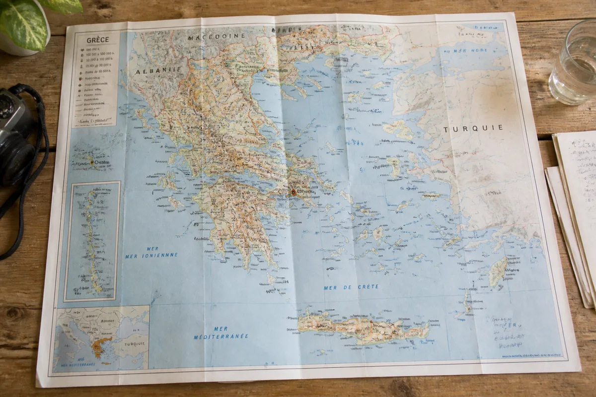
- Step 1: choose the final format. Select A4 for a portable document or A3 for more comfortable reading. Switch to landscape orientation when the width of Greece and its islands exceeds the available height. The expected result is a page where the map frame remains intact.
- Step 2: prepare the file resolution. Keep 300 dpi at the final print size. This density properly renders small text, road lines, and island boundaries; a low-resolution file enlarged will produce blurry text, even with a decent printer.
- Step 3: set the print scale. Select “actual size” or 100%, then disable automatic page scaling. This way, the document retains the planned dimensions and the graphic scale remains consistent with the map.
- Step 4: check the paper output. Compare the printed map with the file before printing multiple copies. Margins, legend, island names, and all four edges of the frame must remain visible; the expected result is a complete, uncropped map.
Color helps distinguish between relief, water, roads, and administrative boundaries. A grayscale version remains relevant to reduce ink consumption, provided that the main lines also rely on differences in thickness or shape, and not solely on shades.

A vector file better preserves contours when resized, whereas a raster image must already have the resolution needed for the final size. The mention “royalty-free” does not always specify copying, modification, or distribution; for public or commercial use, actual permission remains uncertain when license conditions are not written.
What mistakes should be avoided with a printable map of Greece?
The most troublesome errors come from improper use of the document, not from the geography itself. An overly busy tourist map, automatic enlargement, or a missing date can produce a pleasant-to-look-at support but unusable for measuring a route or distinguishing an island.
- Printing a screenshot: compression and limited resolution make names unreadable as soon as the page is enlarged. Use a file intended for the chosen paper size.
- Choosing a tourist map for driving: notable sites may dominate the image at the expense of roads and distances. Take a road map to organize connections.
- Letting the printer adjust the page: reduction or enlargement changes the intended dimensions. The 100% setting preserves the document’s scale.
- Confusing an old map with a current map: a historical administrative division, such as the nomes, does not describe the 13 regions resulting from law no. 3852/2010.
- Carrying the sheet without protection: moisture, repeated folds, and annotations can obscure the legend. A transparent sleeve or folding along the margins limits this degradation.
The printed map should remain a tool for preparation and orientation. It does not provide the instantaneous status of a road, ferry, mountain access, or trail; on site, this information may have changed since the date indicated on the file.
In this case, do not make a general map your only navigation tool.
Combine the sheet with an updated source of traffic or transport before a specific trip, especially when the itinerary combines road and boat. The map then retains its true value: it shows distances, geographical units, and alternatives, without claiming to know the conditions of the day.


Before leaving, take the folded map in a pouch, mark the stages with a pencil, and keep the legend visible. If the file does not provide scale, date, or cartographic author, choose another version before printing.
.magic-lb-overlay.open{display:flex}
.magic-lb-overlay img{max-width:95vw;max-height:95vh;object-fit:contain;border-radius:8px;box-shadow:0 8px 32px rgba(0,0,0,.5)}
.magic-lb-close{position:absolute;top:16px;right:20px;color:#fff;background:rgba(0,0,0,.5);border:none;width:40px;height:40px;border-radius:50%;font-size:24px;cursor:pointer;display:flex;align-items:center;justify-content:center}
.magic-lb-close:hover{background:rgba(0,0,0,.8)}
.wp-block-image img{cursor:zoom-in;transition:transform .15s ease}
.wp-block-image img:hover{transform:scale(1.01)}
.magic-img-link{display:inline-block;text-decoration:none}
Where can I find a detailed map of Greece for free and in French?
You can download high-definition PDF maps directly from our website, optimized for clear printing on A4 or A3 paper.
Why prioritize a printed map in addition to GPS?
The printed map offers an essential overview to anticipate distances between mountainous regions and islands, and requires no battery or mobile network.
Are the city names on the printable maps translated into French?
Yes, our selections favor French nomenclature (or commonly transliterated) to facilitate reading and pronunciation of place names.
(function(){
var ov=document.getElementById(‘magic-lb’);if(!ov)return;
var img=ov.querySelector(‘img’),btn=ov.querySelector(‘.magic-lb-close’);
var L={fr:’Fermer’,es:’Cerrar’,en:’Close’,pt:’Fechar’,it:’Chiudi’,de:’Schlie\u00dfen’,nl:’Sluiten’,ca:’Tancar’};
btn.setAttribute(‘aria-label’,L[(document.documentElement.lang||”).slice(0,2).toLowerCase()]||’Close’);
function open(src){img.src=src;ov.classList.add(‘open’);document.body.style.overflow=’hidden’}
function close(){ov.classList.remove(‘open’);img.src=”;document.body.style.overflow=”}
document.addEventListener(‘click’,function(e){
var a=e.target.closest(‘a.magic-img-link’);
if(a){e.preventDefault();open(a.getAttribute(‘href’));return}
var i=e.target.closest(‘.wp-block-image img’);
if(i&&!e.target.closest(‘a’)){e.preventDefault();open(i.currentSrc||i.src)}
});
ov.addEventListener(‘click’,function(e){if(e.target===ov||e.target===btn)close()});
document.addEventListener(‘keydown’,function(e){if(e.key===’Escape’)close()});
})();