
Between the great northern parks, volcanic peaks, and the Zanzibar archipelago, Tanzania combines safari, trekking, and beach. The map helps link the “northern circuit” (Arusha–Serengeti–Ngorongoro), climbing Kilimanjaro, and relaxing in Zanzibar, while accounting for the rainy seasons and domestic flights.
What you need to know about Tanzania ?
The Tanzanian state, officially called the United Republic of Tanzania, is a sovereign country in East Africa formed by the historic union of Tanganyika and Zanzibar in 1964.
The country covers a total area of 945,097 km² and has about 58.55 million inhabitants (2024 estimate).
The administrative capital is Dodoma, where the government and parliament are seated, while Dar es Salaam remains the largest city and the main economic center of the country.
Tanzania is distinguished by its geographical diversity, combining Indian Ocean beaches, Serengeti savannahs, majestic mountains, and exotic archipelagos.
The country is a member of many regional and international organizations, including the ADPA, SADC, AfDB, CIRGL, INBAR, and the G33.
The international telephone code for Tanzania is +255 (or 00255).
| Item | Details |
|---|---|
| Official name | United Republic of Tanzania |
| Capital | Dodoma (administrative), Dar es Salaam (economic) |
| Population | ~67–70 million inhabitants, strong coastal urban growth |
| Area | ~945,000 km² |
| Relief & hydrography | Rift Valley, plateaus, Mount Kilimanjaro (5,895 m), Mount Meru, Lakes Victoria/Tanganyika/Nyasa, Serengeti plains |
| Climate | Tropical to equatorial depending on altitude and latitude; variable rainy seasons (long rains ~March–May, short rains ~Oct.–Dec.) |
| Languages | Swahili and English (official) + local languages |
| Currency | Tanzanian Shilling (TZS) |
| Major cities | Dar es Salaam, Dodoma, Arusha, Mwanza, Moshi, Zanzibar City |
| Economy | Agriculture, mining (gold), tourism (safari, beaches), energy |
| Points of interest | Parks (Serengeti, Ngorongoro, Tarangire, Selous/Nyerere), Kilimanjaro, Zanzibar islands |
| Access | Airports JNIA (DAR), Kilimanjaro (JRO), Zanzibar (ZNZ); good domestic flights to safari hubs/islands |
| Tips | Adapt itinerary to rainy seasons, book parks/lodges, prepare for altitude/sun variations and prophylaxis depending on areas |
Colors of Tanzania
The Tanzanian flag is a rectangular flag marked by a thick black band bordered by two narrow yellow bands arranged diagonally starting from the lower hoist side and ending at the upper fly side. The two triangles formed above and below are green and blue in color.

The green color represents the country’s vegetation cover, the black color represents the people, and the blue color represents the ocean as well as inland waters. Conversely, the yellow color represents the country’s mineral deposits.
Best places to visit in Tanzania?
Dar es Salaam
Dar es-Salaam is the largest city and the main economic center of the country.
It offers a fascinating blend of modernity and African traditions.
Among the must-see sites are the National Museum of Tanzania, tracing the history of the country, as well as the botanical gardens and the Askari Cathedral, a symbol of colonial memory.
The city is also an excellent starting point to the Coco Beach beaches or the Bongoyo and Mbudya islands, known for their turquoise waters and peaceful atmosphere.
Dodoma
Dodoma, the administrative capital of Tanzania, is home to the main government institutions and the parliament.
It is a calm and structured city, marked by its institutional architecture and its varied religious buildings.
You can visit Nyerere Square, the Gaddafi Mosque, the Jamatkhana Ismaili Mosque, as well as the modernist Anglican, Catholic, and Lutheran churches, all witnesses to the spiritual diversity of the country.

Arusha
Located at the foot of Mount Meru, Arusha is a must-visit destination for nature and safari enthusiasts.
The city is the gateway to Arusha National Park, home to exceptional wildlife: giraffes, buffaloes, leopards, hyenas, monkeys, and flamingos.
Nearby is Lake Manyara, famous for its water birds and spectacular landscapes.
Arusha also charms with its warm hospitality, its craft markets, and its view of Kilimanjaro.
Zanzibar
A true jewel of the Indian Ocean, Zanzibar is a paradisiacal archipelago blending Swahili culture, merchant history, and dream beaches.
Its capital, Stone Town, is listed as a UNESCO World Heritage Site for its unique Arab-African architecture.
Visitors discover narrow alleys, historic buildings, the old Arab fort, as well as fragrant spice markets.
The beaches of Nungwi and Paje offer an idyllic setting for swimming, diving, and kitesurfing.
Mwanza
Nicknamed the “city of rocks”, Mwanza is located on the southern shore of Lake Victoria, the largest lake in Africa.
It is a lively city surrounded by granite hills and impressive rock formations.
It serves as a gateway to safaris in Serengeti National Park and to the fishing communities of the lake.
Mwanza combines African authenticity, exceptional landscapes, and a warm atmosphere, making it a stop not to be missed.
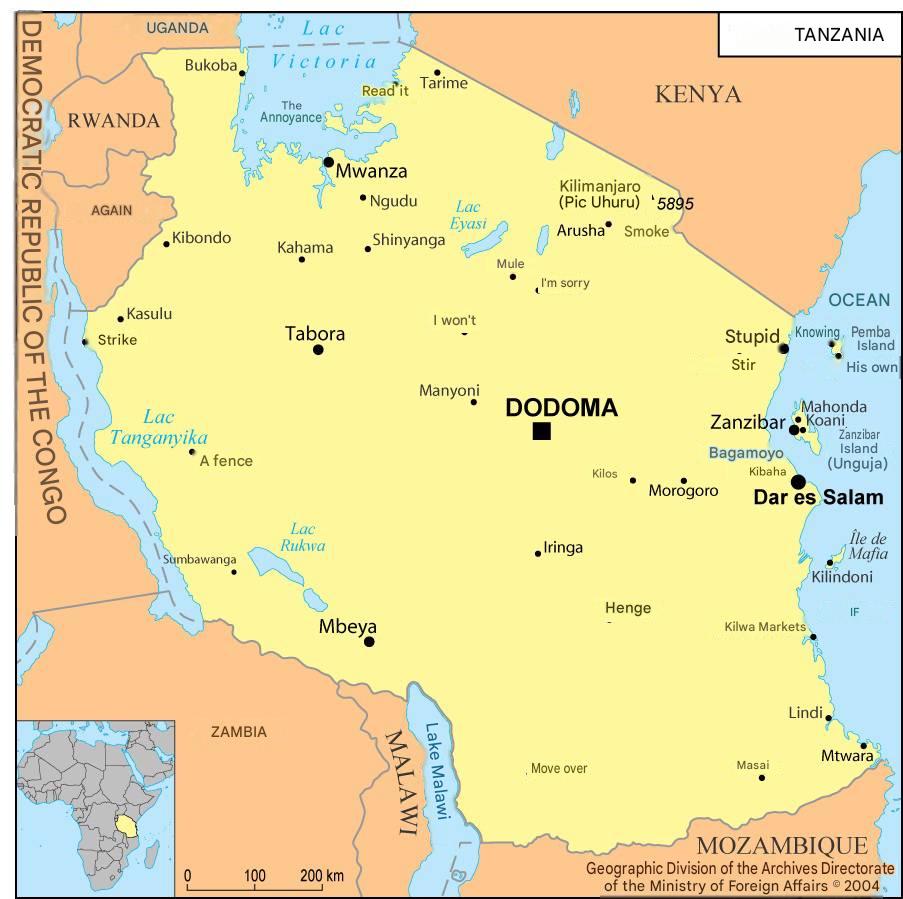
Where is Tanzania located on the world map?

On the world map, Tanzania is located in Africa. On the African continent, it is situated in the eastern section that faces the Indian Ocean. Its neighbors are Mozambique, Zambia, the Democratic Republic of the Congo, Burundi, Rwanda, Uganda, and Kenya. To the east of its territory, the country borders the Indian Ocean.

Climate of Tanzania
The Tanzanian climate is varied but is often likened to a temperate tropical climate. There are two clearly distinct climatic zones:
- The first is the coastline as well as Zanzibar, which have a humid equatorial climate with temperatures ranging between 25 and 30°C
- The second is located in the interior areas, notably the high plateaus and elevated zones. The climate in these parts of the country is tropical and temperate.
In Arusha, temperatures range between 16 and 21°C throughout the year, and in Zanzibar, temperatures range between 22 and 32°C.
The seasons that make up the country’s climate are:
- A hot season occurring between December and February: extremely hot temperatures along the coasts.
- A wet season occurring between March and May: cold in the inland areas and high rainfall in the rest of the country.
- A hot and dry season occurring between May and October: very little precipitation with cool temperatures throughout the day.
- A short wet season occurring between November and December: high temperatures with stormy rains in the afternoon.
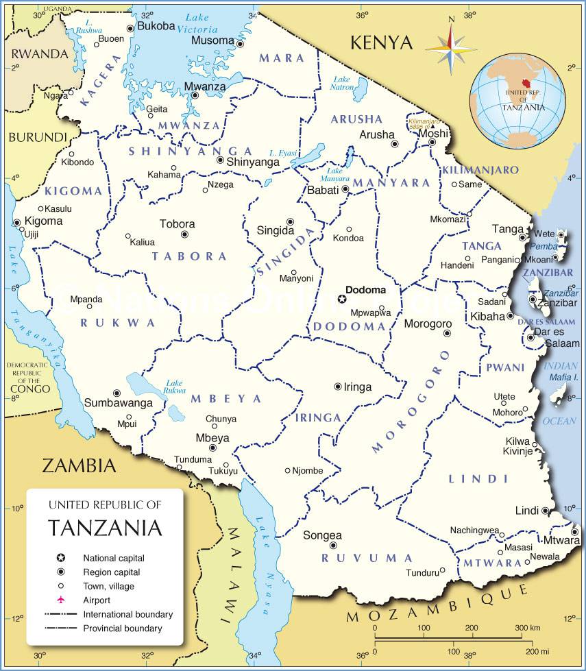
Administrative division of Tanzania
The Tanzanian territory is divided into 31 Mkoa, equivalent to regions. The regions in turn are divided into wilaya, equivalent to districts (127). Then there are the Tarafa or divisions. The final subdivisions are: kata or local neighborhoods, Mtaa or streets, Kijiji or villages, and Vitongoji or hamlets:
26 regions are located on the African continent and the rest on the island of Zanzibar. Here are all the regions:
- Arusha
- Dar es Salaam
- Dodoma
- Iringa
- Kagera
- Kigoma
- Kilimanjaro
- Lindi
- Manyara
- Mara
- Mbeya
- Morogoro
- Mtwara
- Mwanza
- Pwani
- Rukwa
- Ruvuma
- Shinyanga
- Singida
- Tabora
- Tanga
- North Pemba
- South Pemba
- South and Central Unguja
- North Unguja
- Unguja Town and West
Economy of Tanzania

The Tanzanian economy is classified among the lower middle-income economies, according to the World Bank.
Its base sector remains agriculture, which employs more than 65% of the active population and contributes to nearly a quarter of the national GDP.
However, this agricultural dependence exposes the country to climatic variations and global price volatility.
For about ten years, Tanzania has undertaken a structural transformation: the country has strengthened its infrastructure, boosted industrial investment, and developed services (banking, tourism, telecommunications).
This strategy has enabled sustained economic growth, positioning Tanzania as the 7th best performing economy in sub-Saharan Africa and the 1st in East Africa.
Key economic data (2024-2025 Estimates)
- Official currency: Tanzanian Shilling (TZS)
- Nominal GDP: 62.22 billion USD
- GDP at purchasing power parity (PPP): 193.50 billion USD
- Annual GDP growth: 5.8% (nominal) – 5.5% (PPP)
- GDP per capita (nominal): 1,105 USD
- GDP per capita (PPP): 3,402 USD
- Inflation rate: 3.9%
- Poverty rate: 26.4% (and 76.6% of inhabitants living on less than 3.2 USD/day)
Tanzania benefits from its political stability, its natural resources (gold, gas, coffee, cotton, tea), and the development of its maritime corridor in Dar es Salaam, which serves several landlocked countries such as Zambia, Rwanda, and Malawi.
Tourism also plays a driving role, thanks to its world-renowned national parks (Serengeti, Ngorongoro, Kilimanjaro).

Population and Linguistic Data of Tanzania
The Tanzanian population is estimated at 58.55 million inhabitants (2024) with a demographic growth rate of 2.74% per year.
The birth rate stands at 35.3 ‰, compared to a death rate of 7.5 ‰.
The life expectancy at birth is 63.1 years, while the median age is 17.9 years, reflecting a very young and dynamic population.
The male/female ratio is balanced, with about 100 men for 100 women, and the net migration rate is slightly negative at -0.5%.
Languages spoken
Tanzania has two official languages:
- Swahili (Kiswahili), the national and vehicular language spoken by the majority of the population;
- English, used in administration, education, and business.
Arabic is also spoken in the Zanzibar archipelago, and more than 120 local Bantu and Nilotic languages are used in different regions of the country.
Ethnic groups
The population is predominantly made up of Sub-Saharan Africans (99%).
Asians, Arabs, and Europeans make up about 1% of the population, mainly concentrated in Dar es Salaam and Zanzibar.
Religions
Tanzania is a country with strong religious tolerance.
The main faiths are:
- Christianity: 62%
- Islam: 35%
- African traditional beliefs: 3%
This religious and cultural diversity, combined with the country’s political stability, helps make Tanzania a model of peaceful coexistence in East Africa.
FAQ: Tanzania map
A Tanzania road and parks map with airports (JRO, DAR, ZNZ) makes it easier to link the northern reserves and then the archipelago, limiting transfers.
Cross-referencing a Tanzania map with climate zones highlights the “long rains” and “short rains,” useful for adapting tracks and park choices.
A Tanzania topographic map showing park gates, camps, and route profiles (Machame, Marangu, Lemosho) is ideal for Kilimanjaro.
The Tanzania paper map remains useful, but an offline GPX track secures off-road outings and access to certain reserve entrances.
