
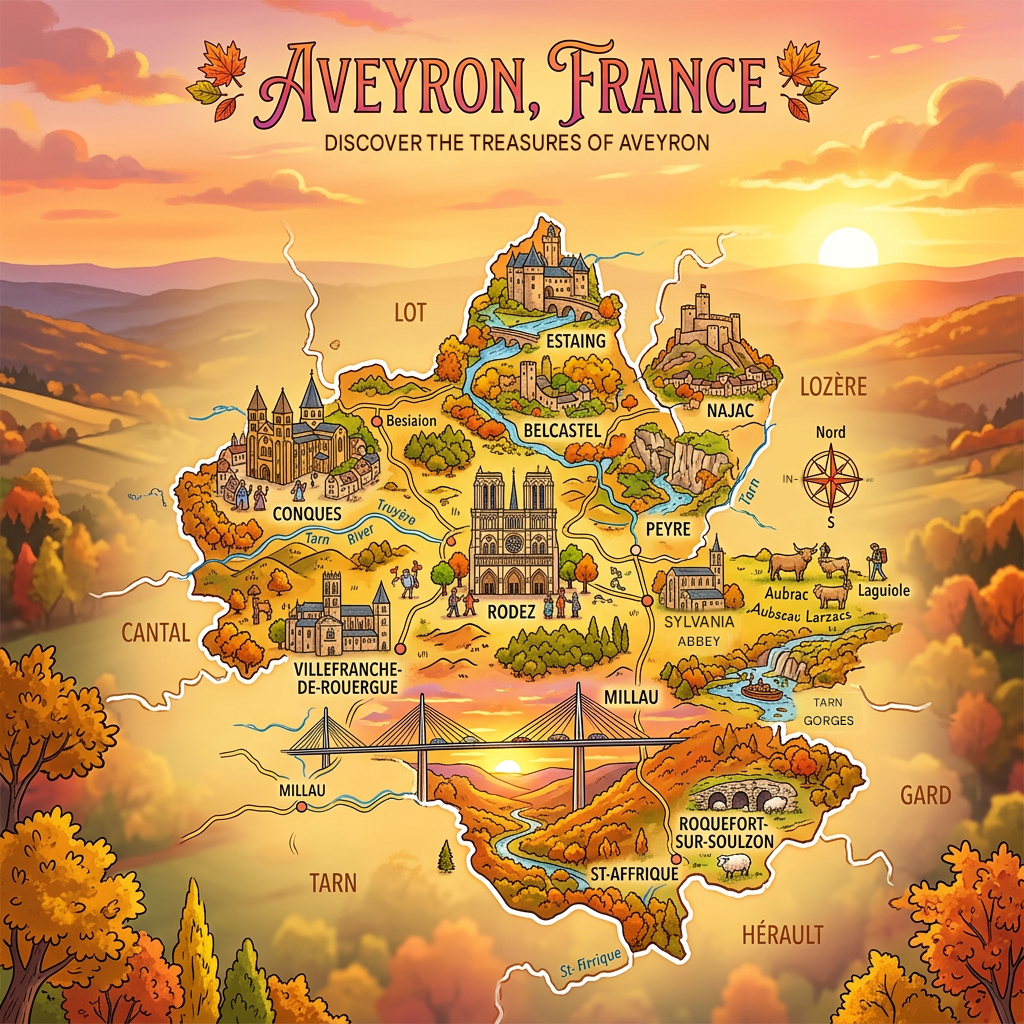
What you need to know about the Aveyron department ?
Still in the Occitanie region, just like department 11, department 12 is called Aveyron. This name comes, as you might have guessed, from a river of the same name. It is located in the southwestern part of the country. Historically, this Aveyron department is bounded by the same borders as the province of Rouergue, which no longer exists.
In terms of land area, Aveyron is the fifth-largest department in metropolitan France. It covers an area of 8,735 km². Today, it has around 280,000 inhabitants, giving it a population density of approximately 32 inhabitants per square kilometer. The department’s prefecture and capital is Rodez.

Climate of the Aveyron department
The Aveyron department is divided into 3 distinct zones:
First, the climate of the western zone is characterized as oceanic. Secondly, the northern zone is characterized by a mountain climate, and finally, the southern zone is characterized by a Mediterranean-type climate.
In fact, temperatures in the high mountains reach 14°C in summer and 0.2°C in winter. Winters are harsh, but sunshine lasts 296 hours during summer hours. On the other hand, winter is harsh in this area and precipitation barely reaches 731mm per year. This suggests that snowfall is much more significant.
In the western zone, as altitude increases, the climate is milder. Annual rainfall is 894.2mm and average summer temperatures hover around 35°C. However, in winter, temperatures can drop to as low as -4°C.
Neighboring departments of the Aveyron department
The Aveyron department is triangular in shape with French cities at its vertices, including Montpellier, Clermont-Ferrand, and Toulouse.
In fact, Aveyron is part of the Massif Central and its neighboring departments are the Cantal department, the Lozère department, the Hérault department, the Gard department, the Tarn-et-Garonne department, the Lot department, and finally, the Tarn department.

What Are the most important cities in the Aveyron department?
The cities with the highest population density per km2 according to the 2016 census have been identified, so here are the most important cities in the Aveyron department:
- Rodez,
- Millau,
- Villefranche-de-Rouergue,
- Onet-le-Château,
- Saint-Affrique,
- Decazeville,
- Luc-la-Primaube,
- Capdenac-Gare,
- Espalion,
- Aubin,
- Olemps,
- Sébazac-Concourès,
- Baraqueville,
- Bozouls,
- Firmi,
- Sévérac-le-Château,
- Flavin,
- Le Monastère.
What are the most important municipalities in the Aveyron department?
Referring to the area of the municipalities in Aveyron, we have listed below the most important municipalities:
- Millau
- Saint-Affrique
- Nant
- Sévérac d’Aveyron
- Salles-Curan
- Cornus
- Vézins-de-Lévézou
- Saint-Chély-d’Aubrac
- Salles-la-Source
- Bozouls
Referring to the population density per km2, the most important municipalities in Aveyron are:
- Rodez
- Millau
- Villefranche-de-Rouergue
- Onet-le-Château
- Saint-Affrique
- Decazeville
- Luc-la-Primaube
- Capdenac-Gare
- Espalion
- Aubin
FAQ-Aveyron map
Aveyron is a department located in the Occitanie region in the southern part of the Massif Central. It is known for its limestone plateaus, called causses, as well as its valleys and picturesque villages.
Rodez is the prefecture and main administrative center of Aveyron. The department has a population of approximately 280,000 people.
A map of Aveyron helps locate its main towns, natural parks, and tourist attractions. It is also useful for planning a trip and discovering famous landmarks such as the Millau Viaduct, the Tarn Gorges, and the Aubrac Plateau.
